Wieże ciśnień: Polska
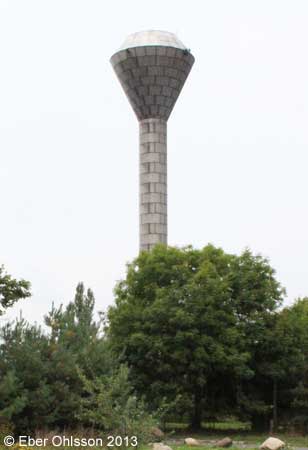
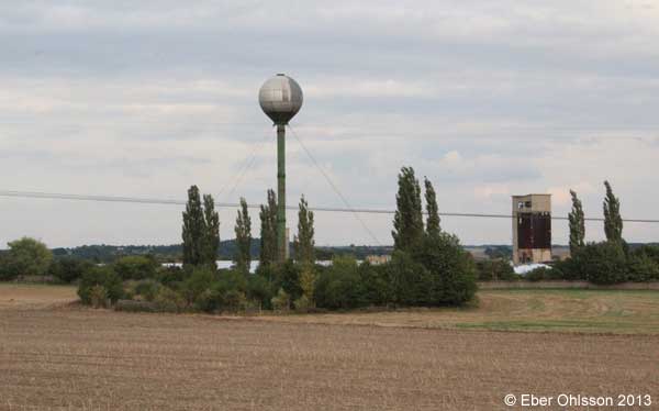
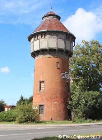
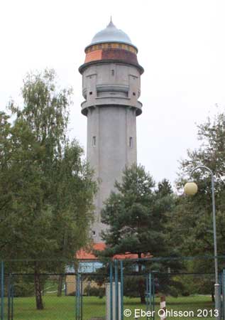
Chociwel (Freienwalde), Bahnhof (railway)
N 53.4696 – E 15.3345
Dębno (Neudamm), Adama Mickiewicza
N 52.7406 – E 14.7088
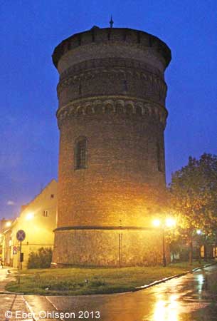
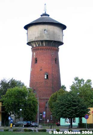
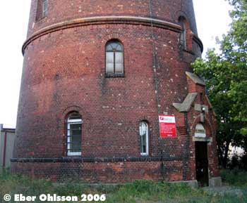
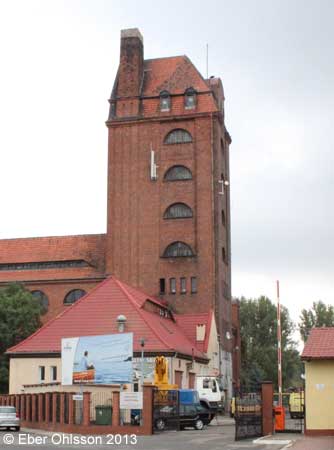
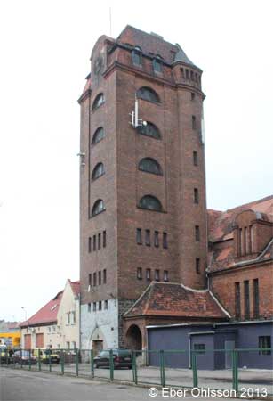
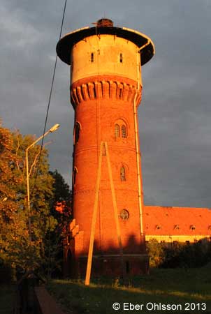
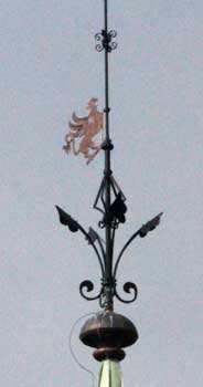
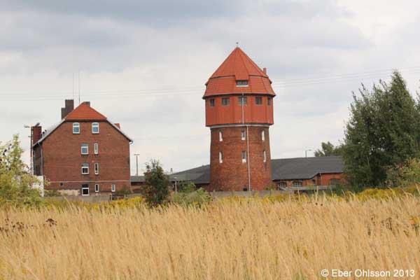
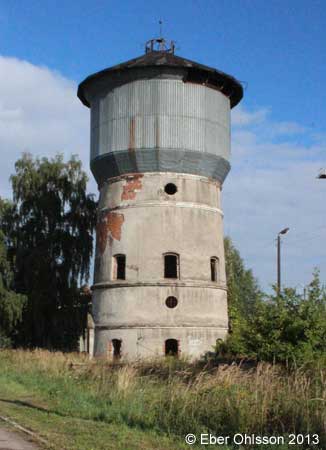
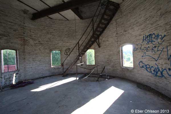
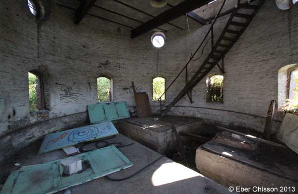
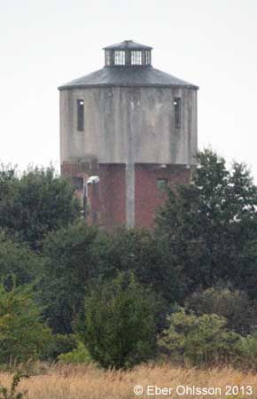
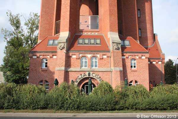
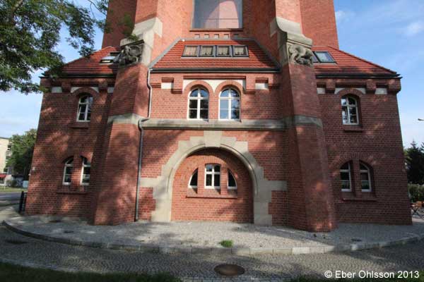
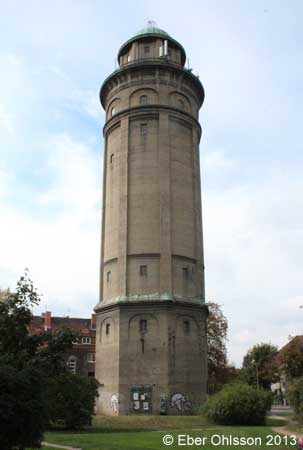
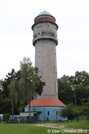
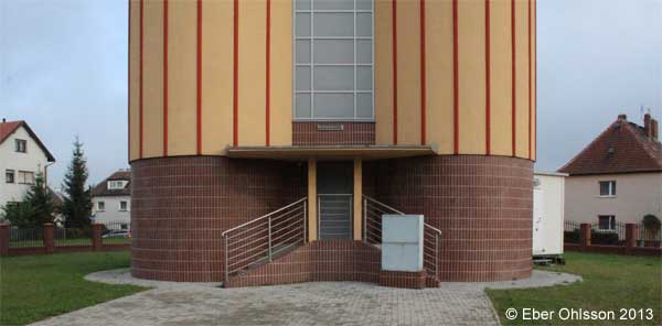
Sign at the water tower
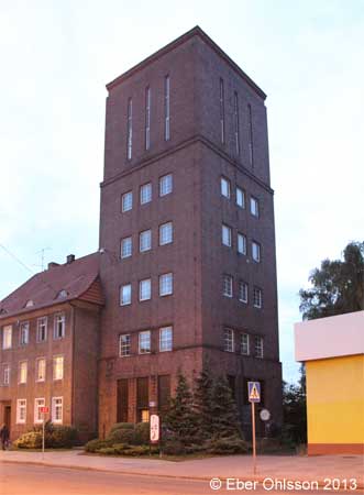
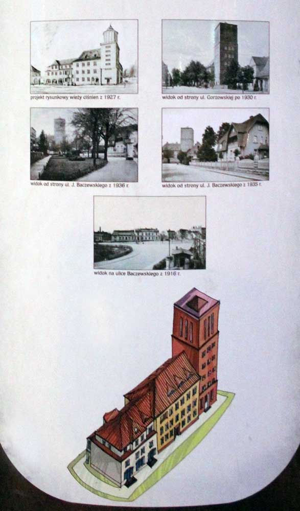
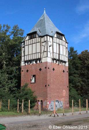
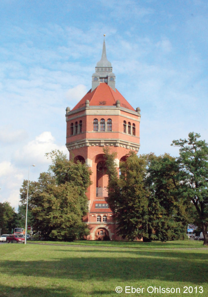
Wasserturm
Der Wasserturm wurde in Jahren 1927-1928 errichtet. In dieser Zeit wurden auch die Stadtwasserleitung und die Kanalisation in der stadt vorbereitet. Der Turm ist ebenfalls ein Zeichen der Geschichte von Wasserleitungen in Westpommern aus den 20. Jh. Das ursprüngliche Aussehen kann man noch heute bewundern. Am Turm befinden sich noch weitere, in dieser Zeit errichtete Gebäude.
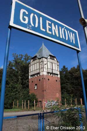
Goleniów (Gollnow), Nowgardzka
N 53.5694 – E 14.8323
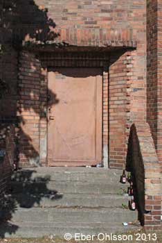
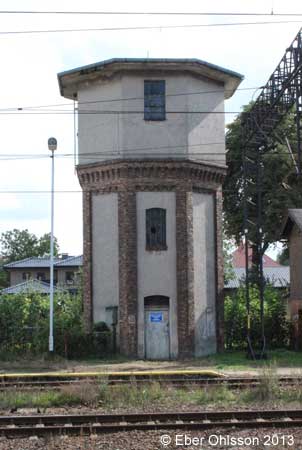
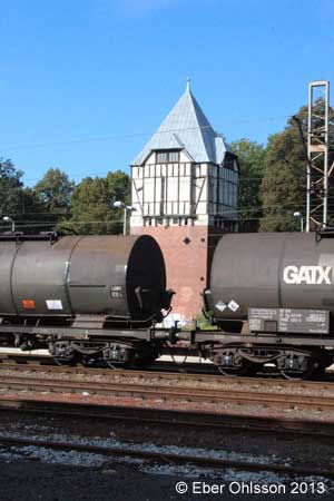
Goleniów (Gollnow), Bahnhof (railway)
N 53.5577 – E 14.8381
Jawor (Jauer), Plac Seniora
N 51.0504 – E 16.1960
Katowice (Kattowitz), Bahnhof (railway)
N 50.2575 – E 19.0195
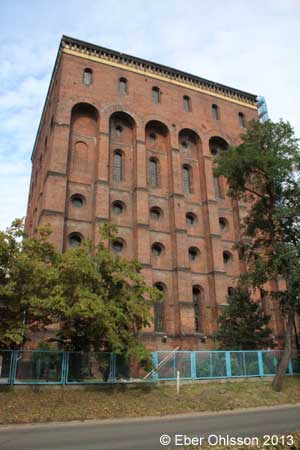
Kołbacz (Kolbatz) (agrarian)
N 53.2910 – E 14.7923
Kostrzyn (Küstrin), Adama Mickiewicza
N 52.5914 – E 14.6518
Legnica (Liegnitz), Ścinawska
N 51.2143 – E 16.1650
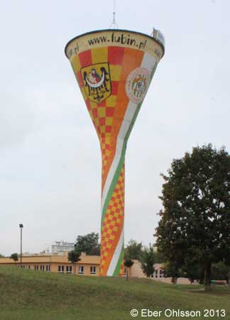
Lubin (Lüben), Parkowa
N 51.4035 – E 16.1882
Lubin (Lüben), Jerzego Kukuczki
N 51.3887 – E 16.2071
Miłkowice (Arnsdorf), Bahnhof (railway)
N 51.2503 – E 16.0692
Myślibórz (Soldin), Cienista
N 52.9199 – E 14.8566
Myślibórz (Soldin), Bahnhof (railway)
N 52.9184 – E 14.8638
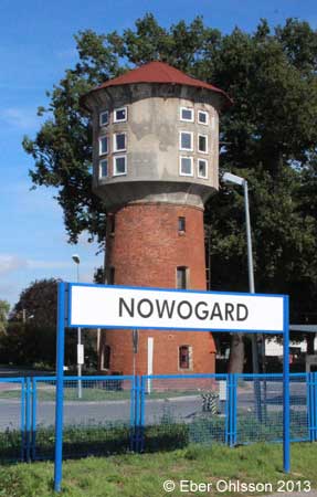
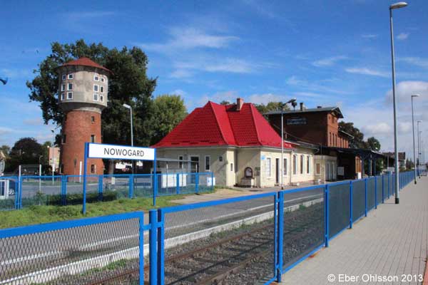
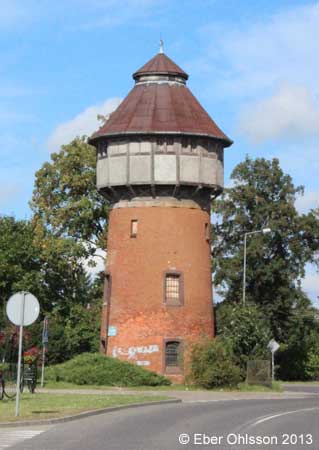
Nowogard (Naugard), Bahnhof
N 53.6665 – E 15.1205
Płoty (Plathe), Bahnhof (railway)
N 53.8081 – E 15.2624
Pyrzyce (Pyritz), Staromiejska
N 53.1365 – E 14.9089
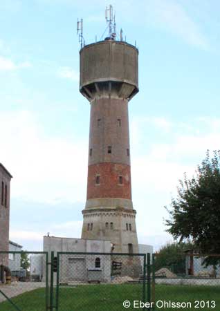
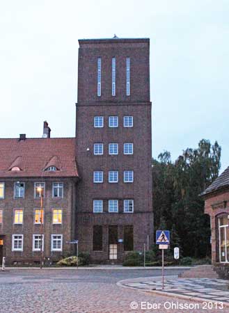
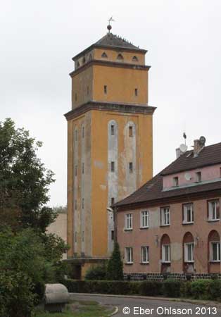
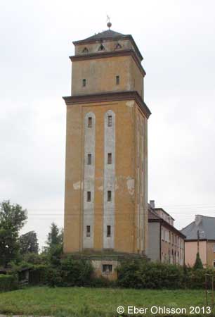
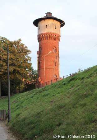
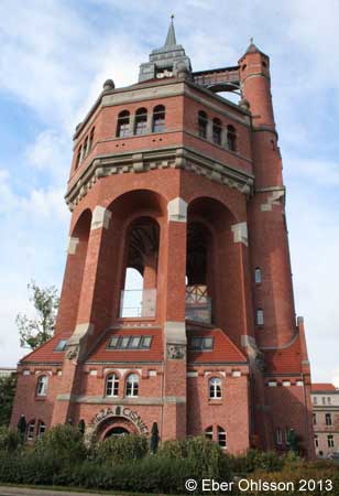
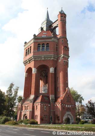
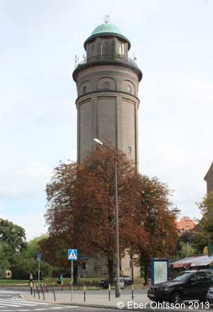
Stargard Szczeciński (Stargard), Hetmana Stefana Czarnieckiego
N 53.3379 – E 15.0391
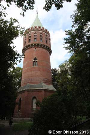
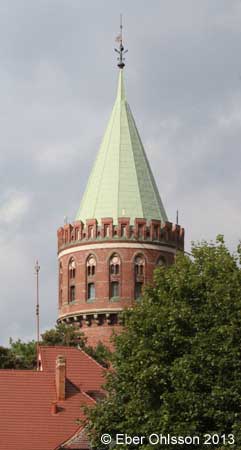
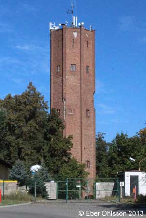
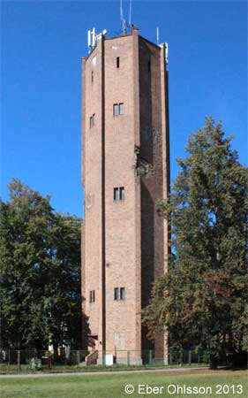
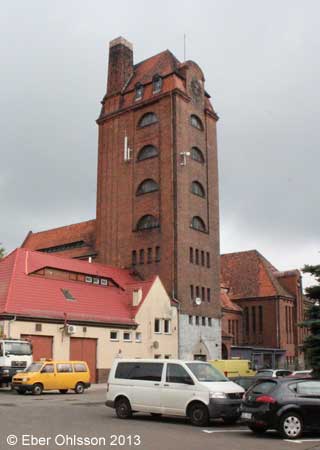
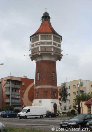
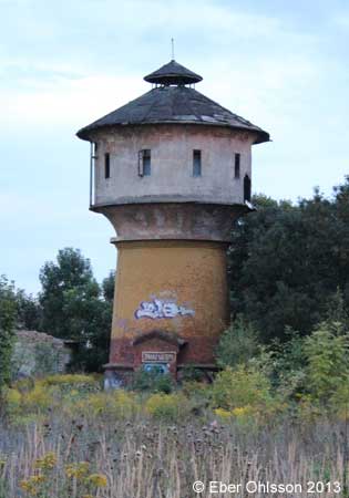
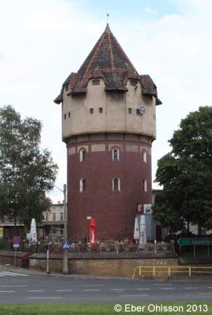
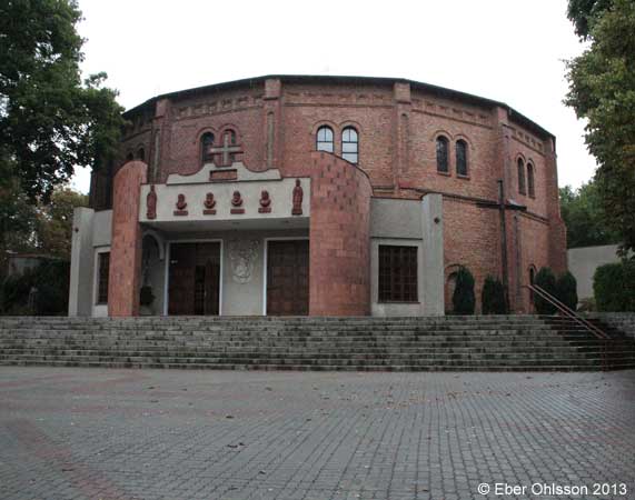
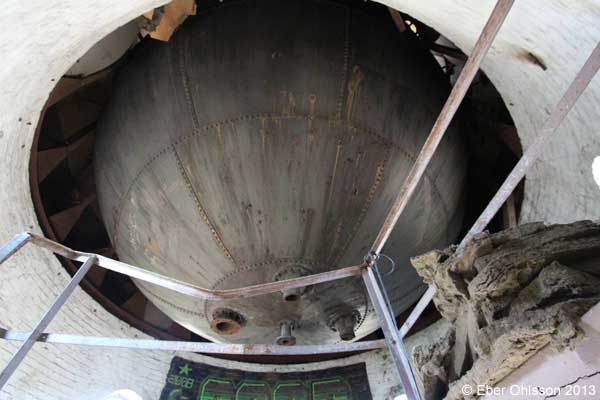
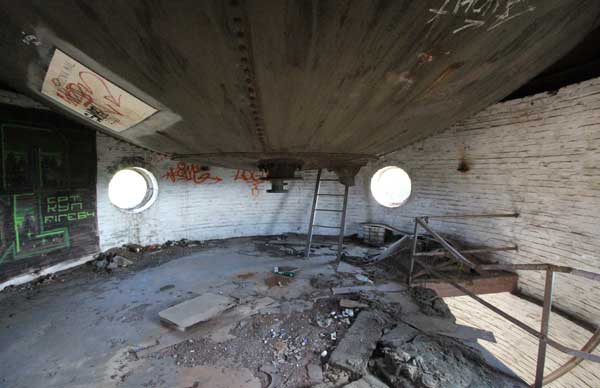
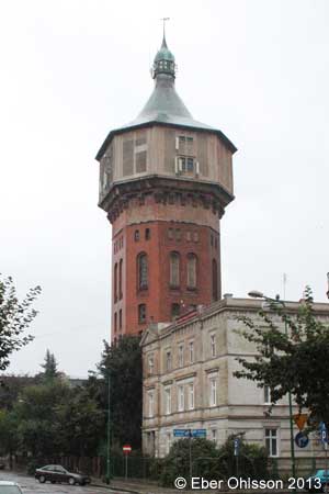
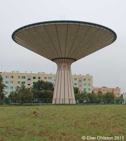
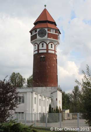
Sign at the water tower
Water Tower
Built in 1896 as a part of the water network. The 65-meter high tower has a rich wall decorations. the upper part of the tower holds a water tank that stores 500 m³ of water for the residential area.
Wasserturm
Dieser Turm wurde 1896 als ein Element der städtischen Wasserwerke errichtet. Der 65 Meter hohe neugotische Turm besitzt eine prächtige Verzierung seiner Fasaden. Im oberen Teil des Turmes befindet sich ein Behälter mit einem Fassungsvermögen von 500 m³. Er speist Wasserleitungen für Wohnungen.
Stargard Szczeciński (Stargard, Bahnhof) (railway)
N 53.3388 – E 15.0306
Stargard Szczeciński (Stargard, Lokschuppen) (railway)
N 53.3473 – E 15.0204
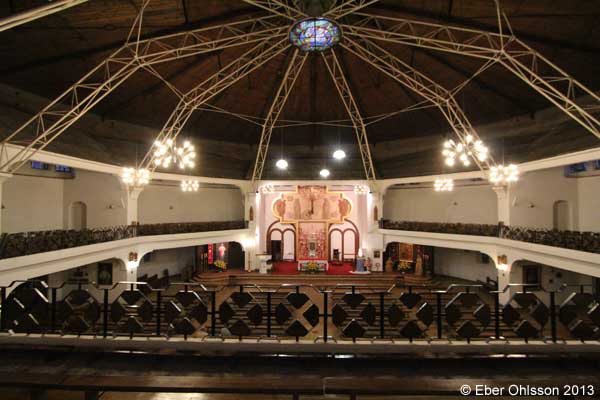
Szczecin (Stettin), Orawska (converted to a church)
N 53.40570 – E 14.5230
Szczecin (Stettin), Doktora Judyma (converted)
N 53.4569 – E 14.5288
Szczecin (Stettin), Piesza (Güterbahnhof) (railway)
N 53.4086 – E 14.5744
Szczecin (Stettin) (railway)
N 53.3970 – E 14.4858
Świdnica (Schweidnitz), Nauczycielska
N 50.8394 – E 16.4867
Świdnica (Schweidnitz), Ignacego Prądzyńskiego
N 50.8460 – E 16.4606
Wrocław (Breslau), Aleja Wiśniowa
N 51.0853 – E 17.0176
Läs om vattentornet – Ebers vattentorn – Cirkulation nr 6/2015.
I tyska Schlesiens huvudstad Breslau byggdes 1904-05 ett påkostat tegelvattentorn ritat av arkitekten Karl Klimm. Gestaltningen blev en medeltida borg i en blandning av nyromansk och nygotisk stil och fasaden dekorerad med fabeldjur i sandsten. I bottenvåningarna fanns tjänstebostäder och på 42 meters höjd en utsiktsplattform, som kunde nås med hiss.
Vattentornet klarade sig oskadat genom andra världskriget. I mitten av 1980-talet upphörde vattentornsdriften och 1995 blev tornet renoverat och hyser nu restaurang och konferenslokaler. Vattentornet står idag i polska Wrocław.
Ladda ner Cirkulations version som en pdf-fil.
Wrocław (Breslau), Na Grobli (Am Weidendamm)
N 51.1046 – E 17.0578
Wrocław (Breslau), Karlowice
N 51.1383 – E 17.0602
Wrocław (Breslau), Lesnica
N 51.1545 – E 16.8680
Wrocław (Breslau), Tarnogaj
N 51.0770 – E 17.0694
Wrocław (Breslau), Brochów
N 51.0770 – E 17.0694
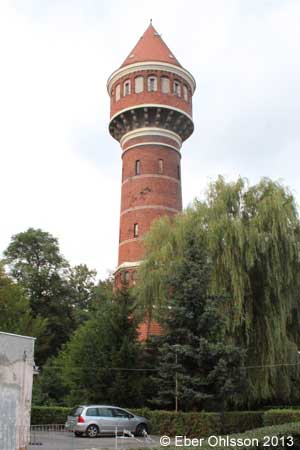
Zgorzelec (Görlitz), Świętego Jana
N 51.1387 – E 15.0081
Zgorzelec (Görlitz), Górna
N 51.1534 – E 15.0048
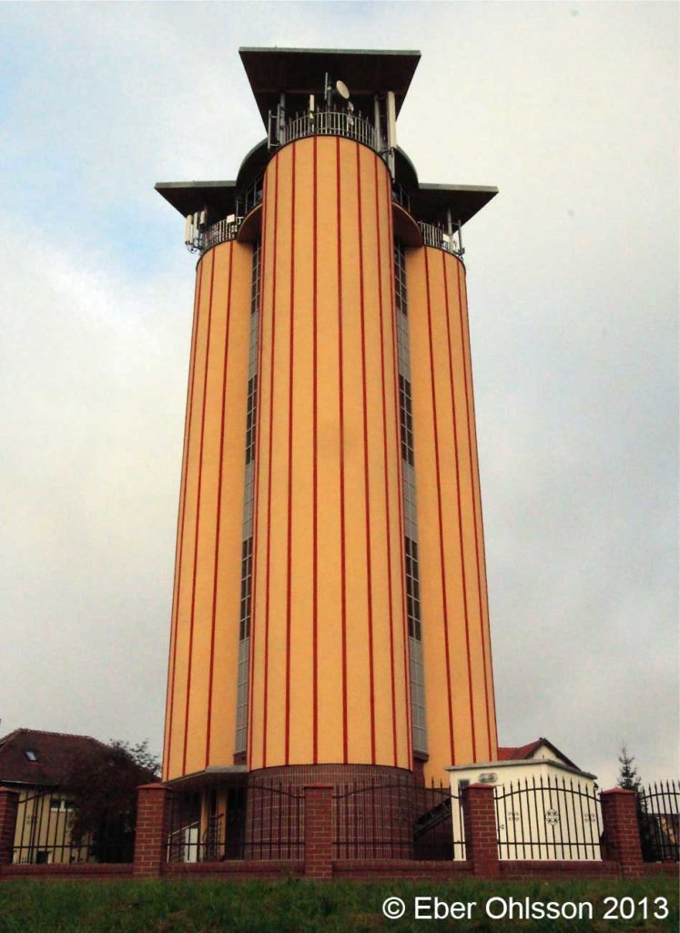
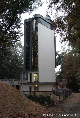
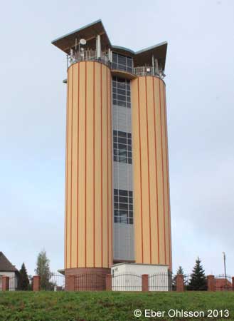
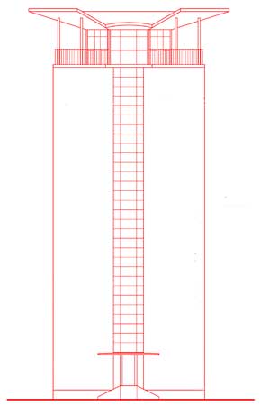
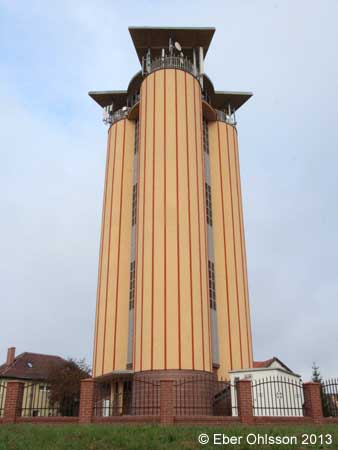
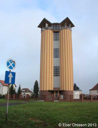
Läs om vattentornet – Ebers vattentorn – Cirkulation nr 3/2021.
När andra världskriget var slut kom gränsen mellan Tyskland och Polen att bli floderna Oder och Neiße. Det innebar också att städer som sträckte sig över floden kom efter kriget att hamna i olika länder. En sådan stad är Görlitz, där den östra stadsdelen nu ligger i Polen och heter Zgorzelec.
Även om en gräns flyttas, måste de som bor där ha vatten och kanske ett vattentorn. I Zgorzelec byggdes därför ett vattentorn 1969 bestående av tre i triangelform stående runda betongcylindrar med diametern 4,2 meter och 28, 5 meter höga, vardera rymmande 260 m3, förbundna med glasväggar och en trappa i mitten.
Ladda ner Cirkulations version som en pdf-fil.
Żródła (Borne) (agrarian)
N 51.1655 – E 16.7408