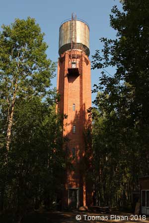
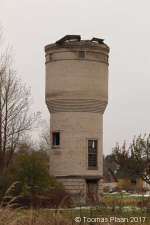
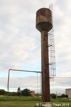
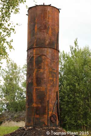
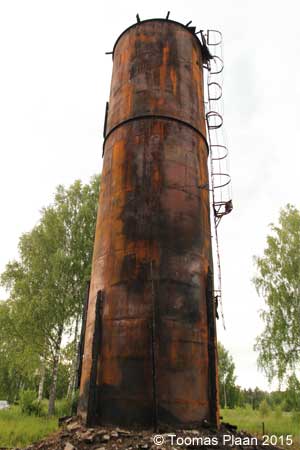
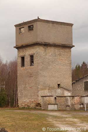
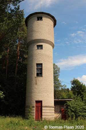
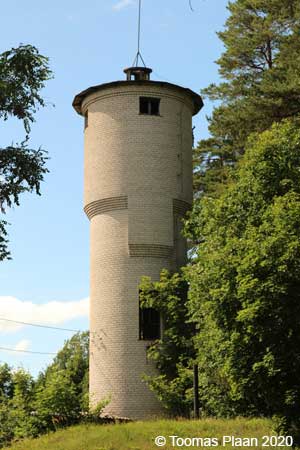
Veetornid: Eesti
Harjumaa
Hiiumaa
Ida-Virumaa
Jõgevamaa
Järvamaa
Läänemaa/Wiek
Lääne-Virumaa
Põlvamaa
Pärnumaa
Raplamaa
Saaremaa
Tartumaa
Valgamaa
Viljandimaa
Võrumaa
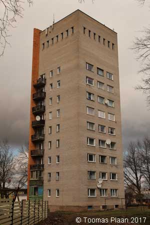
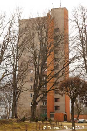
Harjumaa
Aegviidu (railway)
N 59.2871 – E 25.6091

Audevälja, Keila-Haapsalu
N 59.1828 – E 24.0856
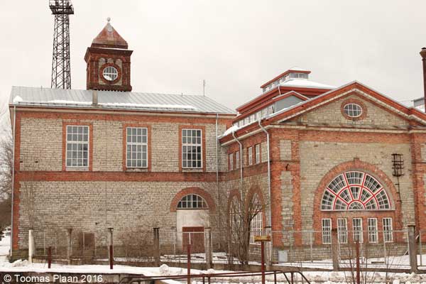
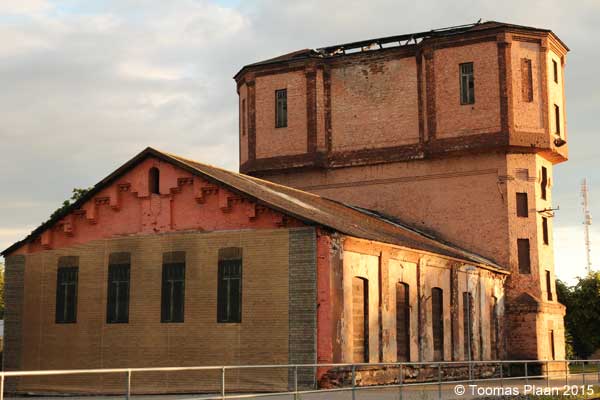
Ellemaa, Tööstuse (power plant)
N 59.0777 – E 24.2419
Habajaa, Sipasoo tee
N 59.1065 – E 25.1702
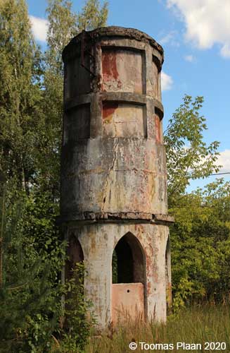
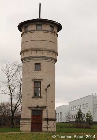
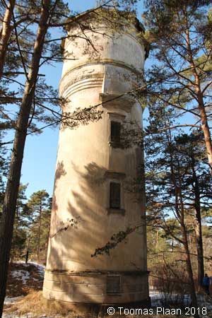
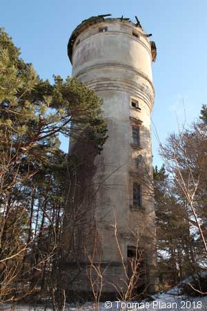
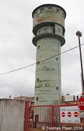
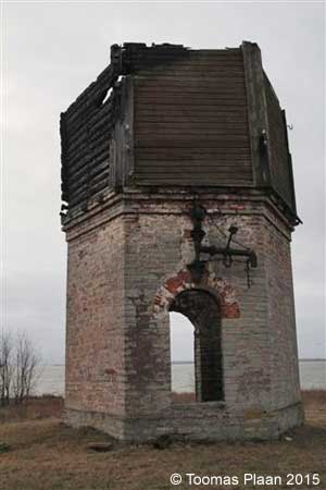
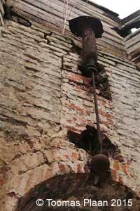
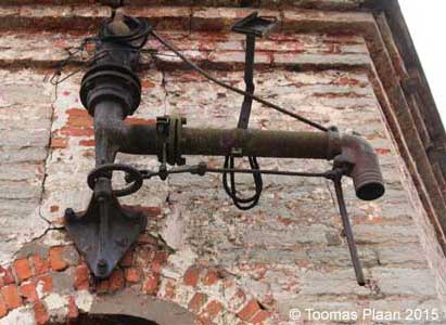
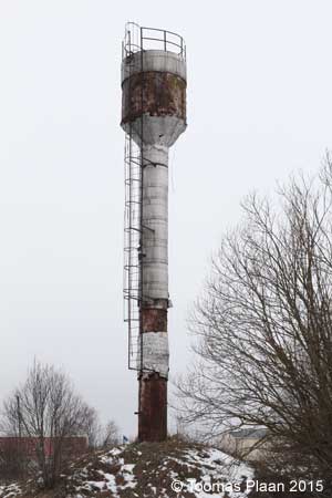
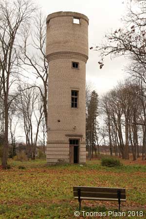
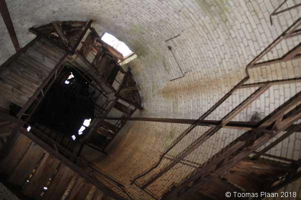
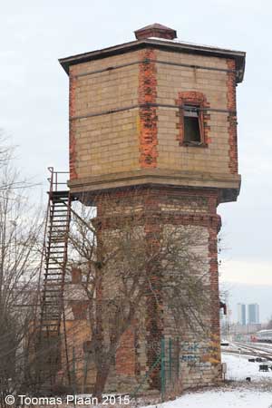
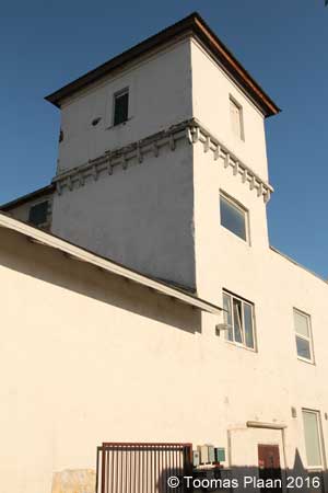
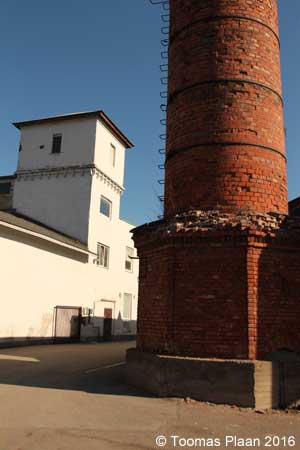
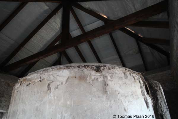
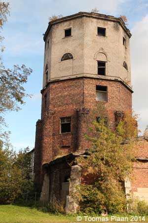
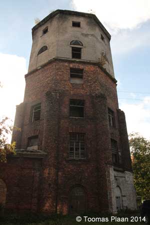
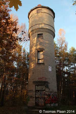
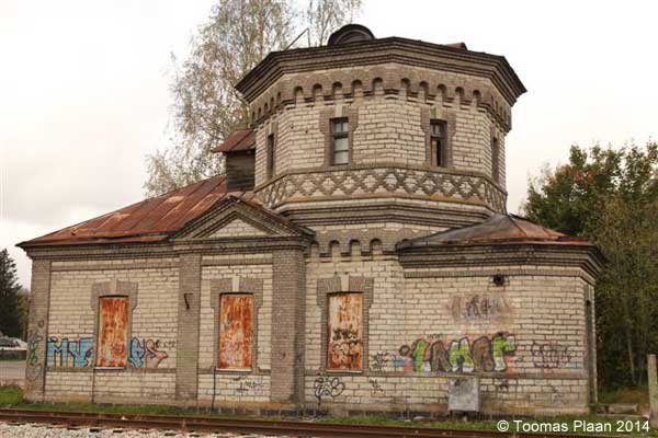
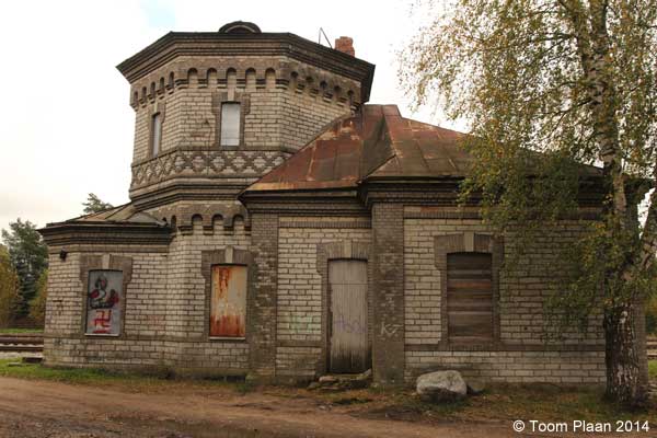
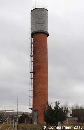
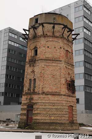
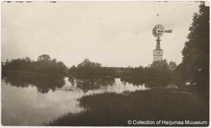
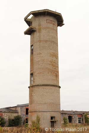
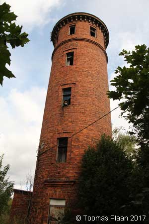
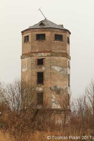
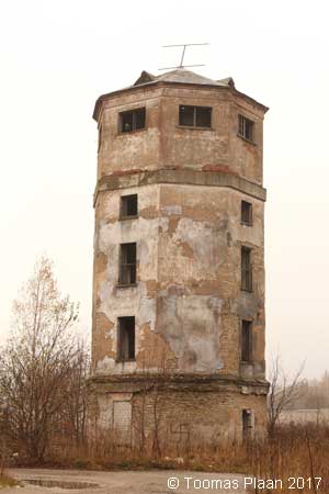
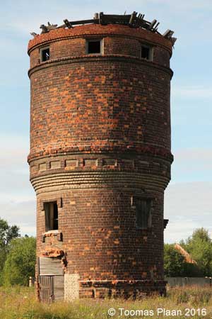
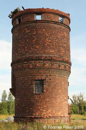
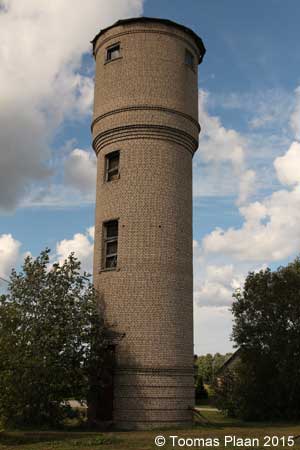
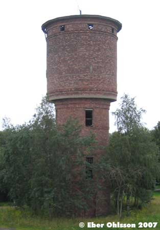
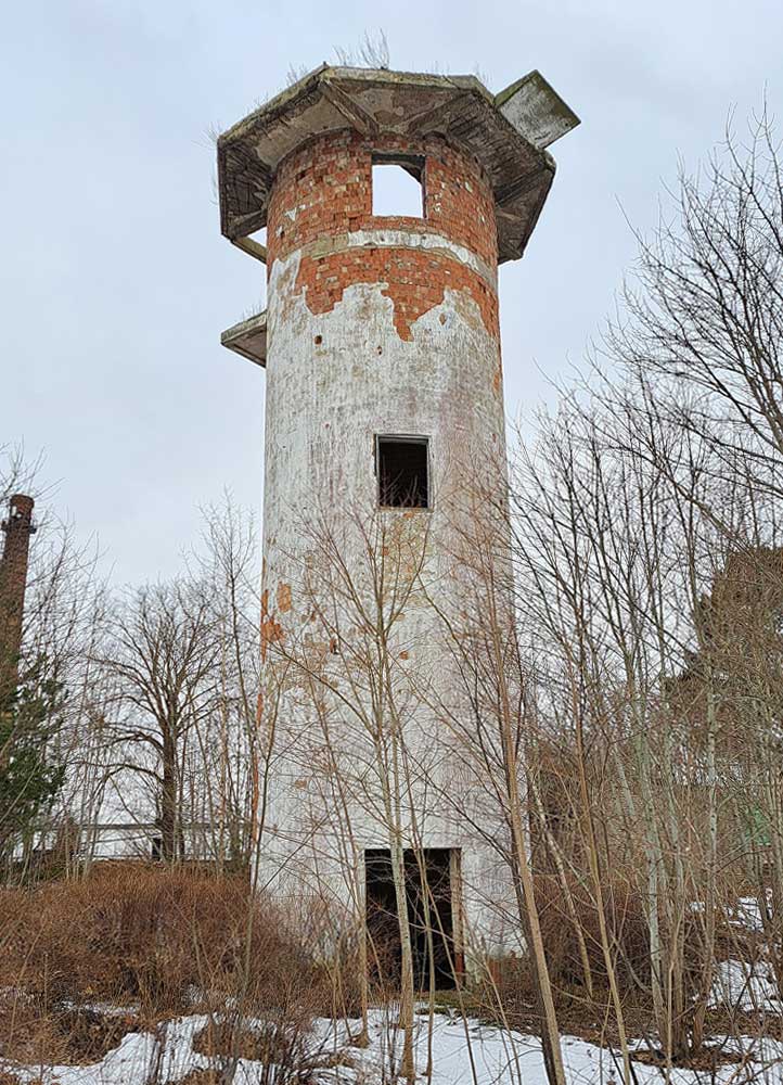
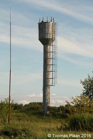
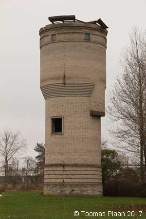
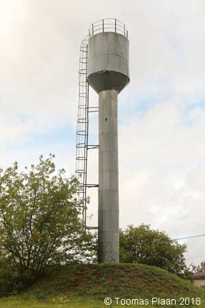
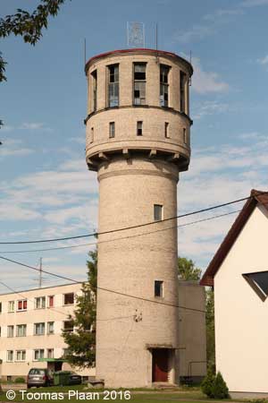
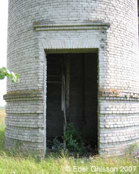
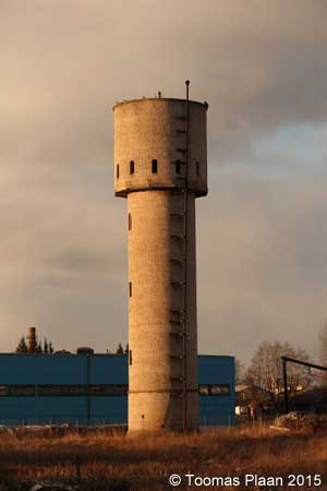
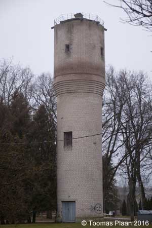
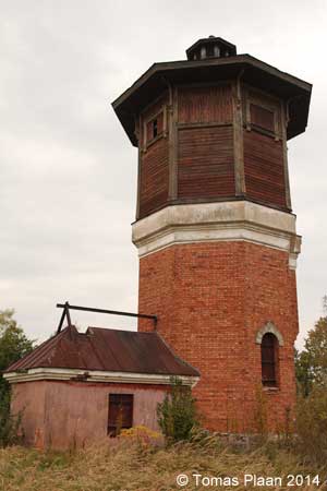
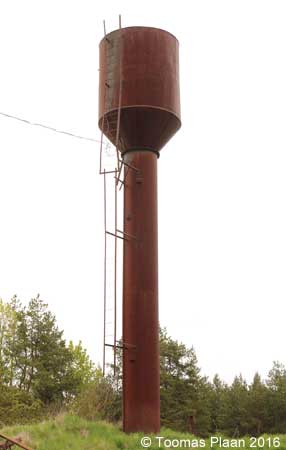
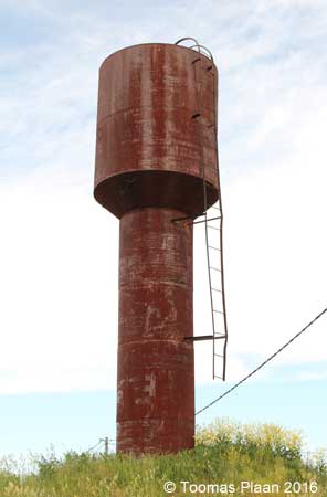
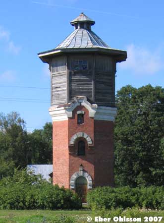
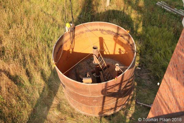
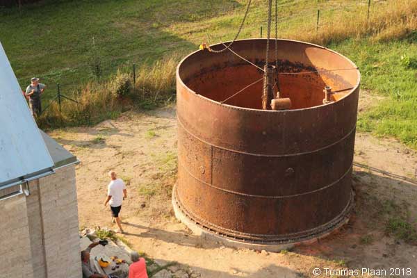
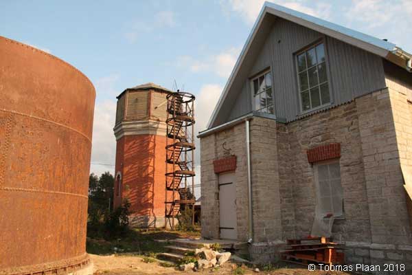
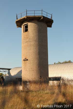
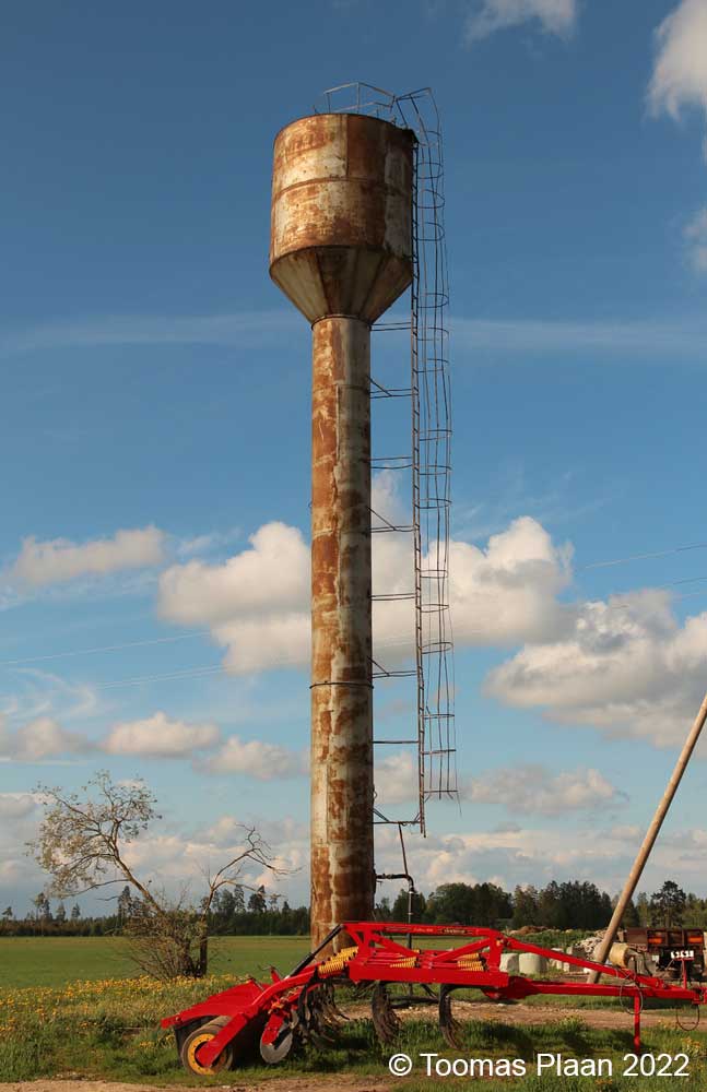
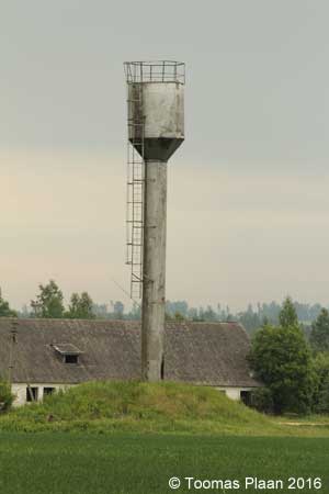
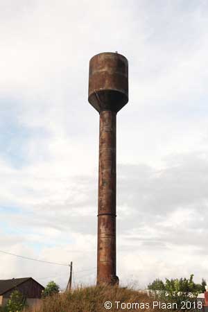
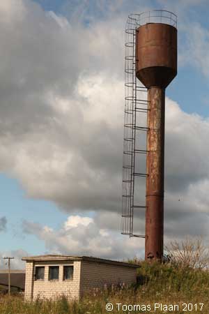
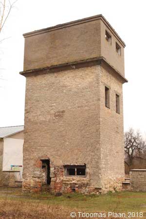
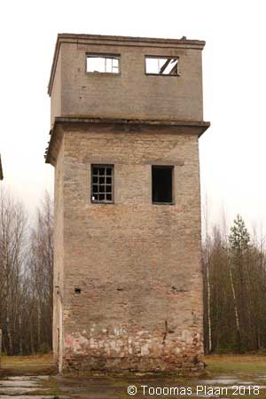
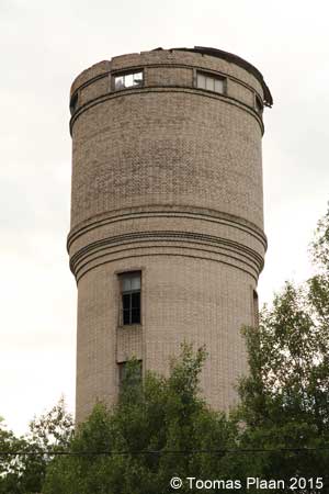
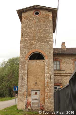
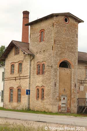
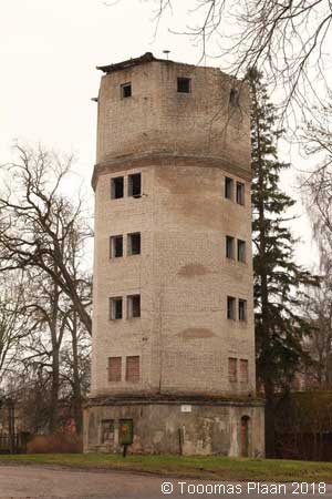
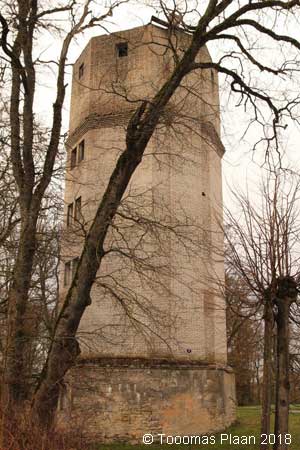
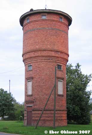
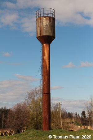
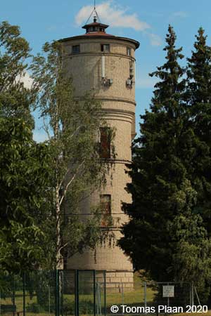
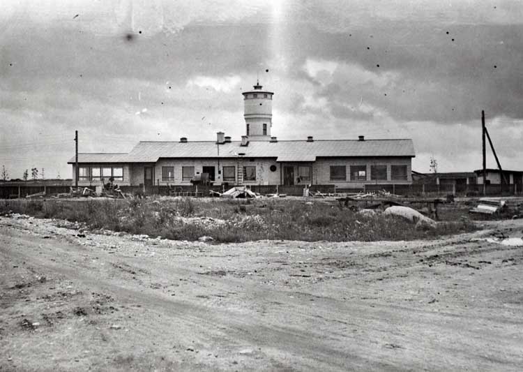
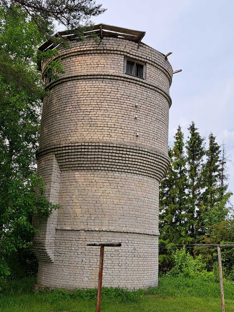
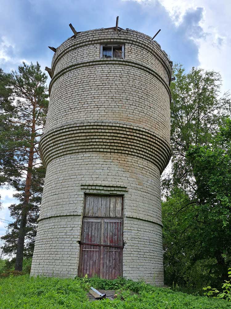
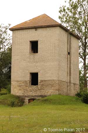
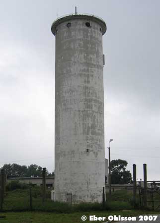
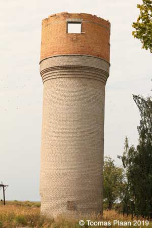
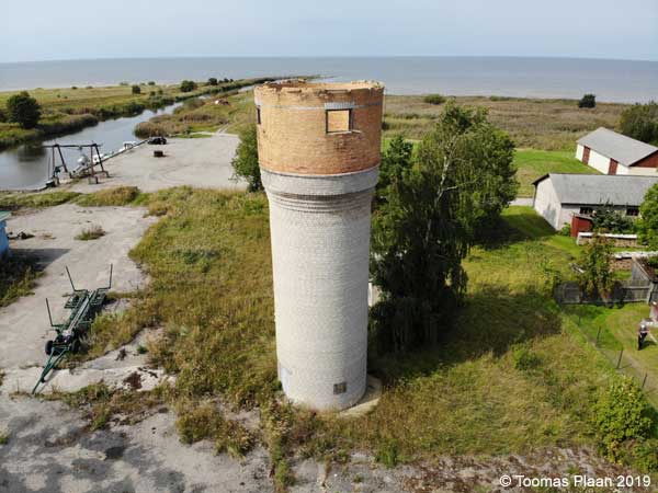
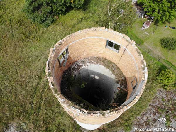
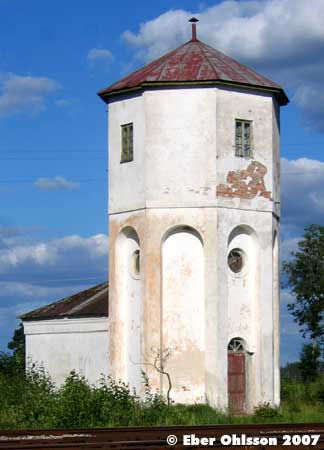
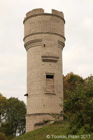
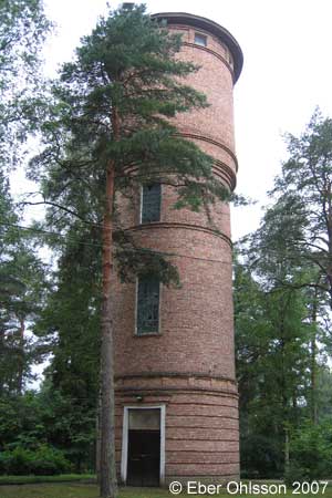
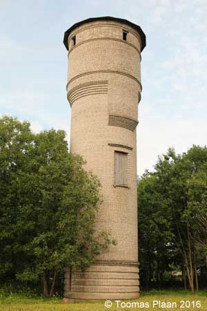
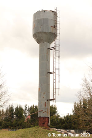
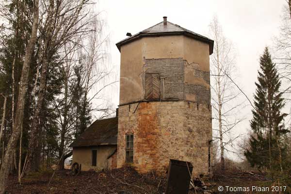
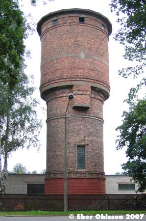
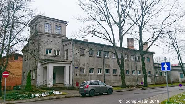
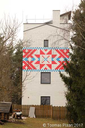
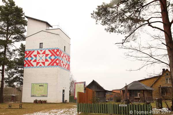
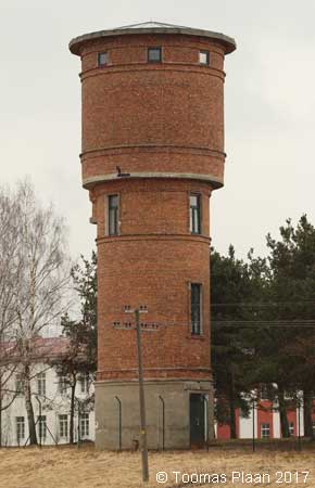
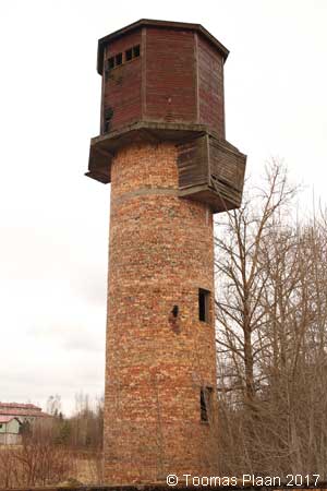
Hara (military)
N 59.5784 – E 25.6133
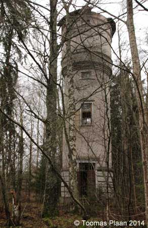
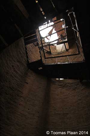
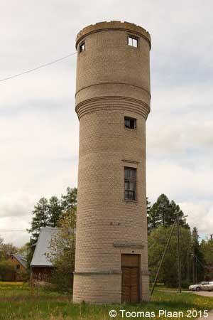
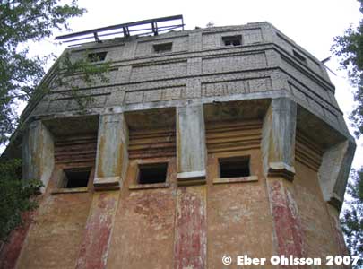
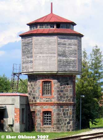
Hara was an old Soviet military base, that they left for 20 years ago. The water tower is now in a very bad condition, with stolen tank and no roof. /Toomas Plaan
Jüri, Aruküla tee
N 59.3570 – E 24.8981
Karjaküla, Naaritsa
N 59.3387 – E 24.3905

Kehra, Kooli
N 59.3286 – E 25.3334
Keila, Jaama (tower demolished)
N 59.3086 – E 24.4167
Keila (railway)
N 59.3062 – E 24.4162
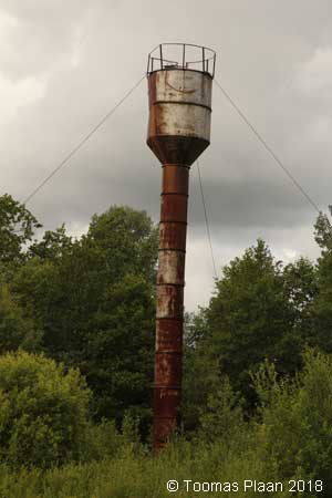
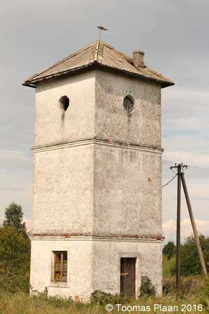
Kiiu, Veski
N 59.4500 – E 25.3887
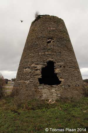
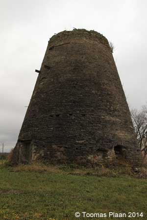
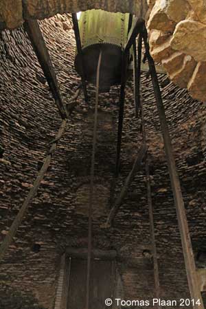
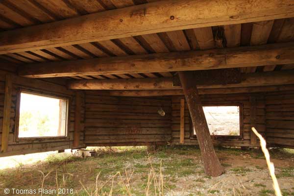
An old windmill, there it is a water tank. I believe it’s a construction, when the windmill was decommissioned. /Toomas Plaan
Klooga, Kalda puiestee
N 59.3193 – E 24.2243
Kuusalu
N 59.4444 – E 25.4351
Loksa, Tallinna tn
N 59.5868 – E 25.7066
Loo, Vibeliku tee
N 59.4320 – E 24.9488
Munalaskme park
N 59.1849 – E 24.2671
Paldiski, Jaama (railway)
N 59.3455 – E 24.0575
Paldiski, Sadama
N 59.3551 – E 24.0867
Patika
N 59.3162 – E 24.9345
Peningi, Raasiku tee
N 59.3367 – E 25.1556
Raasiku (railway)
N 59.3660 – E 25.1728
Riisipere (tower demolished)
N 59.1026 – E 24.3140
Riisipere (railway)
N 59.1182 – E 24.3104
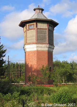
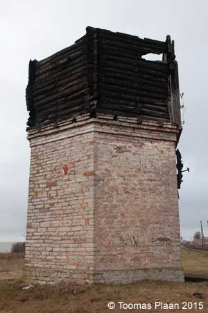
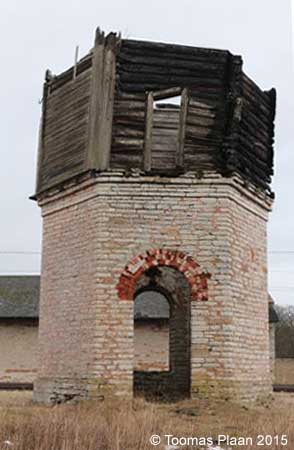
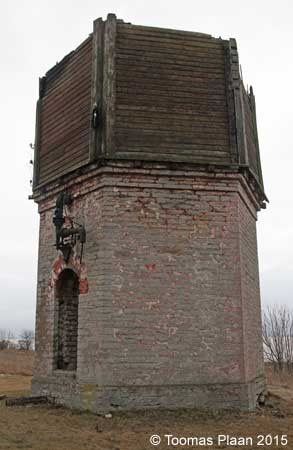
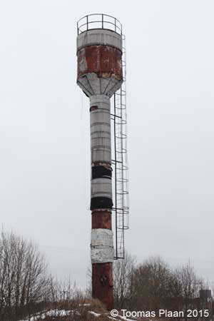
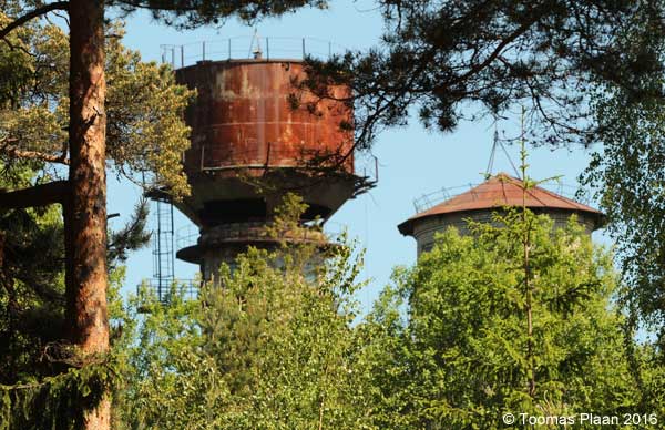
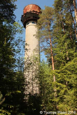
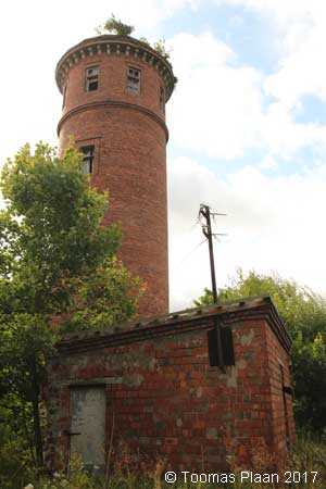
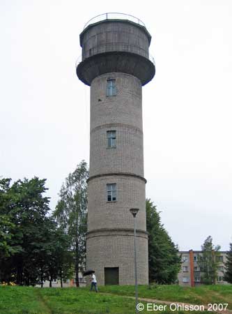
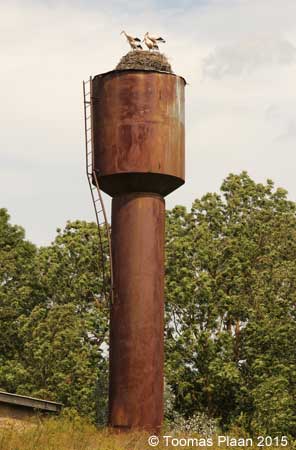
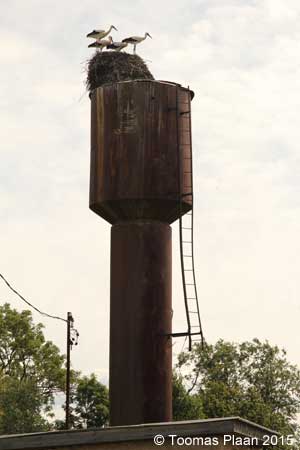
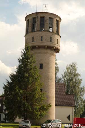
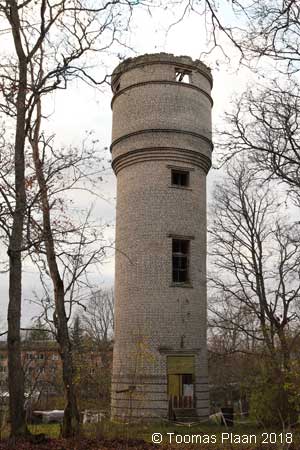
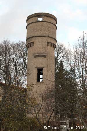
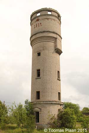
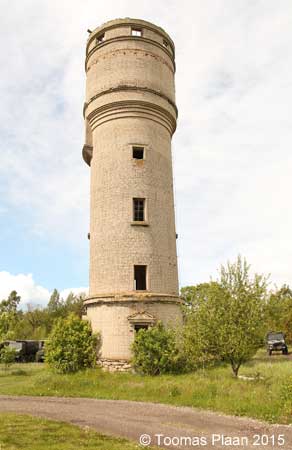
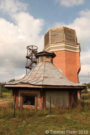
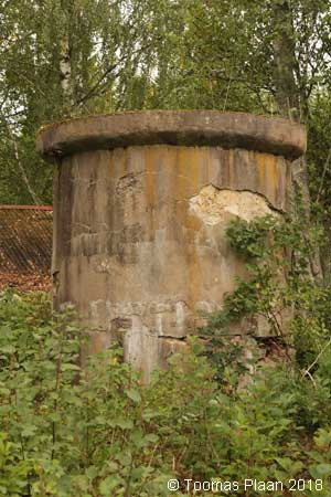
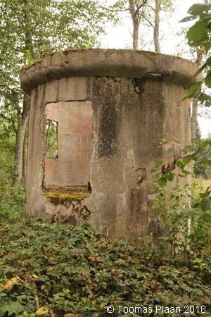
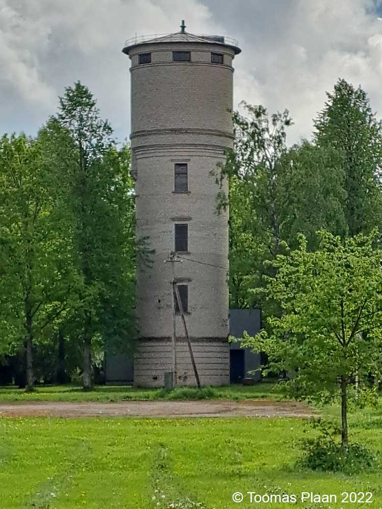
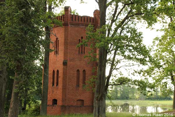
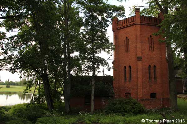
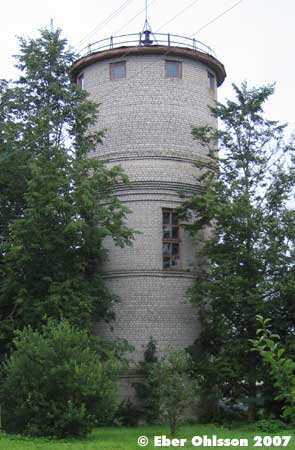
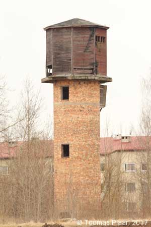
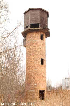
Suurpea (1)
N 59.6262 – E 25.6910
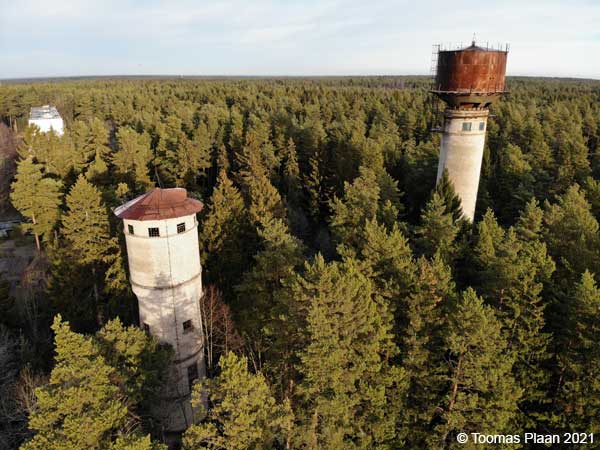
It is a quite amazing story.
When I one time visited Loksa water tower, saw I from the top of the tower, far away – behind all trees, something that could be another water tower.
Later I tried to find this place. It was like a time travel. Old soviet military base, only russians in 10…12 storey houses: music, chickens, russian flags…
But no water tower. I asked an old lady on a balcony on the second floor – where is the tower? She came down, took very freindly my hand and showed me the trail I should go.
Between the trees I saw first a high tower with steel tank, then after 50 meter a solid brick tower, and after further 50 meters a steel tank again.
It was like a science fiction movie!!
After 10 minutes reconnoitring – there was two water towers. Even better!
But it was not easy to take pictures among all these trees.
Toomas Plaan
2016-06-03
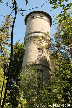
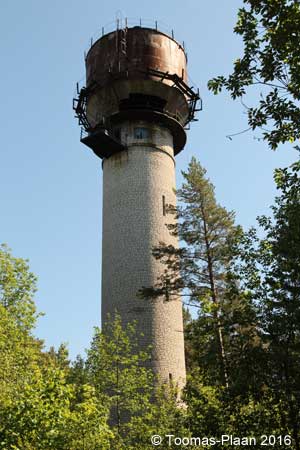
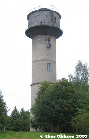
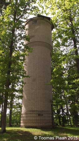
Suurpea (2)
N 59.6263 – E 25.6916
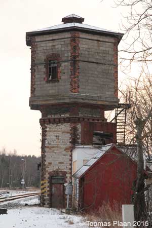
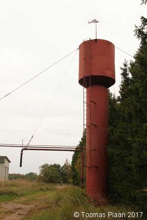
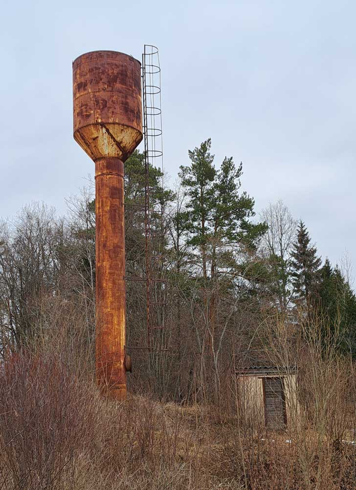
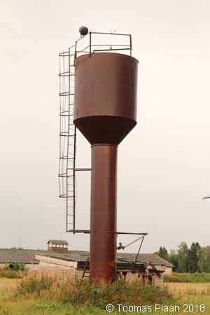
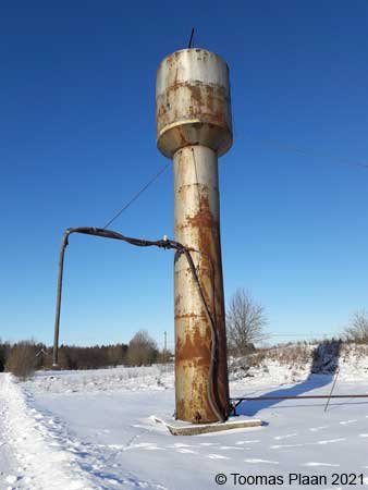
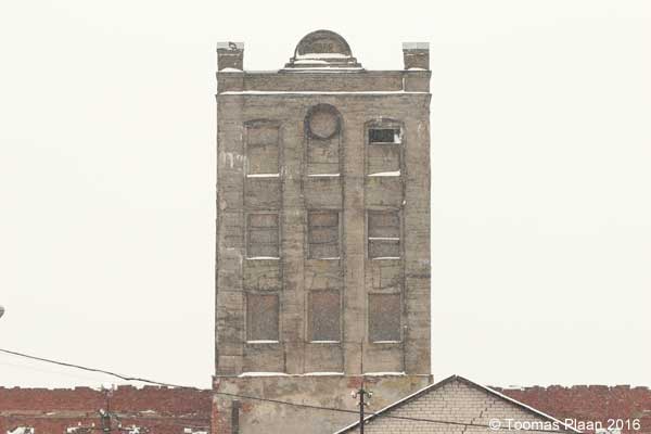
Sõrve, Jaama tee (railway)
N 59.4204 – E 24.4639
Water tower of an old narrow-gauge railway (earlier military, later normal railway). /Toomas Plaan
Tabasalu, Teenuste
N 59.4286 – E 24.5427
Tagadi (agrarian)
N 59.2279 – E 24.7508
Tallinn, Suurtüki
N 59.4427 – E 24.7434
Tallinn, Tuvi
N 59.4296 – E 24.7411
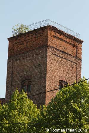
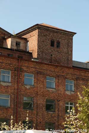
Tallinn, Kopli (Bekker shipyard) (industry)
N 59.4580 – E 24.6744
Tallinn, Telliskivi (railway)
N 59.4407 – E 24.7295
Tallinn, Volta (industry)
N 59.4491 – E 24.7268
Tallinn, Sitsi (Balti Manufaktuur) (industry)
N 59.4498 – E 24.7011
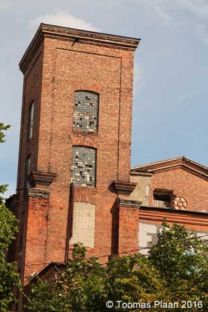
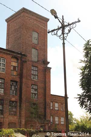
N 59.4504 – E 24.7024
N 59.4512 – E 24.7044
Tallinn, Kitseküla, Tallinn-Väike (railway)
N 59.4104 – E 24.744
Tallinn, Kopli, Köievabrik (industry)
N 59.4504 – E 24.7076
Tallinn, Maarjamäe, Pirita tee (industry)
N 59.4525 – E 24.8108
Tallinn, Erika
N 59.4496 – E 24.7162
Tallinn, Laevastiku (industry)
N 59.4588 – E 24.6972
Tallinn, Haabersti
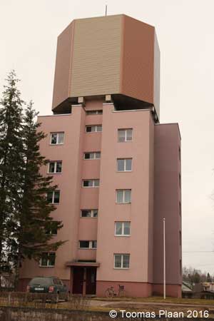
N 59.4278 – E 25.6403
Tallinn, Merimetsa (hospital)
N 59.4307 – E 24.7012
Tallinn, Liiva raudteepeatus (railway)
N 59.3886 – E 24.7236
Tallinn, Kaluri (Eesti Mereakadeemia)
N 59.4616 – E 24.6661
Tallinn, Harku, Paemurru tee (quarry)
N 59.4043 – E 24.6043
Tallinn, Kopli, Maleva
N 59.4610 – E 24.6775
Tallinn, Ülemiste, Keevise
N 59.4211 – E 24.8002
Tallinn, Tatari
N 59.4245 – E 24.7451
Vasalemma
N 59.2327 – E 24.2514
Maardu
Hiiumaa/Dagö
Emmaste (agrarian)
N 58.7086 – E 22.5875
Suuremõisa, Niidufarmi tee
N 58.8760 – E 22.9377
Viskoosa, Kõrgessaare, Tööstuse (industry)
N 58.9797 – E 22.4692
Ida-Virumaa
Ahtme, Maleva
N 59.3249 – E 27.4239
Aseri, Tsemendi (industry)
N 59.4537 – E 26.8675
Jõhvi, Kaare
N 59.3492 – E 27.4129
Jõhvi, Sompa (industry)
N 59.3582 – E 27.3866
Kiviõli
Kothla-Järve
N 59.4022 – E 27.2963
Kothla-Järve (railway)
N 59.3957 – E 27.2470
Kukruse
N 59.3868 – E 27.3560
Laagna
N 59.3968 – E 27.9695
Lüganuse
N 59.3387 – E 27.0319
Narva, Aleksander Puškini
N 59.3767 – E 28.1940
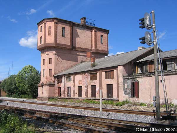
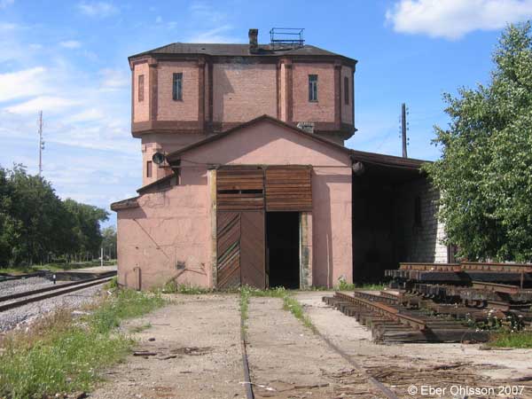
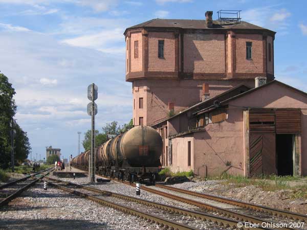
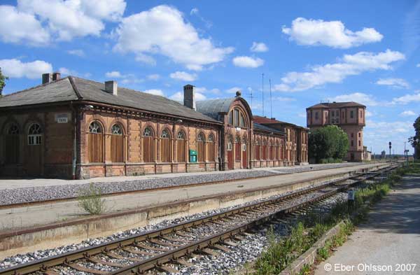
Narva (railway)
N 59.3682 – E 28.1959
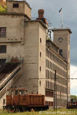
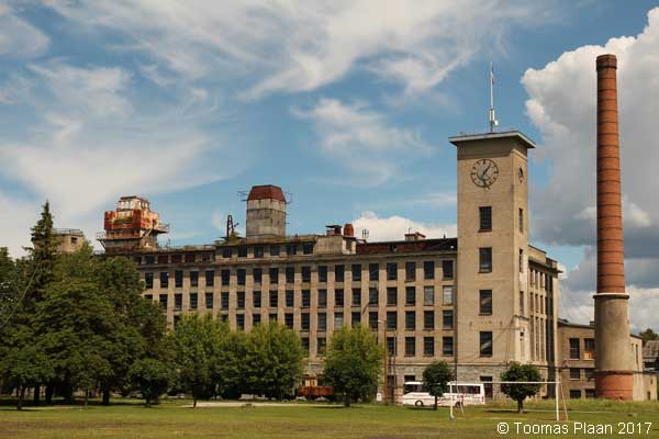
Narva, Kreenholm, Kose (textile industry)
N 59.3621 – E 28.1990
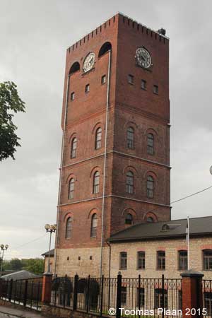
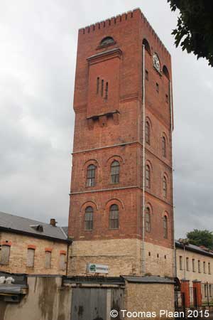
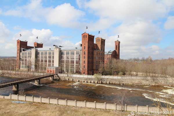
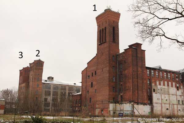
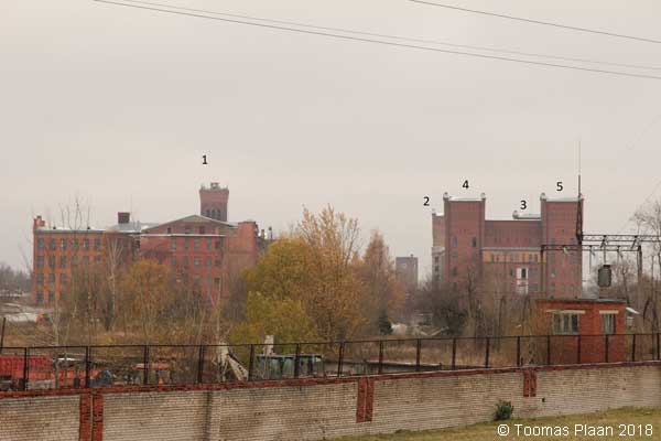
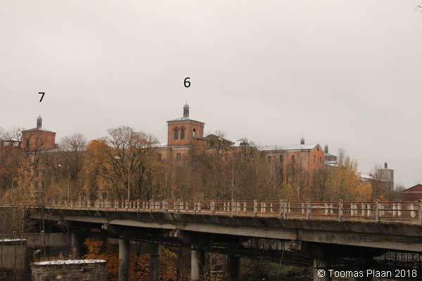
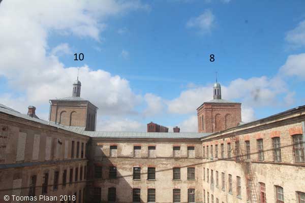
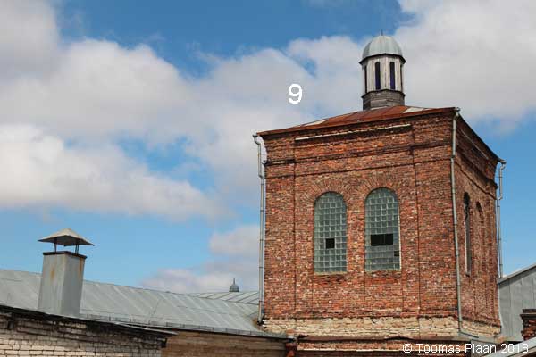
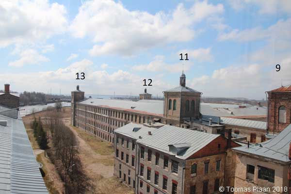
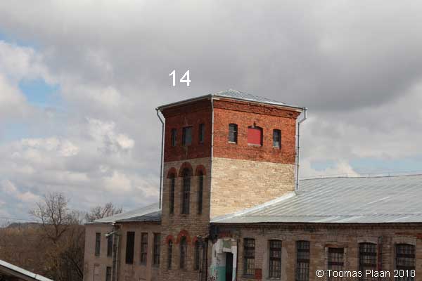
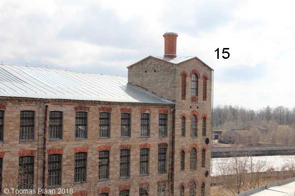
Narva, Kreenholm,(textile industry)
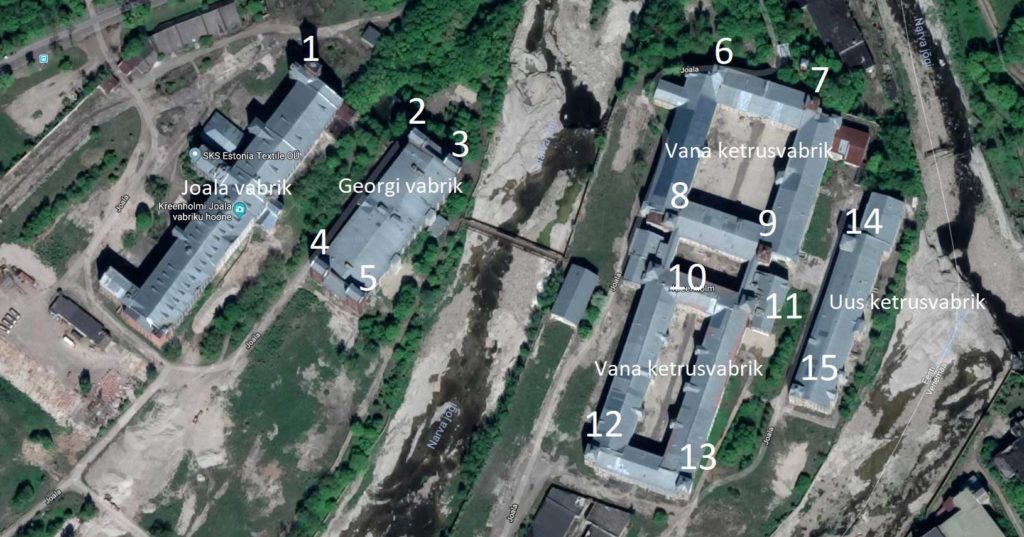
Coordinates:
1 = N 59.3591 – E 28.1927
2 = N 59.3586 – E 28.1939
3 = N 59.3585 – E 28.1944
4 = N 59.3578 – E 28.1927
5 = N 59.3577 – E 28.1932
6 = N 59.3591 – E 28.1975
7 = N 59.3589 – E 28.1987
8 = N 59.3582 – E 28.1969
9 = N 59.3580 – E 28.1981
10 = N 59.3579 – E 28.1967
11 = N 59.3569 – E 28.1978
12 = N 59.3568 – E 28.1960
13 = N 59.3566 – E 28.1971
14 = N 59.3580 – E 28.1991
15 = N 59.3571 – E 28.1988
Narva-Jõesuu, Koidu/Pargi
N 59.4589 – E 28.0402
Püssi, Raudtee (railway)
N 59.3589 – E 27.0529
Peeterristi, Vaivara vald
N 59.3988 – E 28.0758
Sillamäe (industry)
N 59.3990 – E 27.7364
Sonda (railway)
N 59.3485 – E 26.8498
Suur-Lootsi
N 59.4665 E 28.0412
Tammiku
N 59.3381 – E 27.3923
Tammiku, Tammiku
N 59.3280 – E 27.3800
Toila, Altküla, Liiva
N 59.4188 – E 27.5052
Toila, Toila gümnaasium, Pühajõe
N 59.4220 – E 27.5365
Uusküla, Männiku tee
N 59.0016 – E 27.3113
Vaivara, Jaama
N 59.3719 – E 27.7661
Viivikonna, Torni
N 59.3372 – E 27.6918
Voka, Voka mõis, Pargi
N 59.4125 – E 27.5809
Jõgevamaa
Avinurme, Põllu
N 58.9887 – E 26.8808
Jõgeva, Puiestee
N 58.7432 – E 26.3970
Jõgeva (railway)
N 58.7463 – E 26.4020
Mustvee, Tähe
N 58.8487 – E 26.9442
Pikknurme
N 58.5996 – E 26.2185
Vägari
N 58.7298 – E 26.2209
Järvamaa
Järva-Jaani, Mõisa
N 59.0468 – E 25.8855
Paide, Pärnu
N 58.8874 – E 25.5630

Paide, Mündi
N 58.8794 – E 25.5691

Türi, Jaama (railway)
N 58.8041 – E 25.4251
Türi, F. J. Wiedemanni
N 58.8087 – E 25.4310
Läänemaa/Wiek
Haapsalu / Hapsal, Posti/Nurme
N 58.9417 – E 23.5420
Haapsalu / Hapsal (former Soviet Union garrison)
N 58.9578 – E 23.5141
Haapsalu / Hapsal (railway)
N 58.9327 – E 23.5374
Haapsalu / Hapsal, Kiltsi, Vabriku
N 58.9189 – E 23.5208
Kirimäe (1)
N 58.9332 – E 23.7430
Kirimäe (2)
N 58.9184 – E 23.7626
Lihula / Leal (railway)
N 58.6808 – E 23.8462
Risti (railway)
N 58.9980 – E 24.0498
Virtsu (industry)
N 58.5807 – E 23.5229
Lääne-Virumaa
Avispea
N 59.1178 E 26.3866
Essu, Varangu-Essu
N 59.4415 – E 26.3673
Kunda, Kasemäe
N 59.5000 – E 26.5136
Lammasküla (agrarian)
N 59.0031 – E 26.2703
Padu (agrarian)
N 59.0696 – E 26.4891
Põdrangu
N 59.1380 – E 26.1256
Rakvere (railway)
N 59.3577 – E 26.3625
Simuna, Katsejaama tee (agrarian)
N 59.0515 – E 26.3902
Sivi
N 59.0307 – E 26.6898
Sääse
N 59.1645 – E 26.1399
Tammise (agrarian)
N 59.4414 – E 26.3673
Tamsalu, Tööstuse (railway)
N 59.1636 – E 26.0999
Tamsalu, Tööstuse (industry)
N 59.1620 – E 26.0939
Tapa (railway)
N 59.2658 – E 25.9636
Tapa, Malle (industry)(tower demolished)
N 59.2685 – E 25.9651
Tapa Karja, Karja tn (industry)
N 59.2601 – E 25.9269
Tõrma
N 59.3238 – E 26.3464
Undla, Vohnja-Kadrina (distillery)
N 59.3503 – E 26.1094
Vinni, Sõpruse
N 59.2919 – E 26.4271
Vinni, Pargi
N 59.2932 – E 26.4304
Põlvamaa
Krootuse, Tuulemäe tee
N 58.0718 – E 26.8306
Mooste, Suurfarmitagune tee
N 58.1606 E 27.1995
Põlva (railway)
N 58.0689 – E 27.0916
Raigla
N 58.1057 E 27.5120
Räpina, Metsa
N 58.0987 – E 27.4678
Veriora, Jaama (railway)
N 58.0051 – E 27.3561
Viluste (agrarian)
N 57.9935- E 27.3444
Pärnumaa
Audru, Kuuse
N 58.4149 – E 24.3311
Halinga, Loomse (agrarian)
N 58.5961 – E 24.5046
Lavassaare, Võidu
N 58.5124 – E 24.3735
Lemmetsa
N 58.4379 E 24.3915
Oidrema
N 58.5971 – E 23.9319
Pärnu, Ülejõe
N 58.3935 – E 24.4934
Pärnu, Suur-Sepa
N 58.3820 – E 24.5080
Sindi, Pärnu maantee (industry)
N 58.4095 – E 24.6581
Sindi, Pärnu maantee (city hall)
N 58.4031 – E 24.6453
Sindi, Pärnu maantee (industry)
N 58.4089 – E 24.6541
Tootsi, Tööstuse tn (industry)
N 58.5868 – E 24.7877
Treimani, Sadama tee (industry)
N 57.9186 – E 24.385
Vändra, C. R. Jakobsoni
N 58.6537 – E 25.03902
Raplamaa
Kohila, Jaama (railway)
N 59.1713 – E 24.7431
Lelle (railway)
N 58.8667 – E 25.0093
Märjamaa, Oru
N 58.9052 – E 24.4325
Märjama, Jaama (railway)
N 58.8980 – E 24.4368
Rapla (railway)
N 58.9943 – E 24.8317
Vana-Vigala, Jaama (railway)
N 58.7667 – E 24.2620
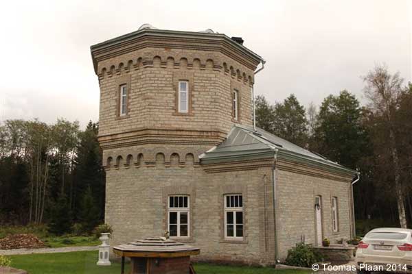
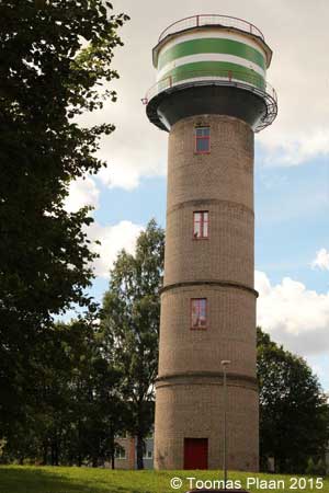
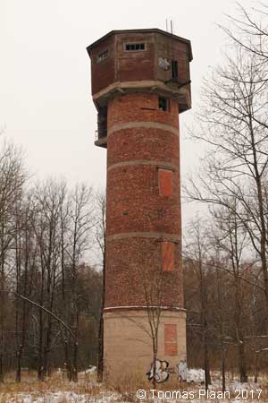
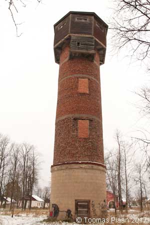
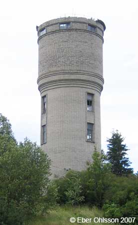
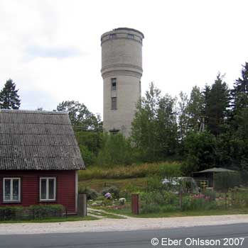
Saaremaa/Ösel
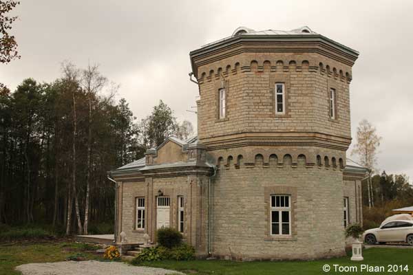
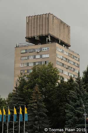
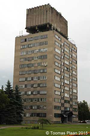
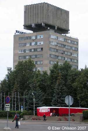
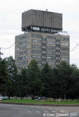
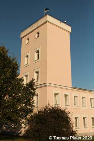
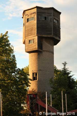
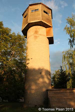
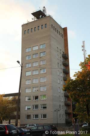
Kuressaare, Tallinna (Living Water Tower)
N 58.2538 – E 22.4895
Kuressaare, Pikk
N 58.2692 – E 22.4921
Karja, Ranna Tee
Orissaare, Ranna puiestee
N 58.5604 – E 23.0800
Tartumaa
Elva
N 58.2339 – E 26.4109
Elva (railway)
N 58.2238 – E 26.4251
Kallaste, Staadioni
N 58.6640 E 27.1600
Kallaste, Tööstuse
N 58.6718 – E 27.1631
Luke, Tamsa
N 58.2394 – E 26.5357
Nõo, Kalju Aigro
N 58.2807 – E 26.5373
Rebase
N 58.2378 – E 26.7963
Rõngu, Tiksi farm (agrarian)
N 58.1277 – E 26.2425
Tartu, Raadi
N 58.4002 – E 26.7433
Tartu, Õpetaja
N 58.3749 – E 26.7165
Tartu, Vaksali (railway)
N 58.3727 – E 26.7089
Tartu, Tulbi
N 58.3739 – E 26.6919
Valgamaa
Sangaste (railway)
N 57.8619 – E 26.1863
Sangaste-Tsirguliina, sawmill (industry)
N 57.8601 – E 26.1873
Sangaste, Lossiküla (castle)
N 57.9029 – E 26.2807
Taheva, Tsirgumäe, Sanatooriumi
N 57.6044 – E 26.3351
Valga, Lai (residential)
N 57.7741 – E 26.0394
Valga, Jaama puiestee (railway)
N 57.7748 – E 26.0501
Valga, Tehnika (railway)
N 57.7726 – E 26.0542
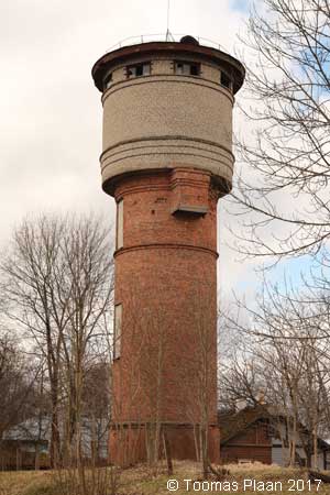
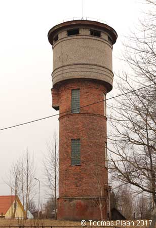
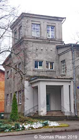
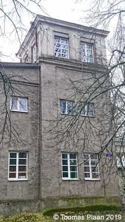
Valga, Aia/Mesipuu (sauna)
N 57.7751 – E 26.0345
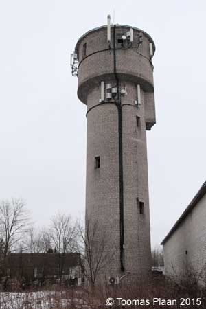
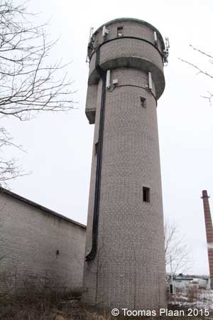
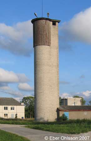
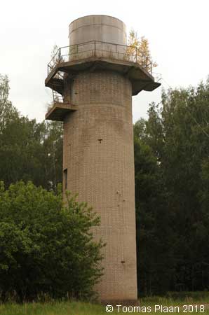
Viljandimaa
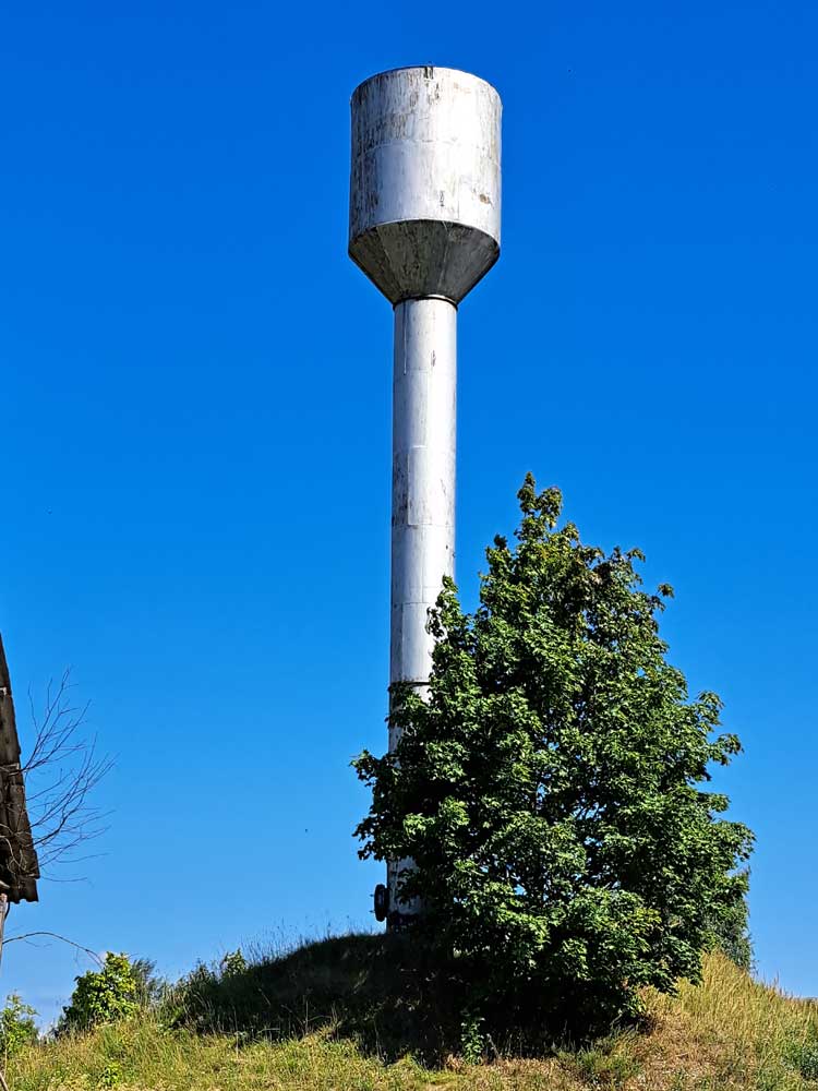
Abja-Paluoja
N 58.1269 – E 25.3492
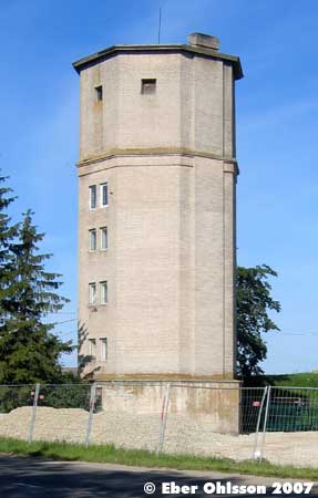
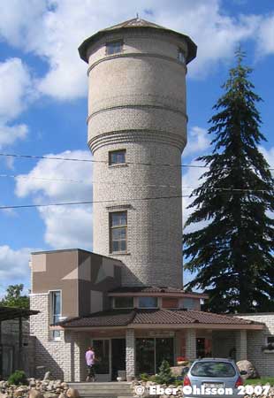
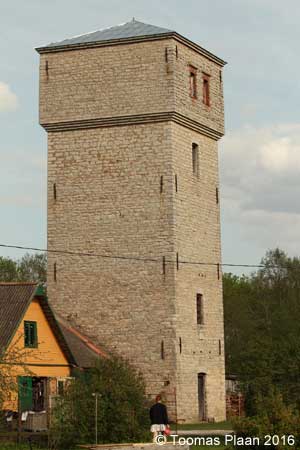
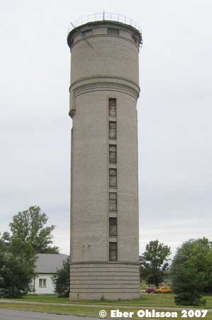
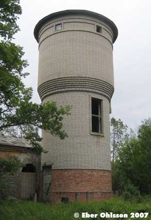
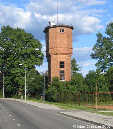
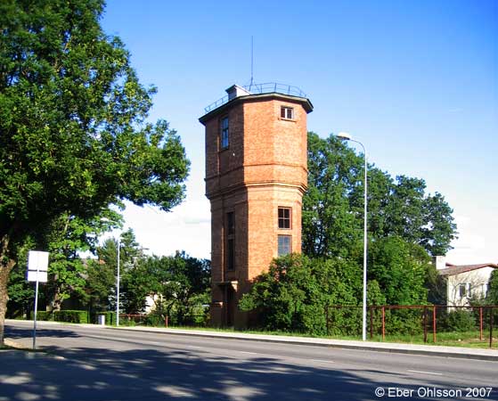
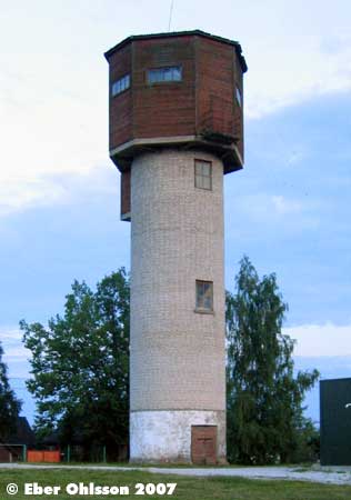
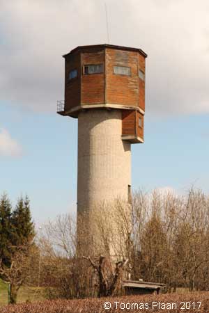
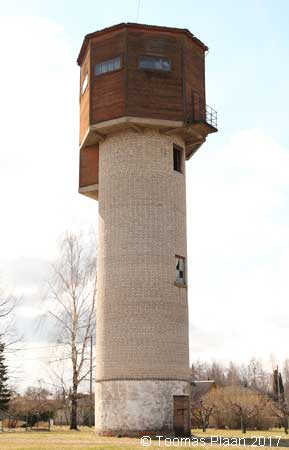
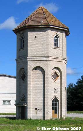
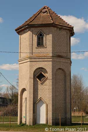
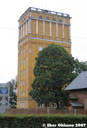
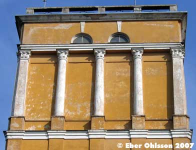
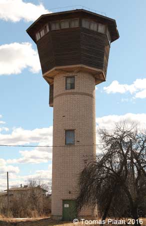
Karksi-Nuia
N 58.0989 – E 25.5538
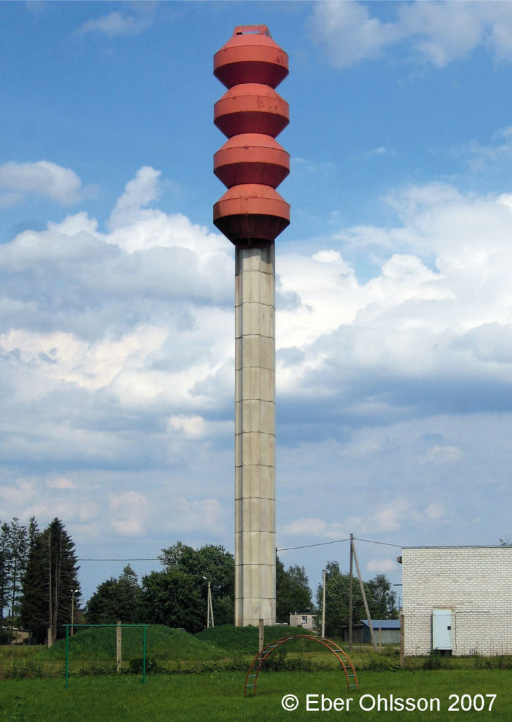
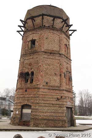
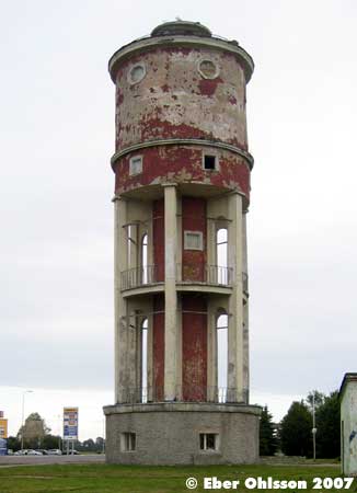
Läs om vattentornet – Ebers vattentorn – Cirkulation nr 4/2017.
I den gamla estniska staden Karksi-Nuia, nära gränsen mot Lettland, står sedan 1994 ett 35 meter högt vattentorn med fyra cisterner, som vardera rymmer 30 m³ vilket ger en total volym på 120 m³. Det är ett lettiskt bolag som konstruerat detta standardvattentorn, med varierande antal cisterner.
I Lettland kan man finna vattentorn med såväl två, tre som fyra cisterner ordnade på samma sätt som i Karksi-Nuia. I den mycket lilla staden Ape i nordöstra Lettland står intill varandra tre vattentorn med vardera tre cisterner, alltså totalt nio cisterner. Frågan är om det är den optimala lösningen?
Ladda ner Cirkulations version som pdf-fil.

Karksi-Nuia, Ettevõtluse
N 58.1058 – E 25.5418
Mõisaküla (railway)
N 58.0943 – E 25.1862
Olustvere, Talli (tower demolished)
N 58.5539 – E 25.5691
Suure-Jaani, Lembitu puiestee
N 58.5373 – E 25.4762
Tohvri, Tohvri tee (industry)
N 58.3927 – E 25.3533

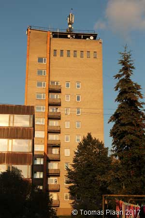
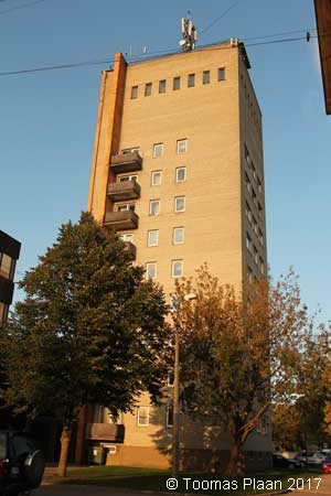
Viljandi, Uusna
N 58.3911 – E 25.7449
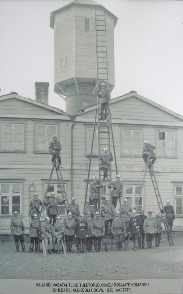
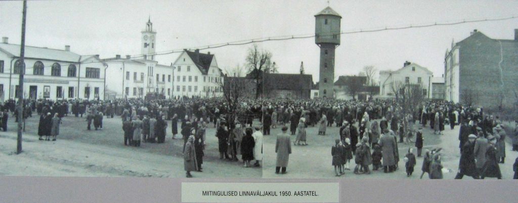
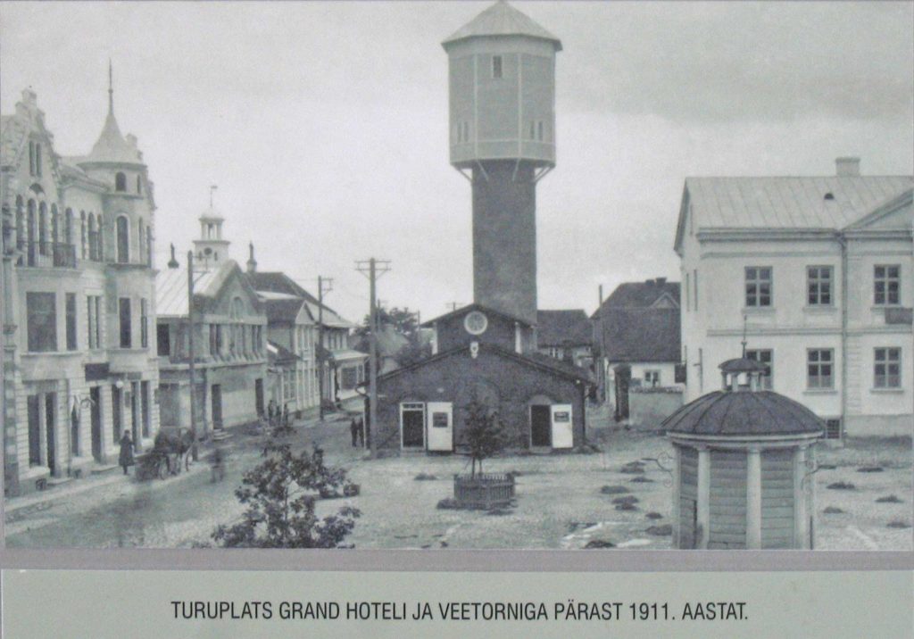
Viljandi, Johan Laidoneri plats
N 58.3628 – E 25.6012
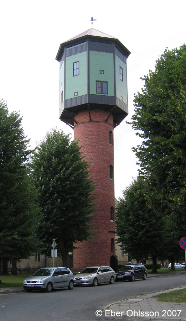
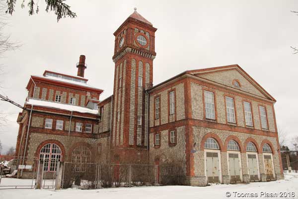
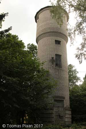
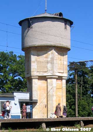
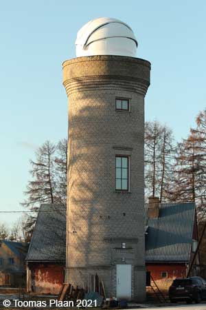
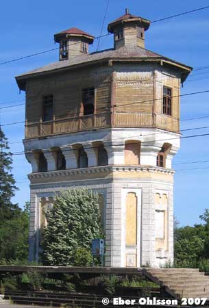
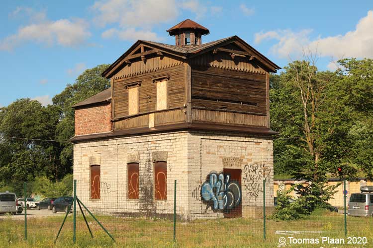
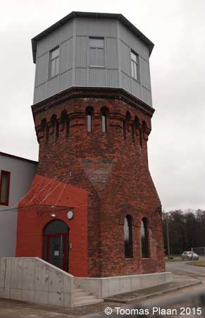
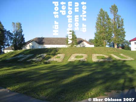
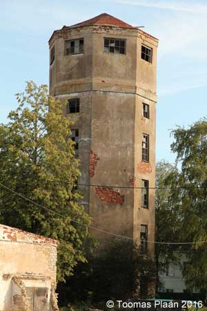
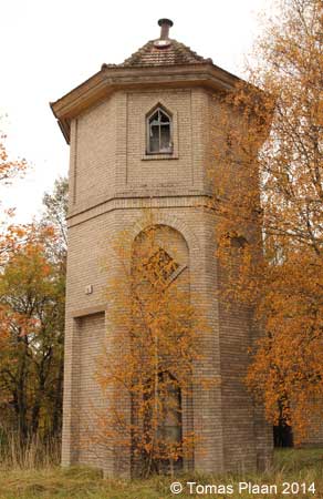
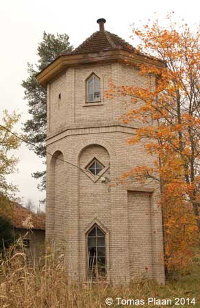
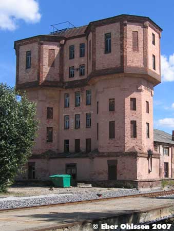
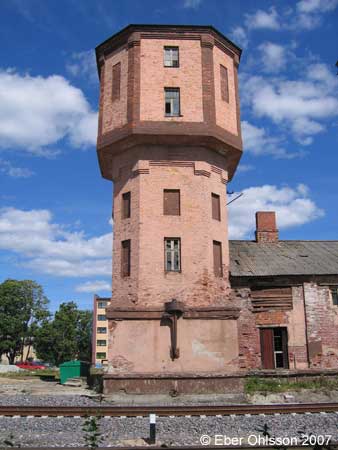
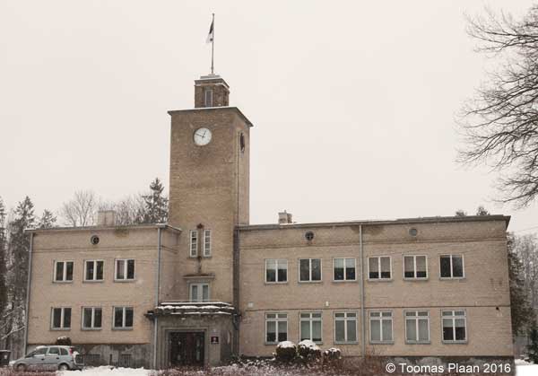
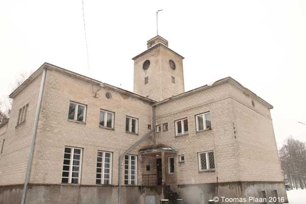
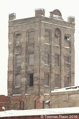
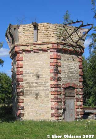
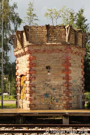
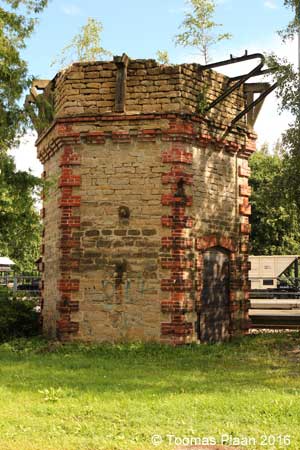
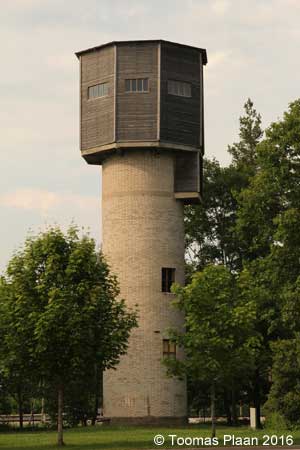
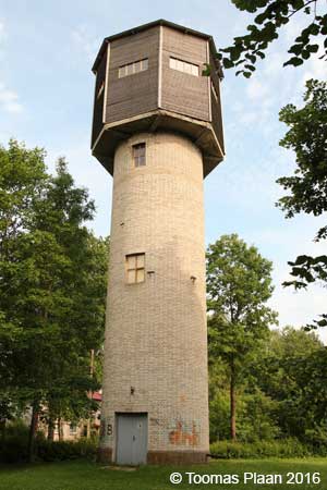
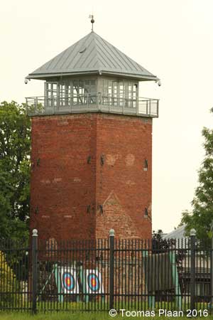
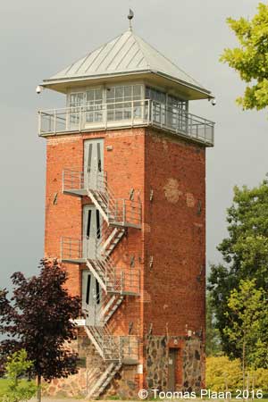
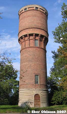
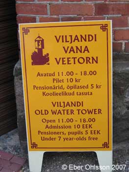
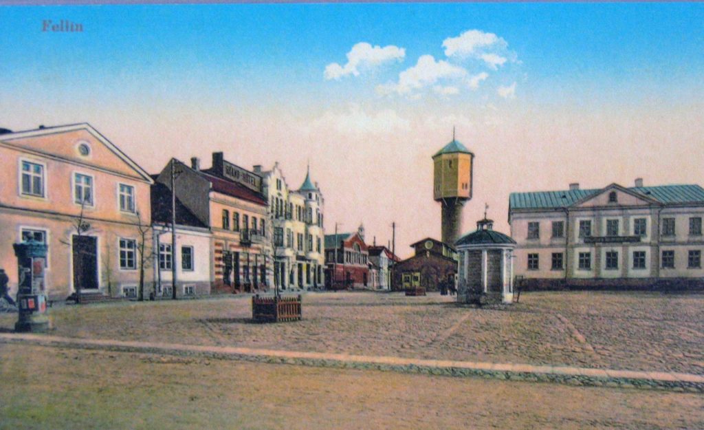
Läs om vattentornet – Ebers vattentorn – Cirkulation nr 7/2007.
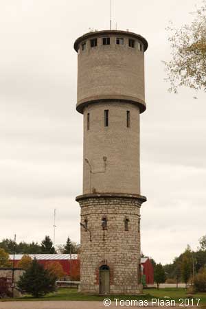
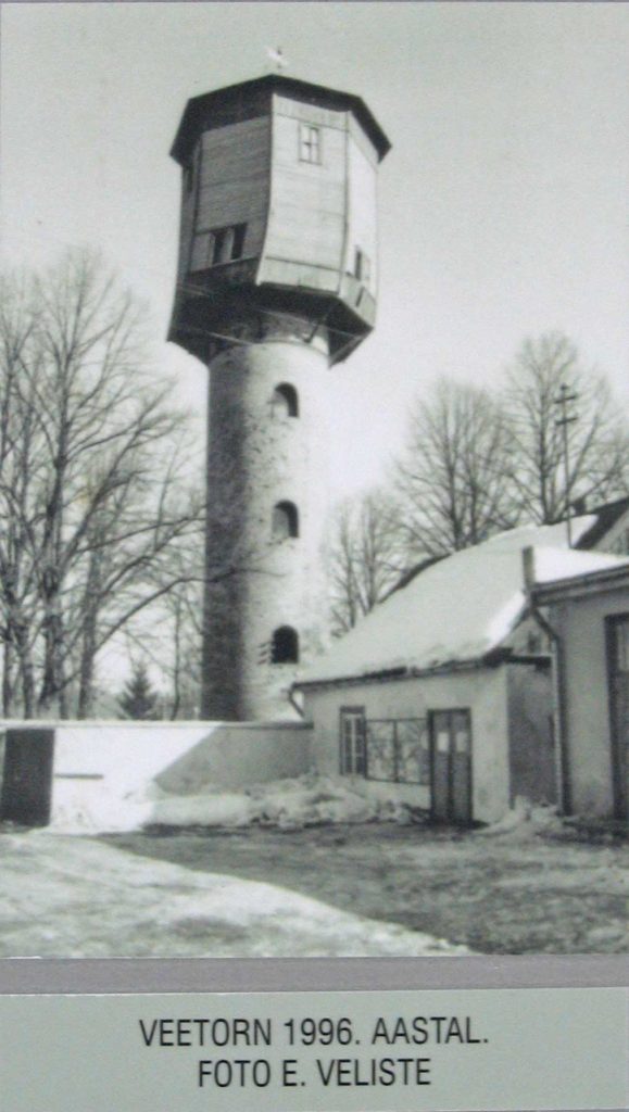
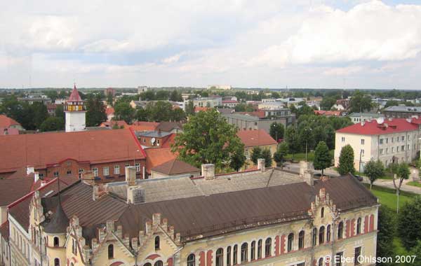
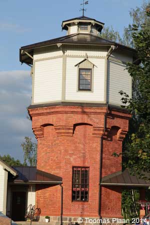
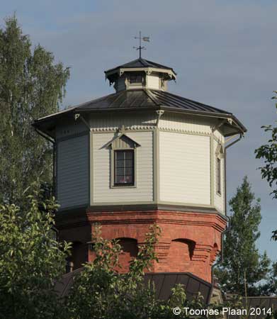
Det är inte helt ovanligt att äldre vattentorn, som inte längre är i drift, får en ny uppgift som utsiktstorn. I regel får då rör och reservoarer vara kvar intakta, antingen det sker av kostnads- eller av byggnadsantikvariska skäl. Ovanligt är det däremot att hela övre delen av tornet lyfts bort och ersätts med en kopia.
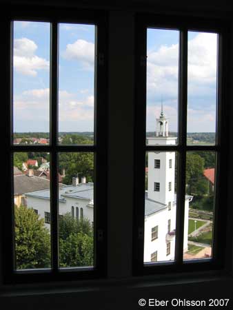
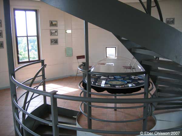
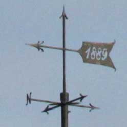
Så skedde dock år 2001 i den estniska staden Viljandi, när dess 30 meter höga vattentorn, byggt 1911 och tagit ur drift 1960, genom en insamling i stadens Rotary Clubs försorg, fick en ny oktagonal trevåningsöverdel. Nu kan man här se på både utsikten och stadshistoriska bilder.
Ladda ner Cirkulations version som en pdf-fil.
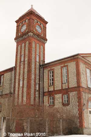
Sign at the water tower:
VILJANDI WATERWORKS AND THE OLD WATER TOWER 1911
By the beginning of the 2Oth century the population growth and expanded business activities in the centre of the town caused numerous communal problems to the municipal government of that time, including the problem of water supply. To solve it, a committee of officials and businessmen was formed at the town council meeting on 25 October 1908. Already in the preliminary stage of work it was clear that there were not sufficient financial means and local skilled work force available for building waterworks. Furthermore, other major projects were in progress – drainage of the lands of the municipal estate of Vilratsi, construction of the sewerage and a slaughterhouse. For the purpose of building the waterworks the municipal government, led by the active mayor Otto v. Engelhard. and the town council decided to make a loan of 40 000 roubles. In autumn 1909 the Rosenberg-Niilus company from Valga started boring the first well and reached underground water in the depth of 45 feet [14 m]. However, the water in the well at the site of the water tower, near the so-called Raska house, was unsuitable because of its high iron content and so in 1911 a new one was ordered from the Siegel and Co from Tallinn to be built near the slaughterhouse. The quantity and quallty of water from the new 298-feet [91 m] well, which was bored between the present Rannapuiestee and the stadium, was satisfactory.
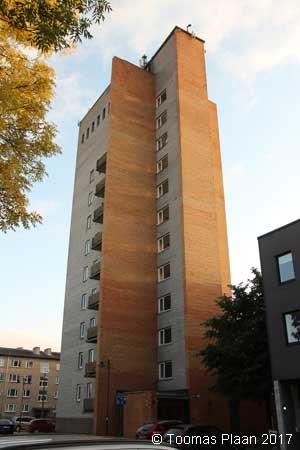
The year 1911 was marked by major digging and piping works in the town, as well as tower building. Still the works were not completed on time. Due to the concurrence of several major projects there was labour shortage in the town. In the competition for employing unskilled workers, farmers from the surroundings of Viljandi tried to overpay the workers. Furthermore, digging was hindered by an unusually wet summer – excavation works were delayed by heavy downpours; the hurriedly filled trenches turned into clay sloughs, which seriously obstructed traffic in the streets. Because of the medieval origin of Viljandi much new and interesting was found in the course of extensive excavation. For instance, the foundation of the watertower was laid on the site of the graveyard around the former St. John and Clara church and numbers of skulls were dug out there. On the corner of Lossi and Oru street workers discovered an old drainage system. The amateur archaeologist members of Viljandi Literary Society could for the first time locate the site and draw the plans of Tartu and Riga Gates. Despite the delay in works and all the obstacles the whole water system was completed before the cold. For the 30-metre water tower a tank holding 6600 buckets [125 m3] of water was ordered from Uno Pohrt’s engineering plant in Kantreküla, and already on 26 October water was pumped in. Around 24 November the first water tests were carried through in different parts of the town – near Schöler’s pharmacy on the Old Market, near the Stifthouse on the corner of Tallinn and Veske street, on the corner of Tartu and Lossi streets and elsewhere. The jet of water reached higher than the roof of a three-storey house, and therefore it was possible to use the water for firefighting purposes. After the water system was taken into use, the piping leaked in some places but soon these problems were solved. A somewhat more serious trouble arose when water consumption became higher than estimated and the pump failed to filt the reservoir to the required level. In 1912 a more powerful pump was procured. The same year the first fountain was opened in Lastepark.
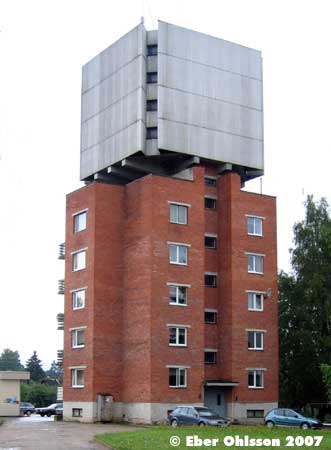
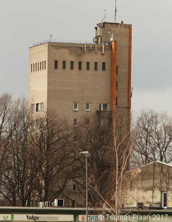
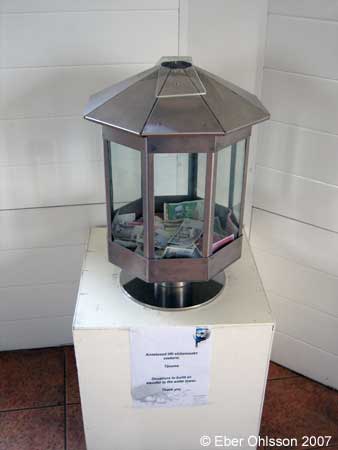
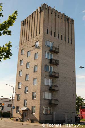
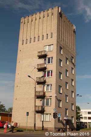
The water tower was used until the new multi-storeyed residential building/water tower was completed in 1960 and has been in disuse since then. In 1981 a draft was made to reconstruct the old tower into a lookout, but there were no interested parties and fortunately the plan was never executed. As a result of the restoration campaign initiated by the Iocal Rotary Club, the tower got a new three-storey, steel structure top. In June 2001 the lookout received its first visitors.
Viljandi, Carl Robert Jakobsoni
N 58.3677 – E 25.5921
Viljandi (railway)
N 58.3584 – E 25.5744
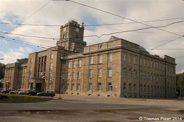
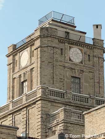
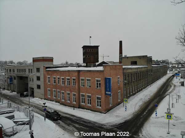
Viljandi, Vabriku (Tikuvabrik) (industry)
N 58.3591 – E 25.5773
Viljandi, Raua (dairy industry)
N 58.3629 – E 25.5718
Viljandi, Lossi (Flax Factory)
N 58.3679 E 25.6022
Võrumaa
Antsla (railway)
N 57.8306 – E 26.5440
Lasva
N 57.8637 – E 27.1793
Orava, Solda tee
N 57.8866 – E 27.4547
Võru, Lembitu
N 57.8469 – E 26.9990
Võru, Kose tee (railway)
N 57.8268 – E 27.0202
Võru, Silikaadi
N 57.8582 – E 26.9831
Võru, Võmmorski
N 57.8293 – E 27.5307