| Skånska vattentornssällskapet - Urbanmorfologi Scanian Water Tower Society - Urban Morphology |
| Hem | Vattentorn - Water Towers | Ebers vattentorn | Eber's Water Towers | Observandum |
Vattenblandat |
aVA |
| VA-historia | VA-Profiler | VA-artiklar | VA-litteratur | Akvedukter | Däxlar | Diverse VA | Gästsidor | Länkar |
| USA | Alabama | Arizona | California | Florida | Georgia | Idaho | Illinois | Indiana | Iowa | Kentucky | Louisiana | Maryland |
| Massachusetts | Michigan | Minnesota | Mississippi | Missouri | Nebraska | Nevada | New Jersey | New Mexico | New York |
| North Carolina | Ohio | Oregon | Pennsylvania | South Carolina | Texas | Utah | Virginia | Washington DC | Wisconsin | Wyoming |
| Water Towers: Illinois Vattentorn: Illinois |
 Aroma Park |
 Aroma Park |
 Ashkum |
 Atterberry |
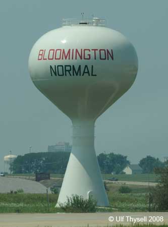 Bloomington |
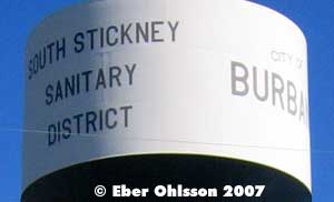
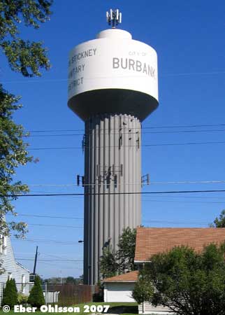 Burbank |
 Centralia |
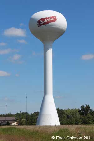 Centralia |
 Centralia |
 Centralia |
 Chenoa |
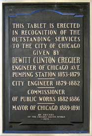
 Chicago |
 Chicago |
 Chicago |
 Chicago |
 Chicago |
 Chicago |
 Chicago |
 Collinsville |
 Collinsville |
 Elmwood Park |
 Fairbury |
 Fairview Heights |
 Frankfort |
 Frankfort |
 Germantown Hills |
 Germantown Hills |
 Grayville |
 Havana |
 Havana |
 Highwood |
 Lewistown |
 Litchfield |
 Lyons |
 Makanda |
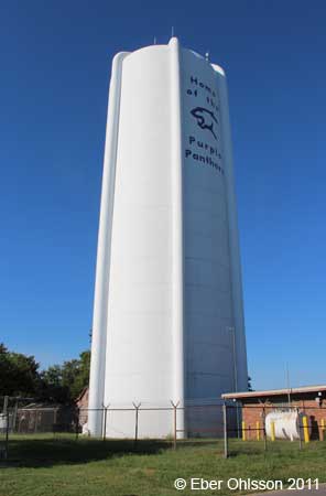
 Metropolis |
 Mid-America Airport |
 Monee |
 Morton |
 Mt Vernon |
 Nashville |
 Normal |
 Norridge |
 North Riverside |
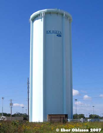
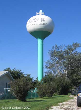 Orland Park |
 Orland Park |
 Palos Heights |
 Peoria Heights |
 Peoria Heights |
 Rend Lake |
 Riverside |
 Summit |
 Tinley Park |
 Western Springs |
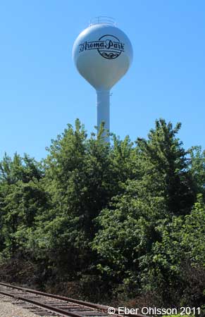
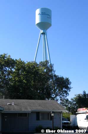
| Aroma Park, Cincinatti Place N 41.0809 - W 87.8057 |
|
| Aroma Park, Lowe Road N 41.0866 - W 87.8105 |
|
 |
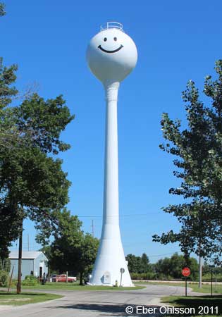
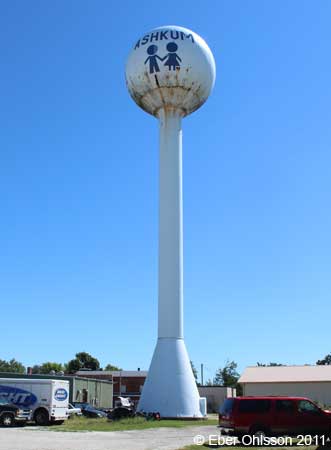
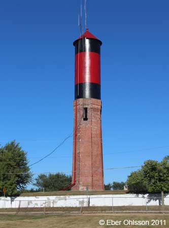
| Ashkum, South 2nd Street N 40.8792 - W 87.9544 |
Enligt borgmästaren i Ashkum är figuerna ett minne från det tillfället då man skulle måla tornet och det färgtestet som då gjordes. |
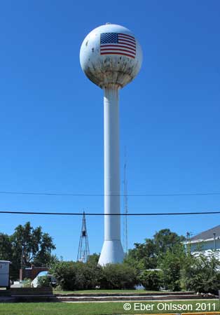 Enligt samme borgmästare tillkom flaggan senare när man skulle måla om tornet, vilket skedde en kort tid efter den 11 september 2001. |
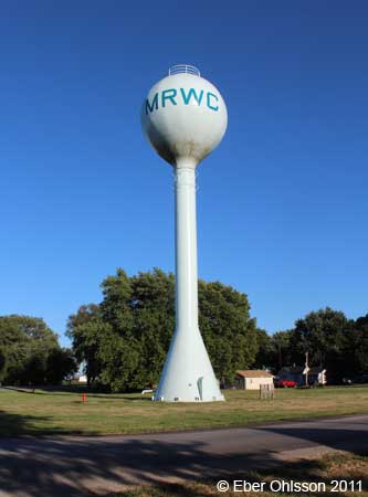
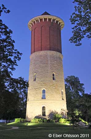
| Atterberry, Church Street N 40.0611 - W 89.9234 |
MRWC = Menard Rual Water Co-op. |
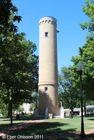
| Bloomington |
|
| Burbank, 83th Street N 41.7379 - W 87.7957 |
|
 |
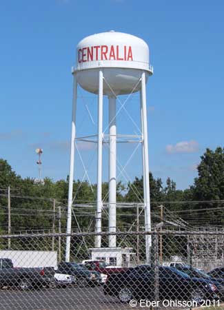
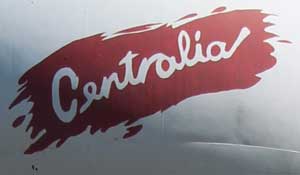
| Centralia, South Oak Street (railway) N 38.5273 - W 89.1353 |
|
|
|
|

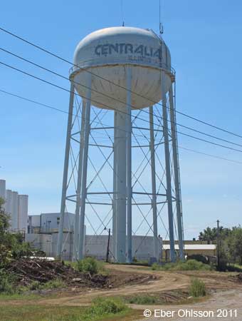
| Centralia, U.S. Route 51 N 38.4774 - W 89.1437 |
|
 |
| Centralia, Mitchell Lane N 38.4958 - W 89.1405 |
|
| Centralia, South Walnut Street N 38.5202 - W 89.1401 |
|
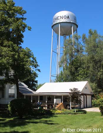
| Chenoa, South Division Street N 40.7433 - W 88.7181 |
|
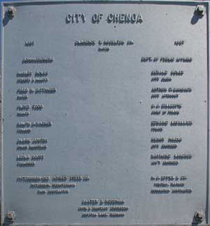 En skylt på vattentornet förtäljer om vem som styrde och ställde i City of Chenoa 1957, alltifrån borgmästaren och neråt. Skylten nämner också att reservoartillverkaren var Pittsburgh - Des Moines Steel Co från Pittsburgh, Pennsylvania och att tornfundamentet tillverkades av H. J. Eppel & Co från Pontiac, Illinois. |
 |
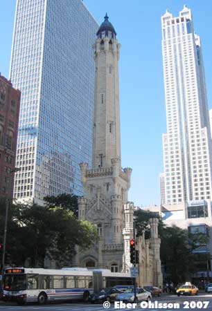
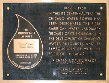
Chicago, North Michigan Avenue
N 41.8971 - W 87.6578
|
 |
 |
 |
|
|
|
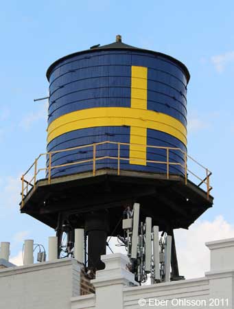
| Chicago, Andersonville, North Clark Street N 41.9767 - W 87.6679 |
|
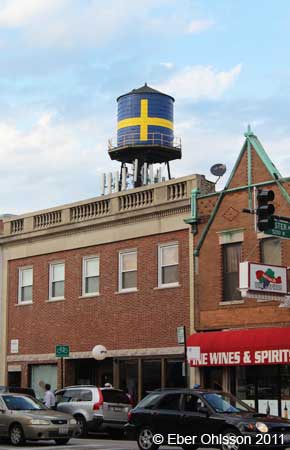 |
|
|
|
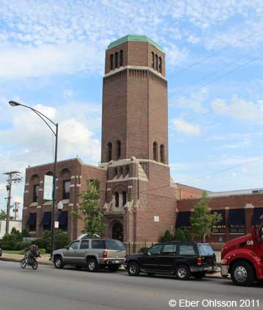
| Chicago, Belmont Gardens, West Belmont Avenue N 41.9388 - W 87.7333 |
|
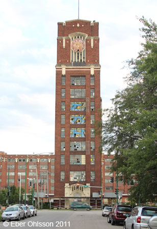
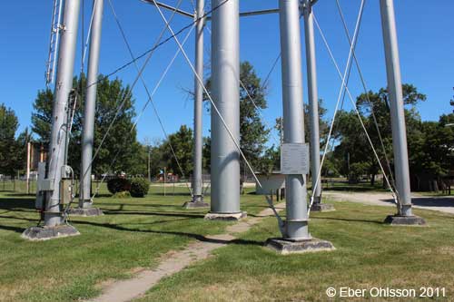
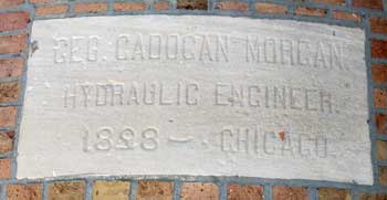
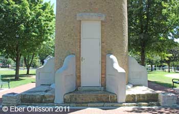
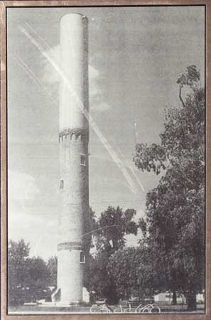
| Chicago, Central Manufacturing District, West Pershing Road N 41.8229 - W 87.6750 |
|
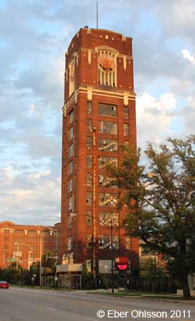 |
| The 1918 book Manufacturing and Wholesale Industries of Chicago by J. Seymour Currey reports: |
|
Located at the head of Robey street [Damen Avenue], facing north on Thirty-ninth street [Pershing Road], in the exact frontage between Ashland and Western avenues, is the new Tower and Sprinkler building, from which water for fire protection purposes will be distributed through the utility tunnel system to every building in the new district. The building is 40 feet by 40 feet in ground area and contains eight floors and basement. An automatic electric high-speed elevator has been installed in the building, making these floors most attractive for office and light manufacturing use. |
At the top of the tower are two gigantic steel water tanks, one nesting in the other, each tank having a capacity of 125,000 gallons of water, thereby giving a total fire protection storage water supply of 250,000 gallons [2 x ca 475 m³ = 950 m³]. These tanks are entirely enclosed in brick and terra cotta, and on each of the four sides of the Tower, near the top, is a large clock face, each nearly 13 feet in diameter [ca 4 m], and lighted by electricity. Within the circle of clock figures is the seal of the Central Manufacturing District in color. |
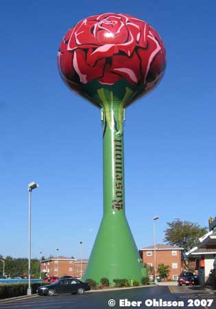
| Chicago, Rosemont, North River Road N 41.9903 - W 87.8608 |
|
|
|
|
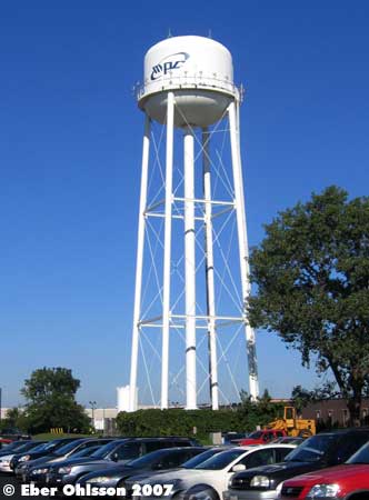
| Chicago, Skokie, Central Avenue (industry) (MPC Products Corporation) 1 N 42.0171 - W 87.7692 |
|
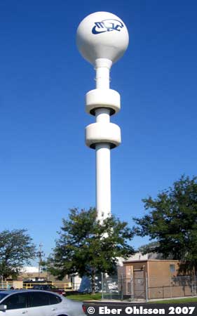
| Chicago, Skokie, Central Avenue (industry) (MPC Products Corporation) 2 N 42.0136 - W 87.7666 |
|
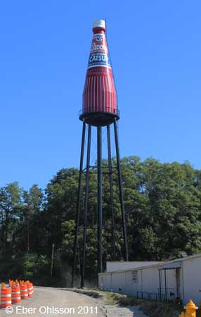
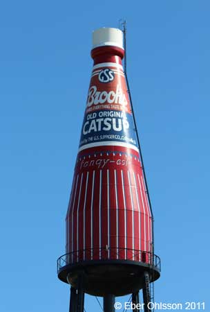
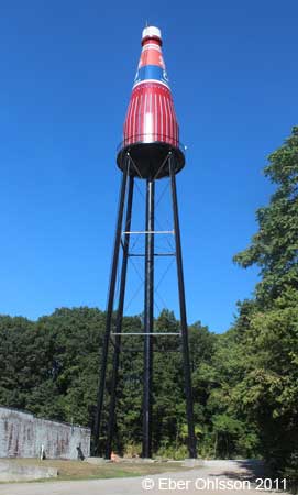
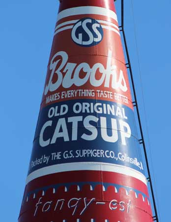
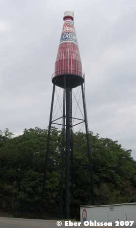
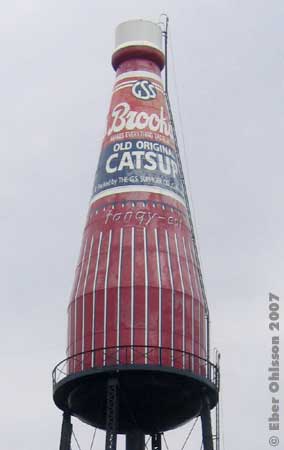
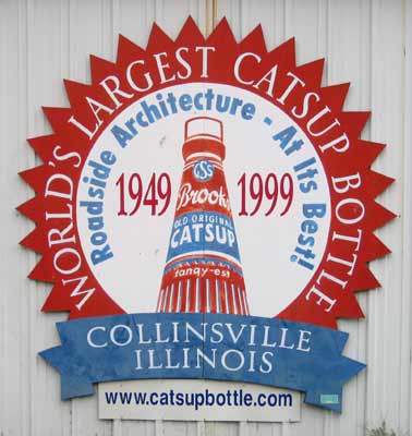
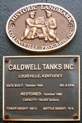
| Collinsville, South Morrison Avenue (Catsup Bottle) N 38.6629 - W 89.9822 |
|
 |
 |
 |
 |
 |
 |
 |
|
|
|
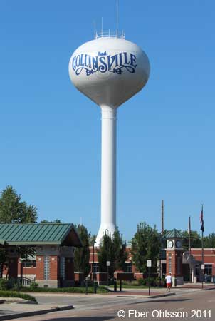
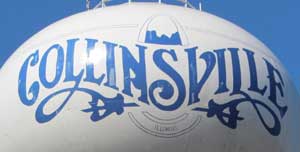
| Collinsville, West Clay Street/North Seminary Street N 36.6701 - W 89.9885 |
|
 |
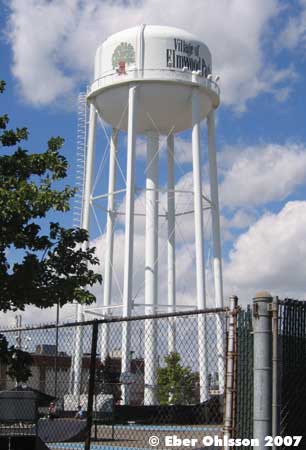
| Elmwood Park, West Fullerton Avenue N 41.9208 - W 87.8119 |
|
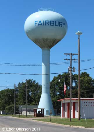
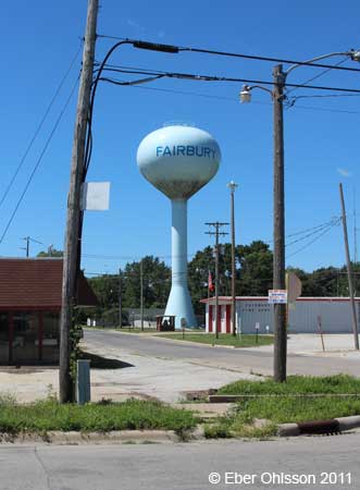
| Fairbury, West Locust Street/North Webster Street N 40.7471 - W 88.5182 |
|
 |
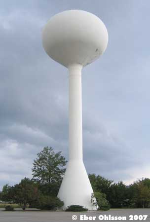
| Fairview Heights N 38.5979 - W 89.9785 |
|
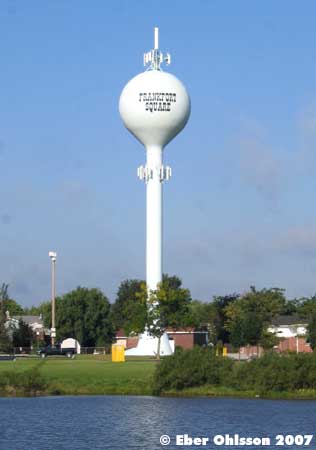
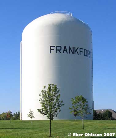
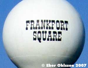
| Frankfort, Frankfort Square, South Graceland Lane N 41.5216 - W 87.8044 |
|
 |
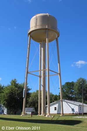
| Frankfort, Raintree Lane N 41.5055 - W 87.8317 |
|
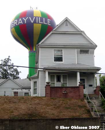
| Grayville, North 21nd Street N 38.2583 - W 87.9996 |
|
| Germantown Hills, Ten Mile Creek Road (1) N 40.7621 - W 89.4725 |
|
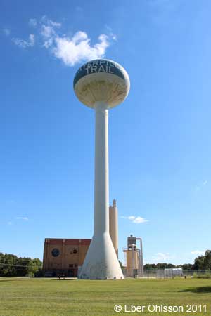
| Germantown Hills, Ten Mile Creek Road (2) N 40.7618 - W 89.4729 |
Caterpillar Trail Public Water District. |
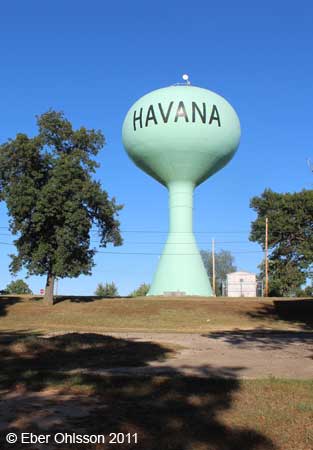
| Havana, East Main Street/North Pearl Street N 40.3004 - W 90.0591 |
|
 |
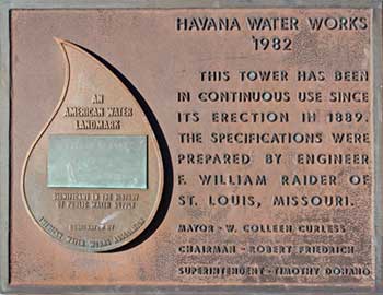 |
Sign at the tower.
|
| Havana, West 1st Street/South Broadway Street N 40.2926 - W 90.0613 |
|
| Highwood, Sheridan Road N 42.2105 - W 87.8155 |
|
| Lewiston, North State Route 97 N 40.3935 - W 90.0828 |
|
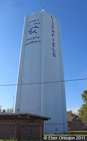
| Litchfield, West Columbus Street N 39.1717 - W 89.6664 |
|
 |
| Lyons N 41.8174 - W 87.8203 |
|
| Makanda, Giant City Lodge Road N 37.5935 - W 89.1844 |
|
 |
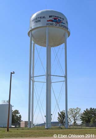
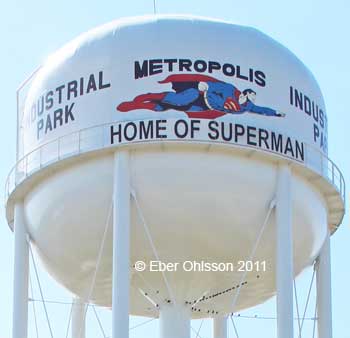
| Metropolis, Gurley Road N 37.1736 - W 88.6840 |
|
 |
|
|
|
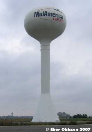
| Mid-America Airport N 38.5460 - W 89.8078 |
|
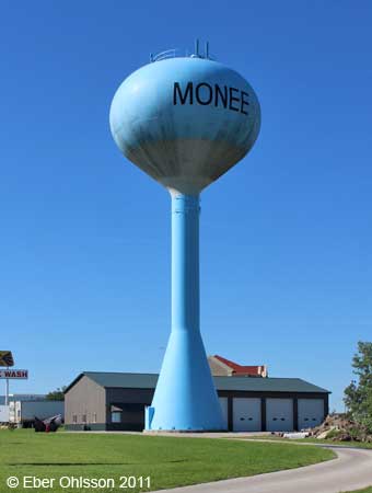
| Monee, Roosevelt Street N 41.4253 - W 87.7577 |
|
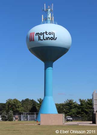
| Morton, South Detriot Avenue N 40.6074 - W 89.4719 |
|
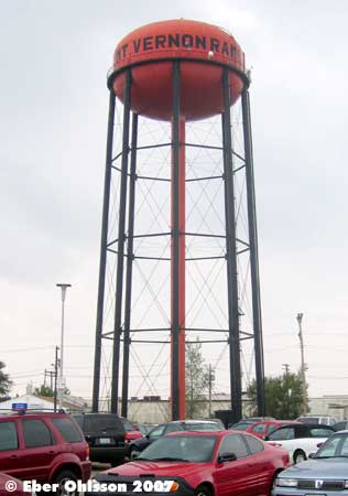
| Mount Vernon, Opdyke Avenue N 38.3135 - W 88.9002 |
|
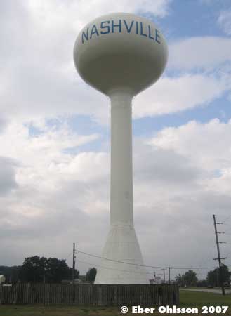
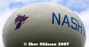
| Nashville, Enterprise Avenue N 38.3682 - W 89.3707 |
|
 |
| Normal, Fell Park, East Cypress Street N 40.5147 - W 88.9810 |
|
 |
 |
Sign at the tower.
|

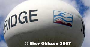
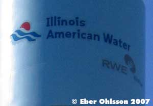
| Norridge, Tot Park N 41.9598 - W 87.8094 |
|
 |
| North Riverside, West 25th Street N 41.8451 - W 87.8075 |
|
| Orland Park, Cherry Lane N 41.6447 - W 87.8267 |
|
| Orland Park |
|
 |
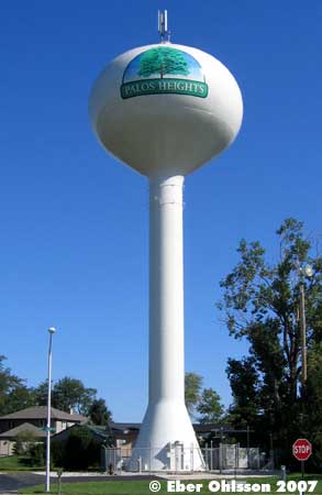
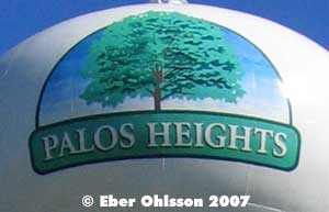
| Palos Heights, Misty Meadow Drive N 41.6495 - W 87.8193 |
|
 |
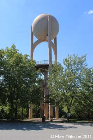
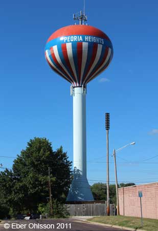
| Peoria Heights, North Grand View Drive N 40.7470 - W 89.5748 |
|
 |
 |
 |
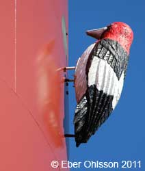 |
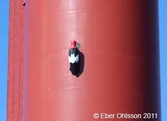
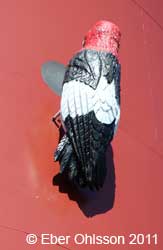
| Hackspetten är en Red-headed Woodpecker. En hyggligt vanlig hackspett öster om Rocky Mountains, USA. /Daniel Melchert |
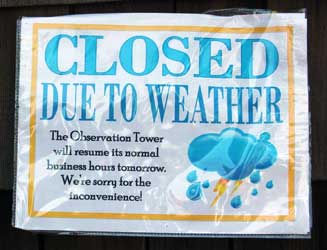 |
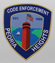
The sign to the left: The weather that day when the pictures were taken could not be better, and therefore no reason to keep the Observation Tower closed due to weather. The emblem to the right was sitting on a pickup truck belonging to The Village of Peoria Heights. |
 |
| Peoria Heights, East Toledo Avenue N 40.7431 - W 89.5788 |
|
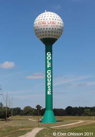
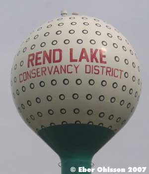
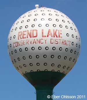
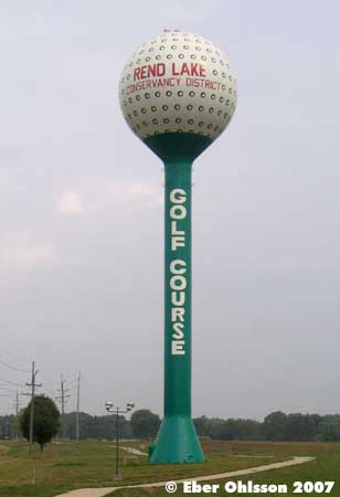
| Rend Lake, Larry E Foster Parkway N 38.0779 - W 98.9201 |
 |
  |
|
|
|
| Riverside, Pine Avenue N 41.8277 - W 87.8210 |
|
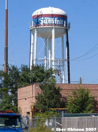
| Summit, West 59th Street N 41.7841 - W 87.8041 |
|
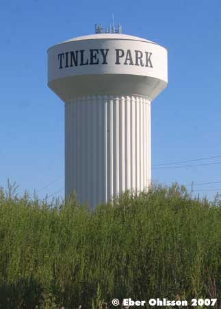
| Tinley Park, Cloverview Drive N 41.5669 - W 87.8184 |
|
| Western Springs, Hillgrove Avenue/Walnut Street N 41.8098 - W 87.9009 |
|
|
| Hem Home |
Vattentorn Water Towers |
Water Towers: USA | Upp Up |
| Senast uppdaterad 250212 |