| Skånska vattentornssällskapet - Urbanmorfologi Scanian Water Tower Society - Urban Morphology |
| Hem | Vattentorn - Water Towers | Ebers vattentorn | Eber's Water Towers | Observandum |
Vattenblandat |
aVA |
| VA-historia | VA-Profiler | VA-artiklar | VA-litteratur | Akvedukter | Däxlar | Diverse VA | Gästsidor | Länkar |
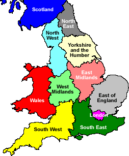
| Great Britain | East of England | East Midlands | Greater London | North East England | North West England | Scotland |
| Regions | South East England | South West England | Wales | West Midlands | Yorkshire and the Humber |
| Water Towers: Region South West England Vattentorn: Region Sydvästra England |
 Baydon |
 Bournemouth |
 Bournemouth |
 Bournemouth |
 Bristol |
 Bristol |
 Charfield |
 Charlton |
 Churchinford |
 Cold Aston |
 Crudwell |
 Culmhead |
 Dorchester |
 Druids Lodge |
 Dunster |
 East Winterslow |
 Failand |
 Fairford |
 Farleigh |
 Freshford |
 Hannington Wick |
 Kemble |
 Kemble Airfield |
 Leigh Woods |
 Ludgershall |
 Malmesbury |
 Malmesbury |
 Poole |
 Poole |
 Prestbury |
 Rockwell Green |
 Rockwell Green |
 Rodbourne |
 Rodmarton |
 Salisbury |
 Seaton |
 Sherston |
 Swanage |
 Swindon |
 Swindon |
 Tarlton |
 Taunton |
 Tetbury |
 The Mythe |
 Tilshead |
 Toddington |
 Toddington |
 Wellington |
 Weston-super-Mare |
 Willand |
 Yatton Keynell |
| Bath and North East Somerset | Bristol | Dorset | Gloustershire | North Somerset | Somerset | South Gloustershire | Swindon | Wiltshire |
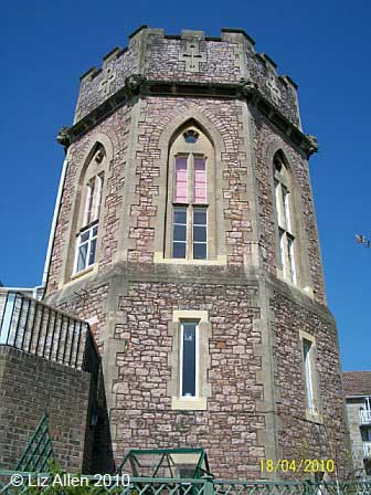
| Bath and North East Somerset |
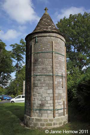
| Freshford, Pipehouse Lane N 51.3430 - W 2.3274 |
|
| Bristol |
| Bristol, Durdham Down N 51.4720 - W 2.6180 |
|
| Bristol, Knowle, Jubilee Road N 51.4339 - W 2.5623 |
|
| Dorset |
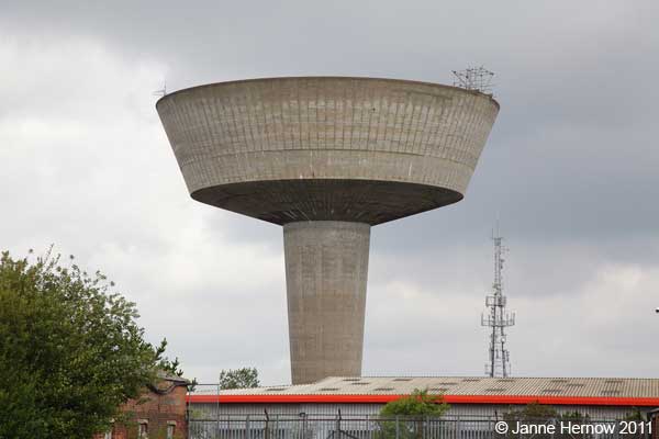
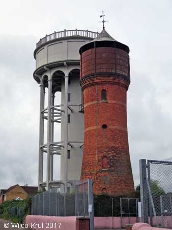
| Bournemouth, Boscombe N 50.7292 - W 1.8425 |
|
| Bournemouth, Tuckton N 50.7249 - W 1.8005 |
|
| Bournemouth, Upper Gardens N 50.7251 - W 1.8954 |
|
| Poole, Parkstone N 50.7282 - W 1.9425 |
|
| Poole, Newton, Mannings Heath N 50.7449 - W 1.9490 |
|
 |
| Dorchester N 50.7142 - W 2.4492 |
|
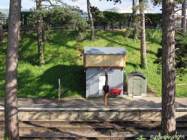
| Swanage, Swanage Station (railway) N 50.6100 - W 1.9620 |
|
| Seaton N 50.7173 - W 3.0874 |
|
| Gloustershire |
| Cold Aston N 51.8779 - W 1.8161 |
|
| Fairford, Coronation Street N 51.7096 - W 1.7893 |
|
| Kemble (railway) N 51.6774 - W 2.0234 |
|
| Prestbury, Evesham Road (railway) N 51.9237 - W 2.0690 |
 |
| Rodmarton N 51.6808 - W 2.0896 |
 |
| Tarlton, Sandpoole Lane N 51.6933 - W 2.0614 |
|
| Tetbury, Lowfield Road N 51.6457 - W 2.1625 |
|
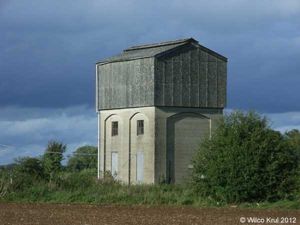
| The Mythe, Mythe Road N 52.0080 - W 2.1619 |
|
| Toddington (railway) N 51.9887 - W 1.9284 |
 |
| Toddington (railway) N 51.9894 - W 1.9283 |
|
| North Somerset |
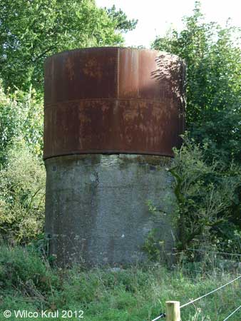
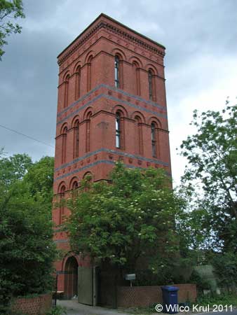
| Failand, Clevedon Road N 51.4464 - W 2.7075 |
|
| Leigh Woods, St Mary's Road N 51.4531 - W 2.6384 |
 |
| Weston-super-Mare, Shrubbery Avenue N 51.3553 - W 2.9844 |
|
| Somerset |
| Churchinford, Church Road N 50.9139 - W 3.1294 |
 |
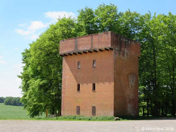
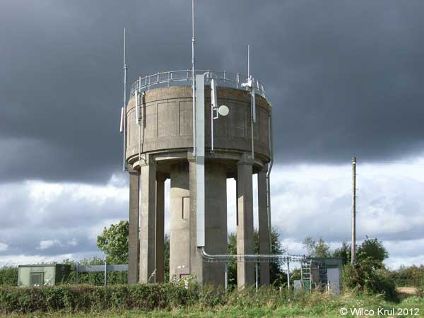
| Culmhead (former RAF Culmhead) N 50.9357 - W 3.1113 |
|
| Dunster, Dunster Castle (earth reservoir) N 51.1812 - W 3.4451 |
 |
| The National Trust provides the following information: “In 1870 an underground water reservoir was constructed beneath the Keep Garden to store 40,000 gallons (182,000 litres) of water for the castle and village.” |
 |
|
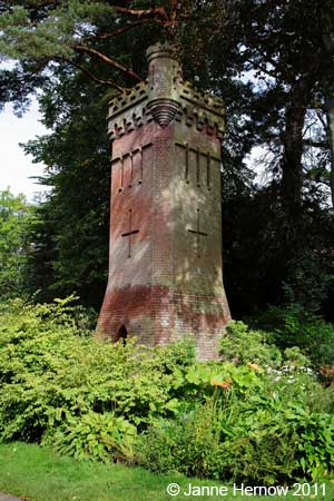
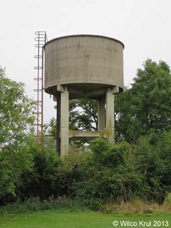
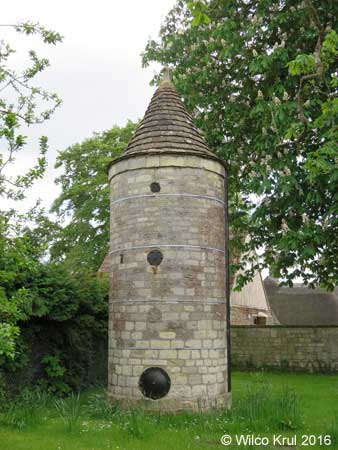
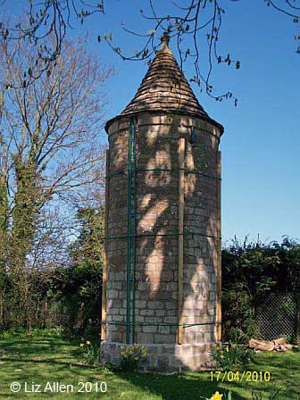
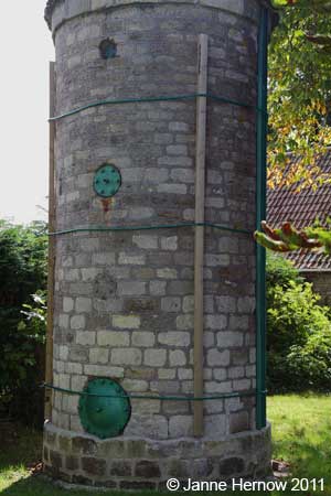
| Farleigh, Hungerford N 51.3150 - W 2.2879 |
 |
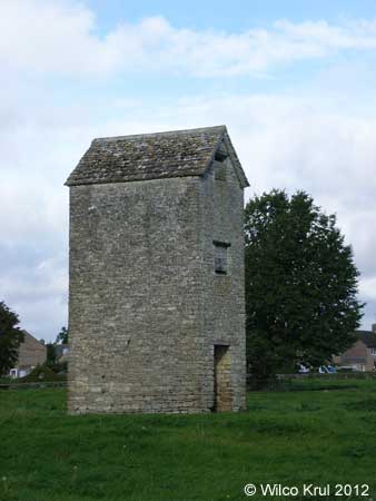
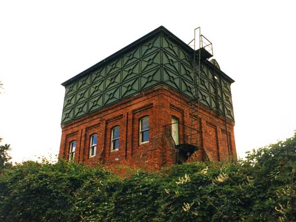
The website of Historic England and a sign next to the water tower provide the following information: “Approximately 2.5 metres diameter, 5 metres high with 3 iron inspection plates and iron depth indicator mechanism. Fed by river power driven pump from fresh water spring via 50 mm cast iron pipe and used until the early 1970s to distribute a domestic water supply to Farleigh Hungerford.” |
 |
|
 |
| Rockwell Green, Popes Lane (old) N 50.9730 - W 3.2460 |
|
 |
| Rockwell Green, Popes Lane (new) N 50.9729 - W 3.2462 |
|
 |
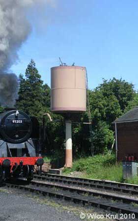
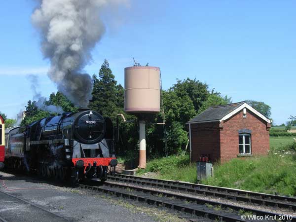
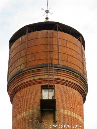
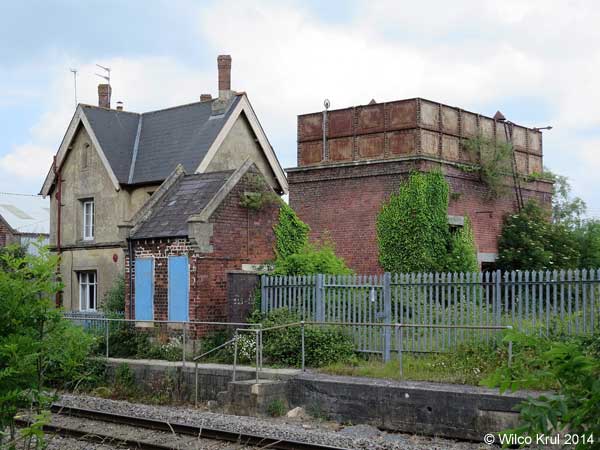
| Taunton, Firepool Lock (railway) N 51.0224 - W 3.0975 |
 |
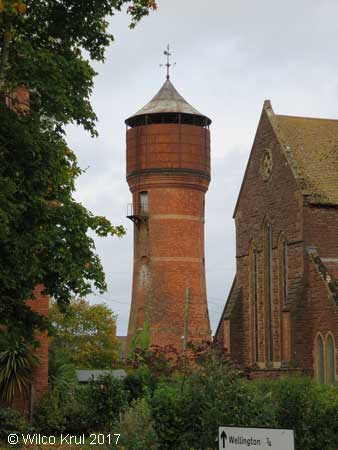
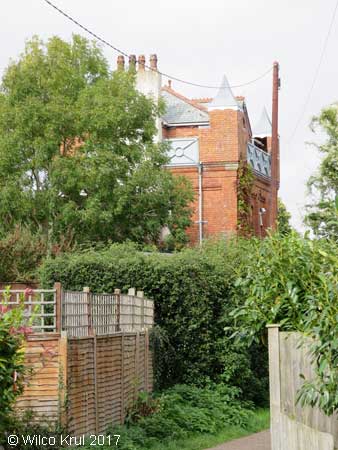
| Wellington, Dark Lane (converted) N 50.9725 - W 3.2272 |
|
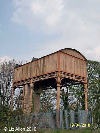
 © Off the Beaten Track in Somerset, blog, 5 October 2017 (photo from 1986, photographer unknown) |
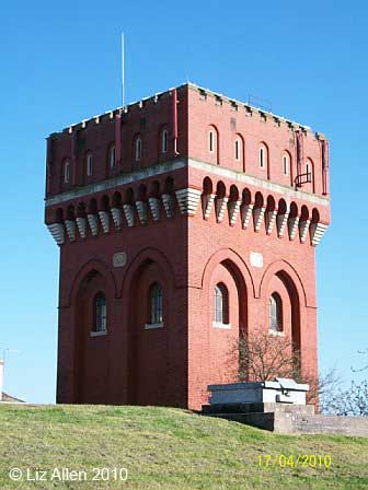
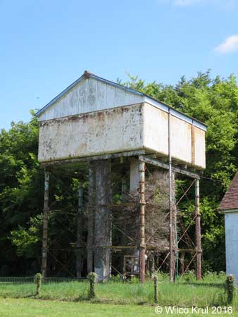
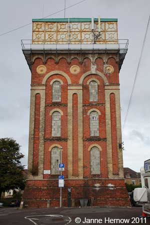
| The Dark Lane water tower in Wellington was built in 1896 and held 40,000 gallons (180,000 litres). The tower was designed by Howard, a local architect. It was built with Thomas bricks (a local brickyard) and ironwork by Ford Brothers (local foundry). The tower was originally a two storey house with a water tank on top and a hipped slate roof on the water tank. It became redundant in 1991 and in the mid 90s the new owner replaced the tank with a third storey, but leaving some of the tank plates as balconies. The corner turrets add further distinction, reflecting some of Howard’s designs for his houses in nearby Wellesley Park. The photo from 1986 shows the tower before the tank was removed and the third storey put on. (Information kindly provided by the Wellington Local History & Museum Society.) /Wilco Krul |
| Willand, Broad Street N 50.9055 - W 3.1444 |
|
| South Gloustershire |
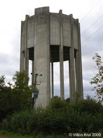
| Charfield, Station Road (railway) N 51.6280 - W 2.3994 |
 |
| Swindon |
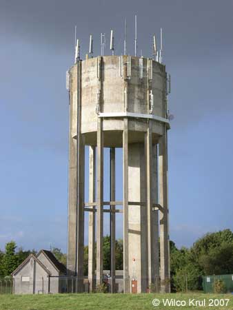
| Hannington Wick N 51.6561 - W 1.7507 |
|
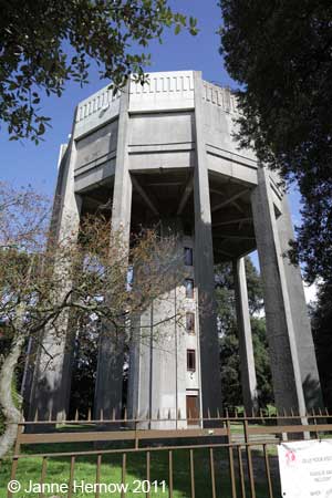
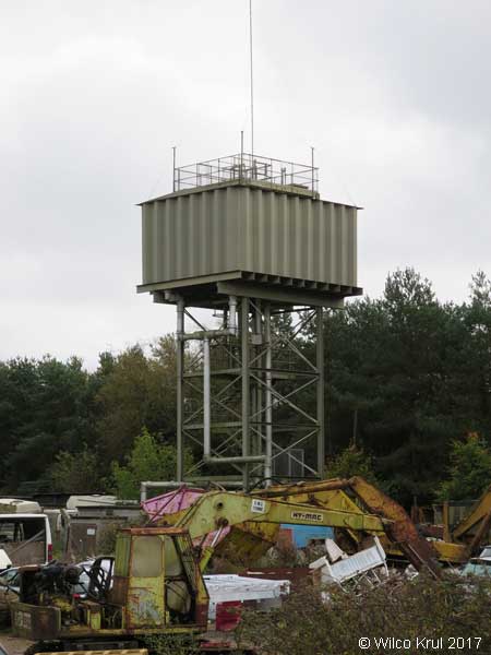
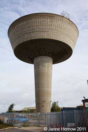
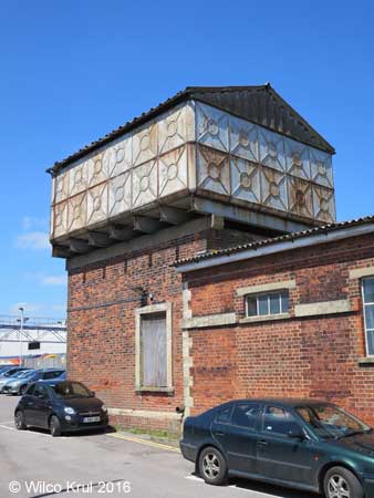
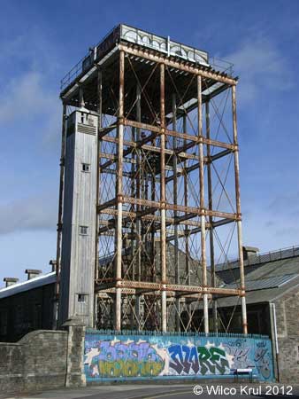
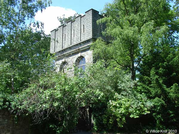
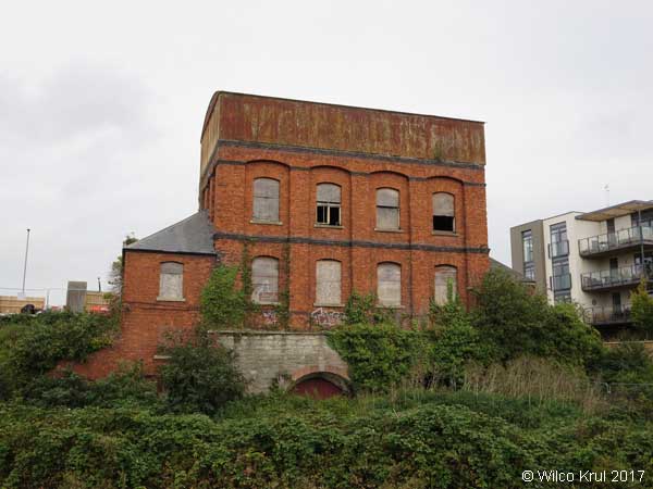
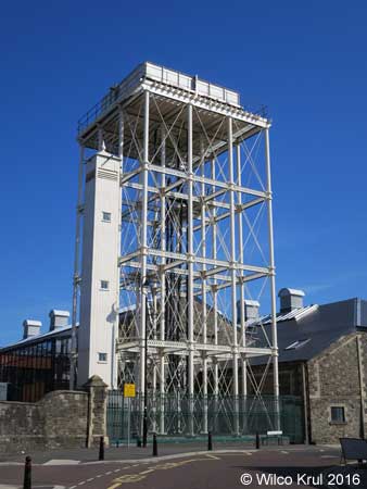
| Swindon, Bristol Street (former Swindon Railway Works) N 51.5615 - W 1.7937 |
|
 |
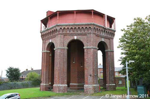
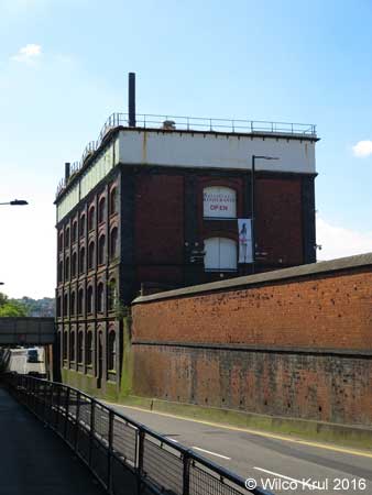
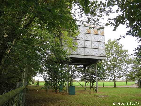
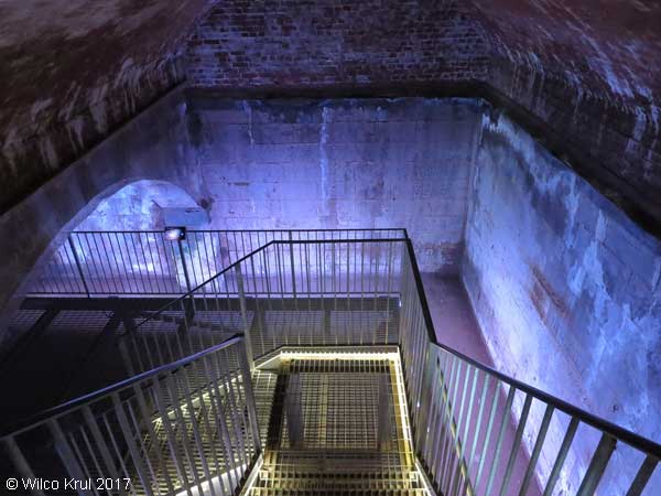
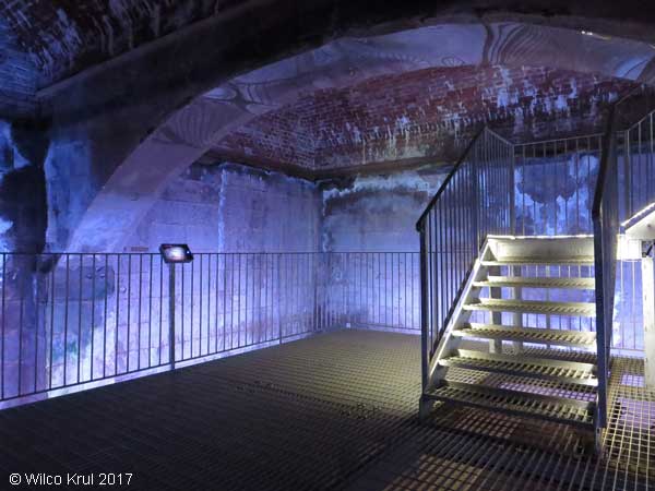
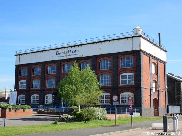
| Swindon, Rodbourne Road (former Swindon Railway Works, converted) N 51.5611 - W 1.7978 |
 |
|
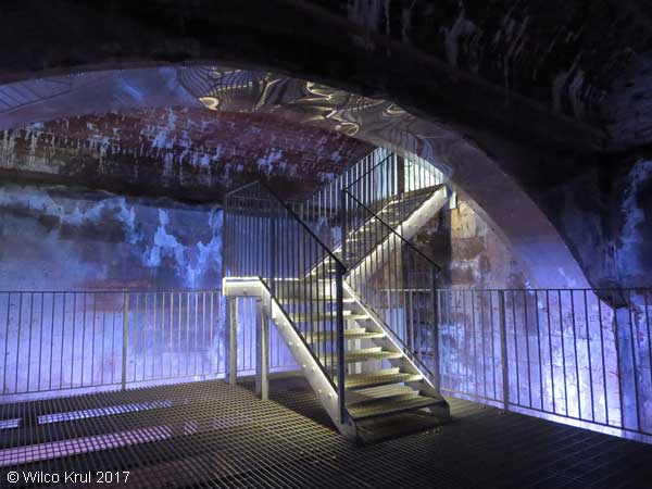
The website of Historic England provides the following information: “The building is a pattern store, dating from 1897, designed and constructed by the Great Western Railway for the Swindon Railway Works. The building is surmounted by a four-section cast iron water tank, which covers the entire roof of the building. The tank is covered in part with modern shallow-pitched roofs, and in part with a flat roof covered in mineral felt. At the south east end of the second floor of the building is a cast iron spiral staircase, which rises up through the tank to the roof, terminating inside a metal turret with a conical roof. The ground floor and basement have been converted into a restaurant, using lightweight cladding and partitions, behind which much of the original structure survives. The first and second floors have not been converted.” |
| Wiltshire |
| Baydon, Finches Lane N 51.4990 - W 1.5872 |
|
| Charlton, Pond Lane N 51.5965 - W 1.9950 |
|
| Crudwell, Odd Farm N 51.6605 - W 2.0557 |
|
| Druids Lodge N 51.1513 - W 1.8588 |
|
| East Winterslow, Pincroft Lane N 51.1021 - W 1.6558 |
|
| Kemble Airfield Enterprise Park N 51.6625 - W 2.0560 |
|
| Ludgershall, Andover Road N 51.2516 - W 1.6023 N 51.2517 - W 1.6022 |
|
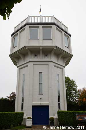
| Malmesbury, Holloway Hill (converted water tower) N 52.0569 - W 1.3618 |
|
| Malmesbury, Crudwell Road N 51.5919 - W 2.0896 |
|
| Rodbourne N 51.5491 - W 2.0992 |
|
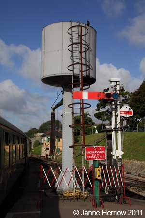
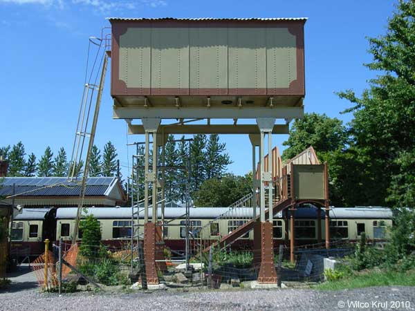
| Salisbury, Fisherton Street (railway) N 51.0708 - W 1.8051 |
|
| Sherston, Knockdown Road N 51.5755 - W 2.2202 |
 |
| Tilshead, Salisbury Plain N 51.2266 - W 1.9681 |
|
| Yatton Keynell N 51.4978 - W 2.1951 |
|
| Hem Home |
Vattentorn Water Towers |
Water Towers: Great Britain | Upp Up |
| Senast uppdaterad 180111 |