| Skånska vattentornssällskapet - Urbanmorfologi Scanian Water Tower Society - Urban Morphology |
| Hem | Vattentorn - Water Towers | Ebers vattentorn | Eber's Water Towers | Observandum |
Vattenblandat |
aVA |
| VA-historia | VA-Profiler | VA-artiklar | VA-litteratur | Akvedukter | Däxlar | Diverse VA | Gästsidor | Länkar |
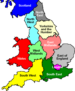
| Great Britain | East of England | East Midlands | Greater London | North East England | North West England | Scotland |
| Regions | South East England | South West England | Wales | West Midlands | Yorkshire and the Humber |
| Water Towers: Region South East England Vattentorn: Region Sydöstra England |
 Adisham |
 Ashford |
 Balcombe |
 Banbury |
 Basingstoke |
 Berinsfield |
 Bicester |
 Bishop's Green |
 Blue Bell Hill |
 Brightwalton |
 Bucknell |
 Bunkers Hill |
 Burghfield Common |
 Camberley |
 Castlethorpe |
 Caterham |
 Chelsam |
 Chesterton |
 Chilbolton |
 Chipping Norton |
 Cholsey |
 Christmas Common |
 Coleshill |
 Compton |
 Cookley Green |
 Coxford Down |
 Coxheath |
 Didcot |
 Didcot |
 East Grinstead |
 Emmer Green |
 Epsom |
 Epsom |
 Epsom |
 Faversham |
 Folkestone |
 Fritham |
 Gillingham |
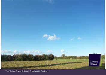
 Goodworth Clatford |
 Gosport |
 Gosport |
 Great Bookham |
 Great Bookham |
 Green Hailey |
 Greenham |
 Harrietsham |
 Haywards Heath |
 Hellingly |
 Hollingbourne |
 Holyport |
 Hornton Grounds |
 Kentsboro |
 Luton |
Marsworth |
 Milton Common |
 Milton Hill |
 Munstead |
 Mursley |
 Netherne-on-the-hill |
 Northfleet |
 Portslade |
 Quainton |
 Quainton |
 Reading |
 Rough Common |
 Rye |
 Rye |
 Shinfield Rise |
 South Wonston |
 Stanton Harcourt |
 Tidmarsh |
 Tilehurst |
 Tilehurst |
 Toy’s Hill |
 Turners Hill |
Uckfield |
 Upper Heyford |
 Upper Heyford |
 Upper Heyford |
 Vigo Village |
 Wallingford |
 Waringlid |
 Warren Street |
 Warrington |
 Wash Common |
 Whitchurch |
 Wickham |
 Winchester |
 Winchester |
 Windsor |
 Woldingham |
 Woodeaton |
 Worthy Down |
| Buckinghamshire | East Sussex | Hampshire | Kent | Luton | Milton Keynes | Oxfordshire | Reading | Surrey |
| West Berkshire | West Sussex | Windsor and Maidenhead | Wokingham |
| Buckinghamshire |
| Coleshill, Tower Road N 51.6525 - W 0.6175 |
|
| Green Hailey, Peters Lane N 51.7245 - W 0.8080 |
|
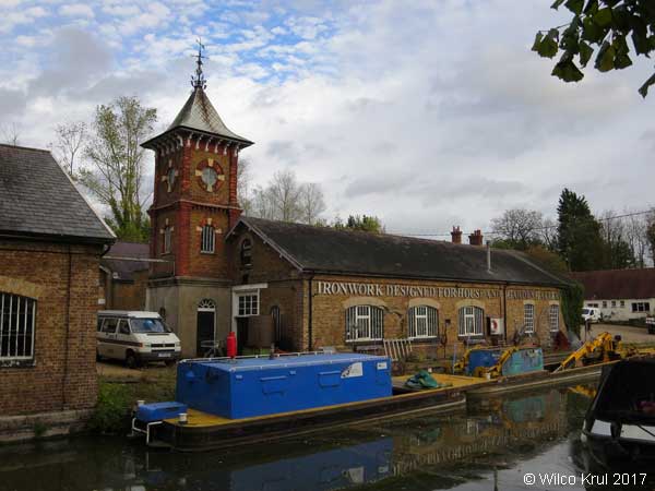
| Marsworth, Upper Icknield Way (former Bulbourne Canal Works) N 51.8143 - W 0.6483 |
 |
| Mursley, Whaddon Road N 51.9555 - W 0.8126 |
|
| Quainton, Station Road (railway) N 51.8641 - W 0.9277 |
|
| Quainton, Station Road (railway) N 51.8643 - W 0.9298 |
|
| East Sussex |
| Hellingly Hospital |
|
| Portslade |
|
| Rye |
|
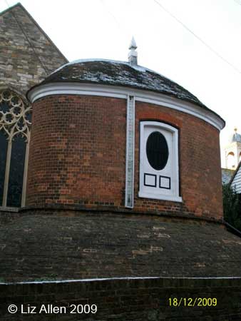
| Rye, Church Square |
|
| Uckfield |
 |
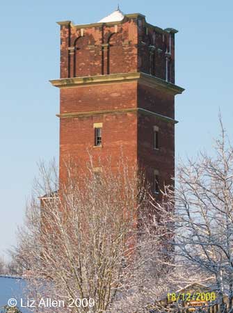
| Hampshire |
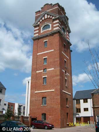
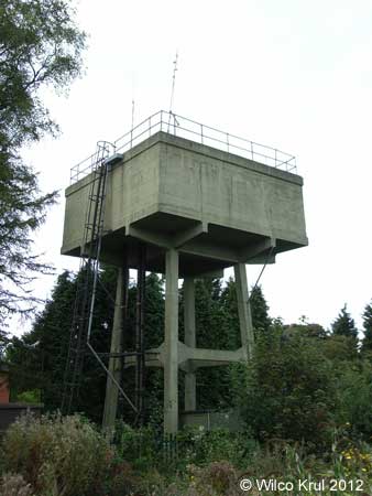
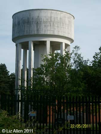
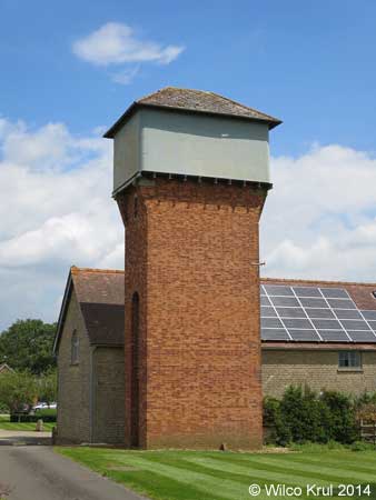
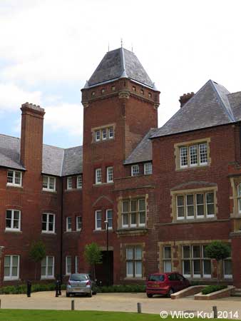
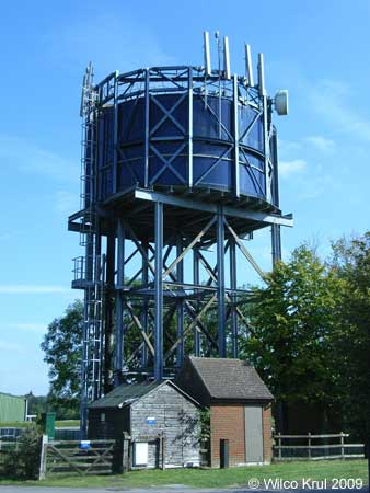
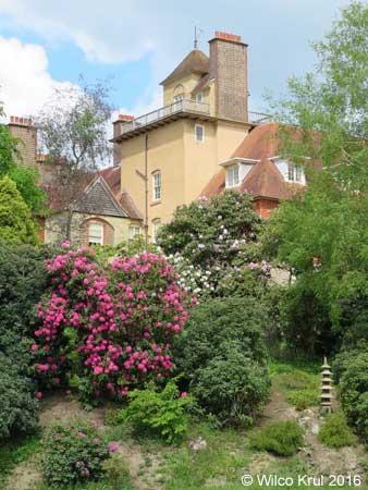
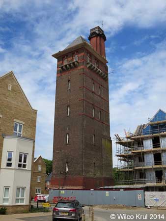
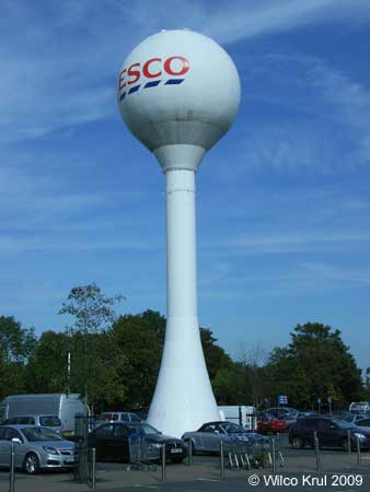
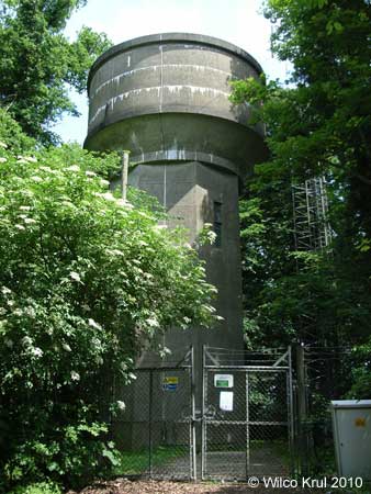
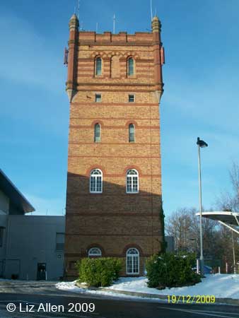
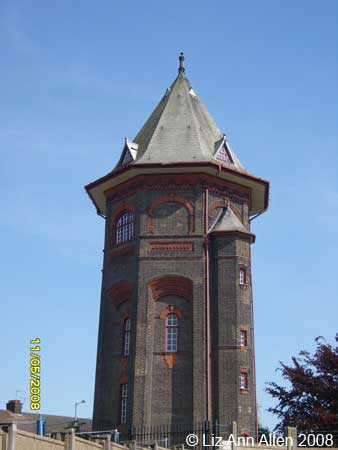
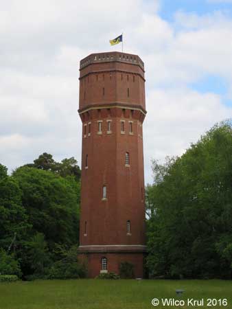
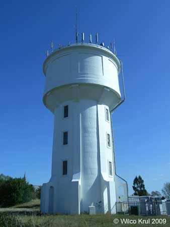
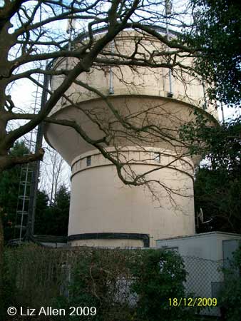
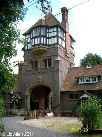
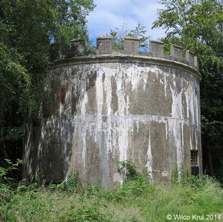
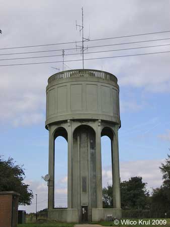
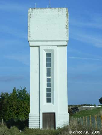
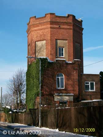
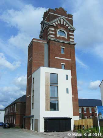
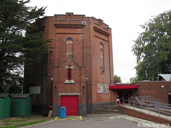
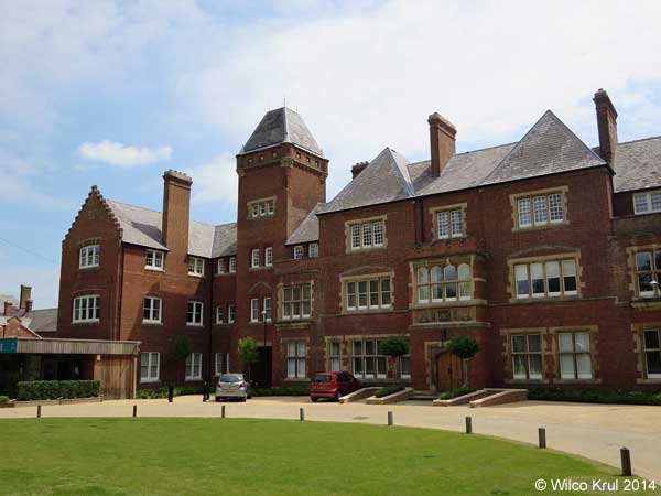
| Basingstoke, Limes Park (former Park Prewett Hospital) N 51.2816 - W 1.1179 |
|
 |
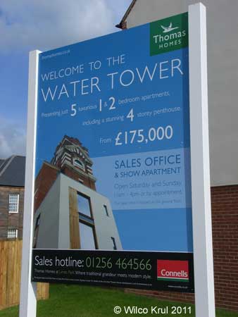 |
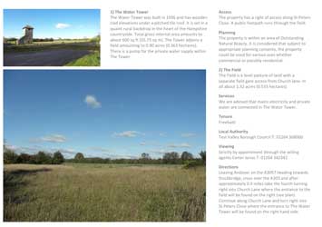
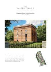
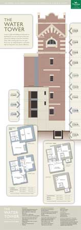 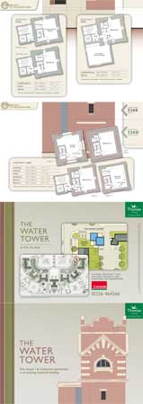 Download a brochure with the floor plans of the five apartments in the converted water tower. |
| The water tower is one of the few remaining buildings that originally belonged to Park Prewett Hospital. After the hospital had closed, the entire site was redeveloped into a housing site, which is named Limes Park. /Wilco Krul |
| Bishop's Green, Eagle Road N 51.3617 - W 1.2819 |
|
| Chilbolton, Thirt Way N 51.1433 - W 1.4256 |
|
 |
| Coxford Down, Popham Airfield N 51.1930 - W 1.2438 |
|
| Fritham, Forest Road (converted) N 50.9277 - W 1.6563 |
|
| Goodworth Clatford, St Peter's Close N 51.1814 - W 1.4769 |
|
|

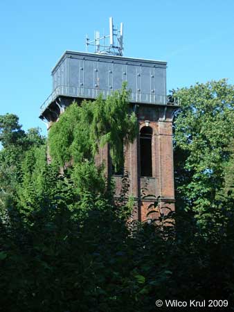
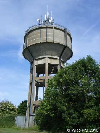
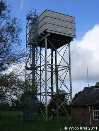
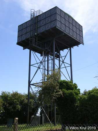
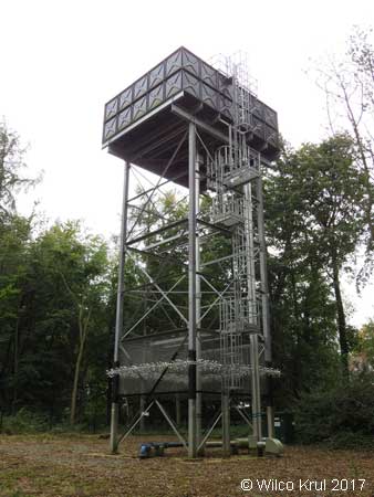
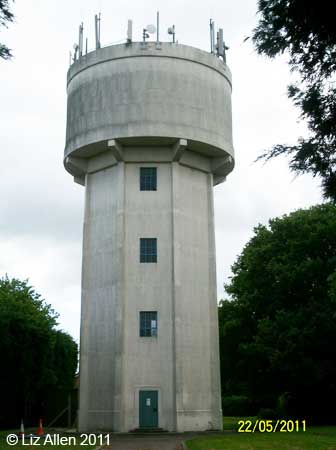
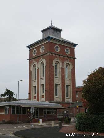
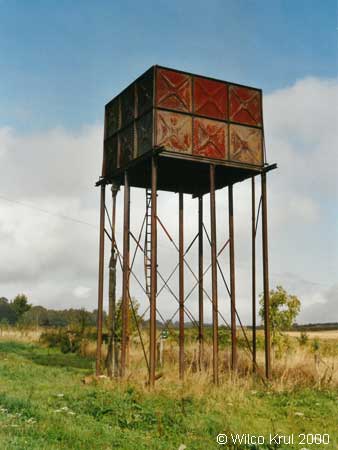
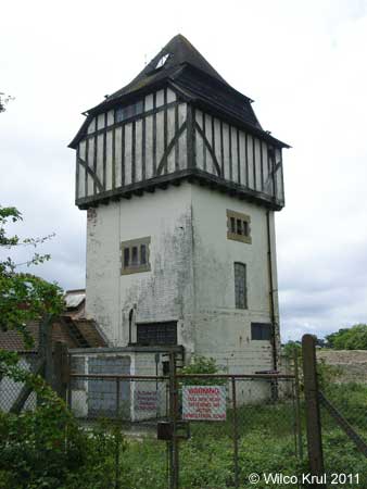
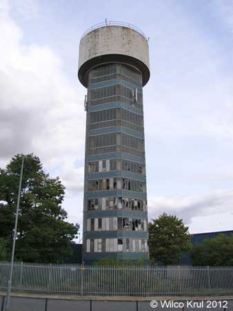
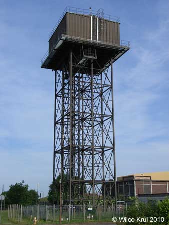
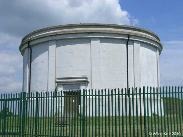
| Gosport, Haslar Road (former Royal Hospital Haslar) N 50.7860 - W 1.1258 |
|
The hospital water tower was built in 1885 and is 120 feet high with two 125-ton water tanks, each with the capacity to hold 50,000 gallons fed from the hospital wells. |
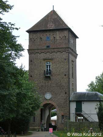
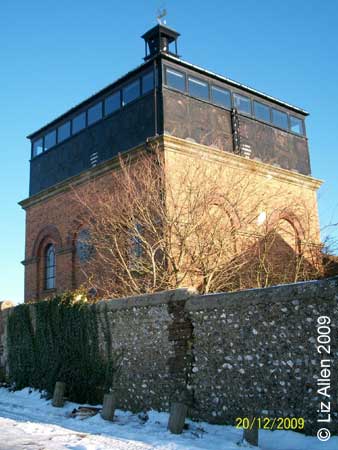
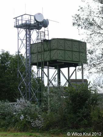
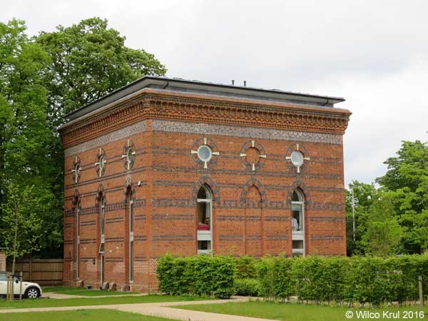
| Gosport, Haslar Road (former Royal Hospital Haslar laundry) N 50.7868 - W 1.1250 |
|
| The laundry was built to serve the hospital in 1854. The northern section of the laundry has a cast iron water tank with corrugated sheeting forming its roof. The laundry remained in use until 2009. |
| Kentsboro, Upper Mead N 51.1573 - W 1.5636 |
|
| South Wonston, Christmas Hill N 51.1178 - W 1.3454 |
|
| Whitchurch, Bere Hill N 51.2370 - W 1.3343 |
|
| Wickham, Hoad's Hill N 50.8886 - W 1.1795 |
|
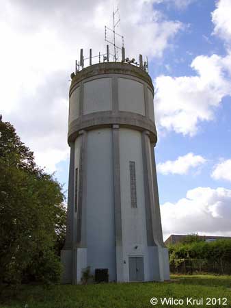
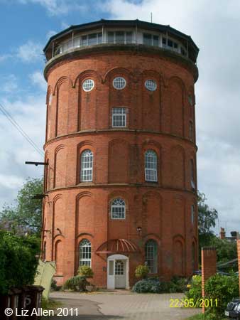
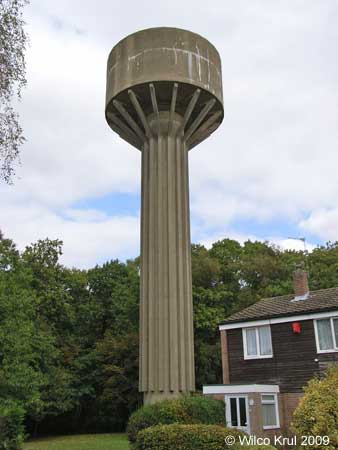
| Winchester, Kings Road (converted) N 51.0583 - W 1.3456 |
 |
| Winchester, Northbrook Avenue (converted) N 51.0611 - W 1.2971 |
|
| Worthy Down, Blackwell Road N 51.1134 - W 1.3435 |
|
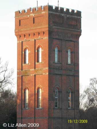
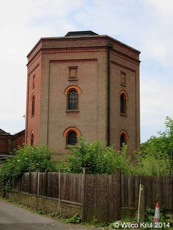
| Kent |
| Adisham, Woodlands Wood N 51.2372 - E 1.1635 |
|
| Ashford, Kennington Road N 51.1521 - E 0.8991 |
|
| Blue Bell Hill, Common Road N 51.3322 - E 0.5022 |
|
| Coxheath, Duke of York Way N 51.2300 - E 0.4952 |
|
| Faversham, Western Link N 51.3166 - E 0.8653 |
|
| Folkestone, Royal Military Avenue N 51.0815 - E 1.1342 |
|
| Gillingham, Courteney Road N 51.3679 - E 0.5815 |
|
| Harrietsham, Stede Hill N 51.2554 - E 0.6913 |
|
| Hollingbourne, Hollingbourne Hill N 51.2767 - E 0.6600 |
|
| Northfleet, Crete Hall Road N 51.4455 - E 0.3385 |
|
| Rough Common, Whitstable Road N 51.2915 - E 1.0575 |
|
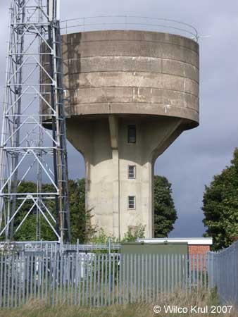
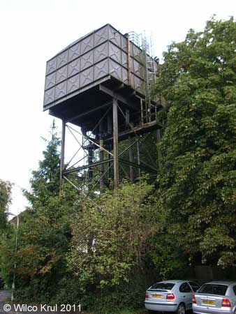
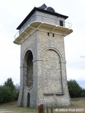
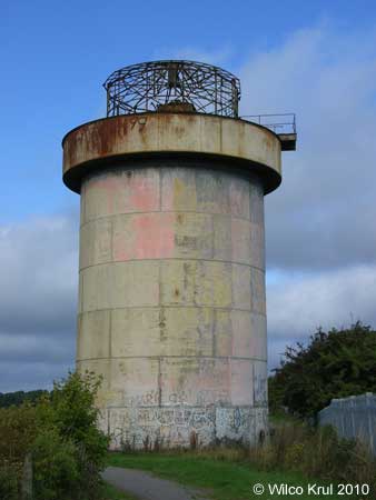
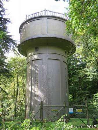
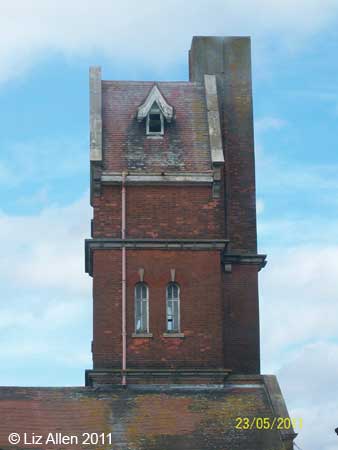
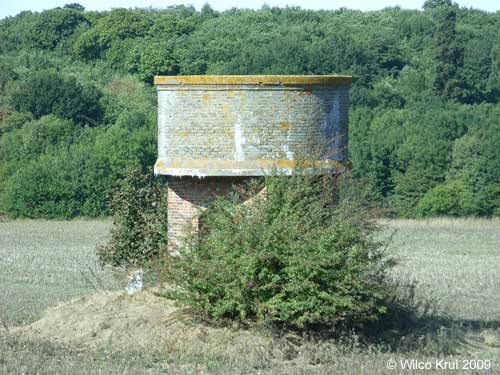
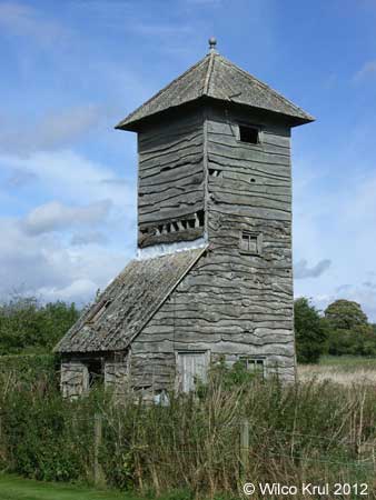
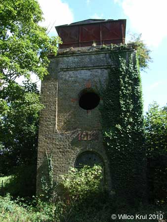
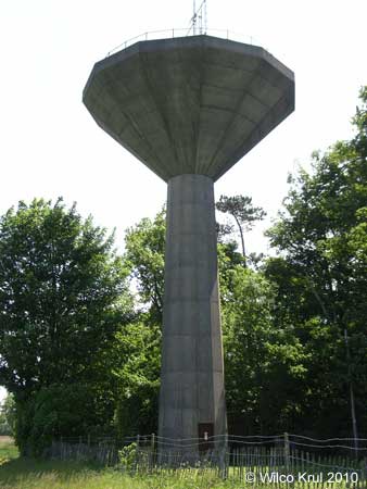
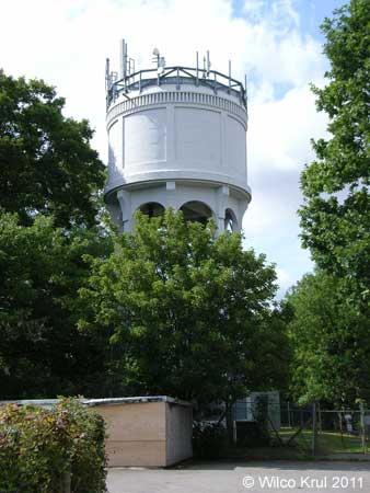
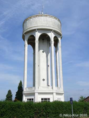
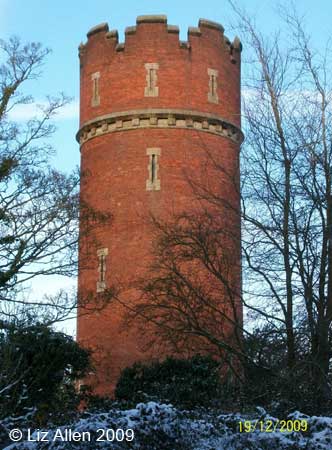
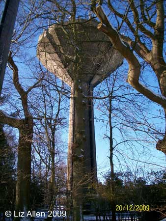
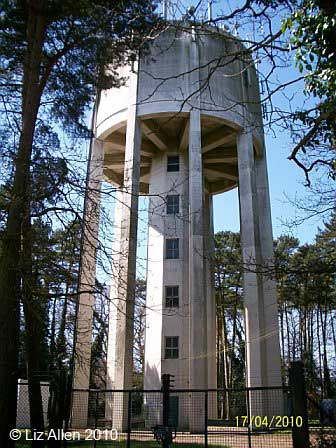
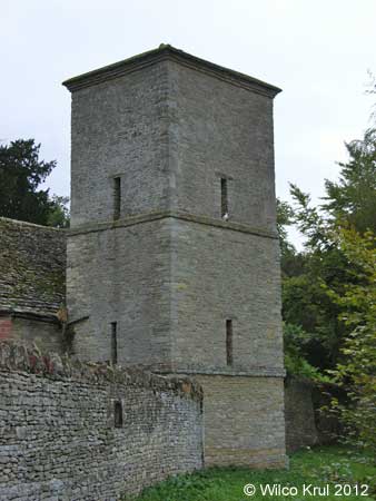
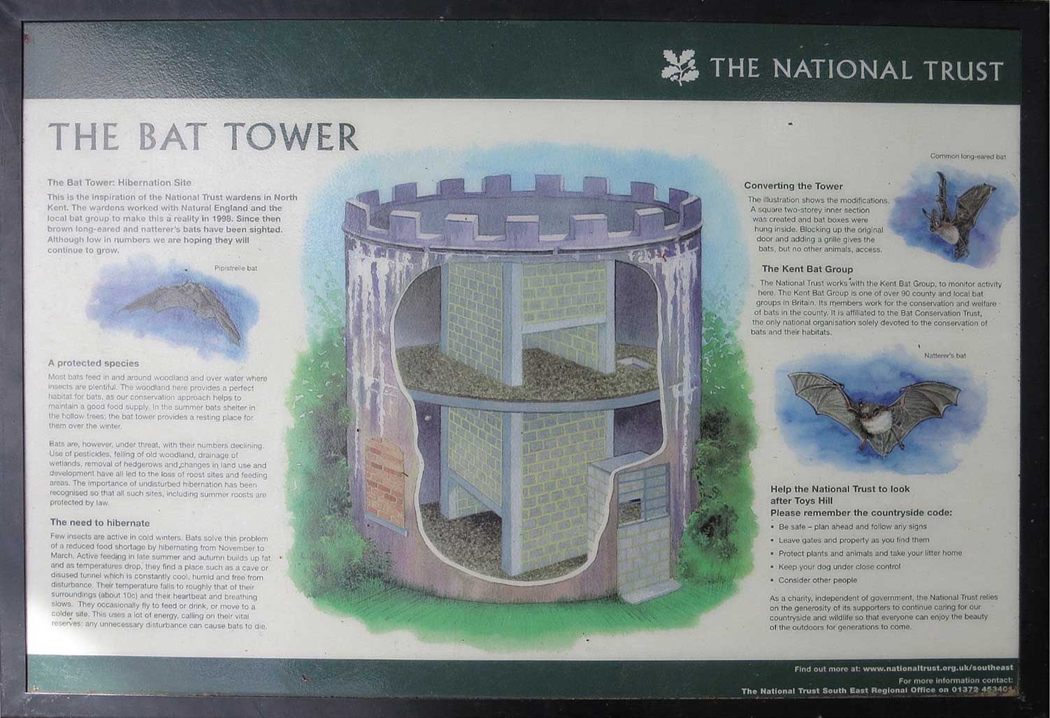
| Toy's Hill, Toy's Hill Road (converted) N 51.2489 - E 0.1037 |
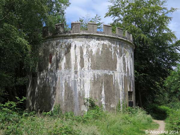 |
| The water tower on Toy’s Hill was converted to a hibernation site for bats in 1998. A square two-storey inner section was created and bat boxes were hung inside. The original door was blocked up and a grille was added, which gives bats (but no other animals) access to the tower. Bats hibernate there from November to March. |
| /Wilco Krul |
 |
| Vigo Village, Beech Mast N 51.3314 - E 0.3623 |
|
| Warren Street, Rayners Hill N 51.2422 - E 0.7576 |
|
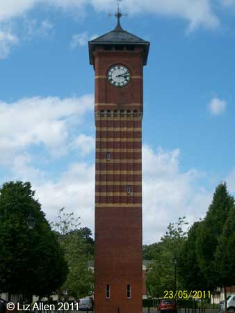
| Luton |
| Luton |
| Milton Keynes |
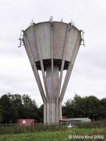
| Castlethorpe N 52.0857 - W 0.8268 |
|
| Warrington, Northey Farm N 52.1959 - W 0.6826 |
|
| Oxfordshire |
| Banbury, Bretch Hill N 52.0569 - W 1.3618 |
|
| Berinsfield, Fane Drive N 51.6661 - W 1.1705 |
|
| Bicester, Buckingham Road (former RAF Bicester) N 51.9161 - W 1.1422 |
|
| Bucknell, Trow Pool N 51.9190 - W 1.2038 |
|
| Bunkers Hill, Bunkers Hill N 51.8583 - W 1.3127 |
|
| Chesterton, Bignell Park Barns N 51.8962 - W 1.2002 |
|
| Chipping Norton, Wards Road N 51.9410 - W 1.5376 |
|
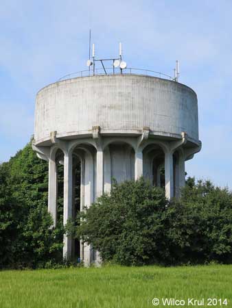
| Cholsey, Reading Road (former Fair Mile Hospital) N 51.5699 - W 1.1391 |
|
 |
| Christmas Common, Cowleaze Wood N 51.6525 - W 0.9540 |
|
| Cookley Green, Coates Lane N 51.6093 - W 0.9997 |
|
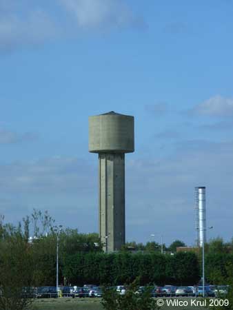
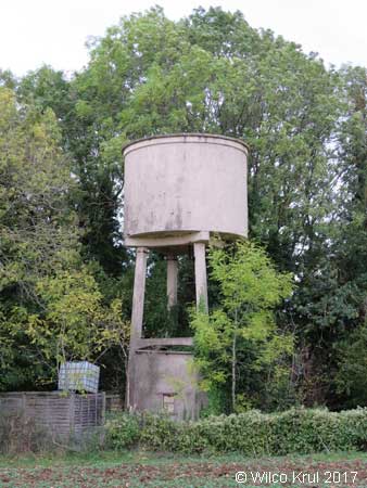
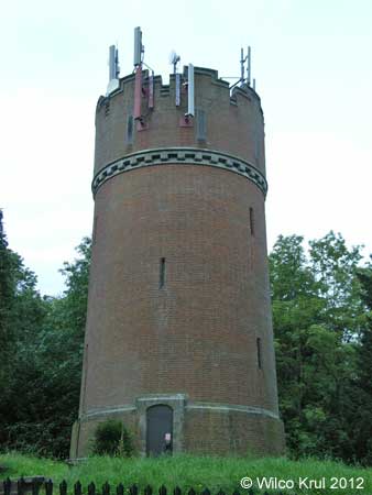
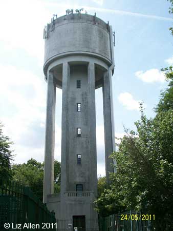
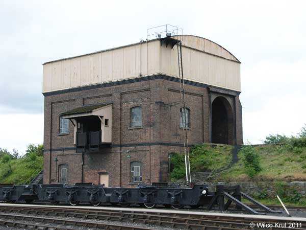
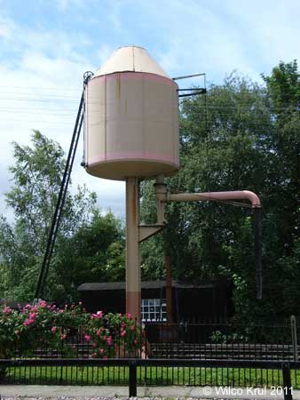
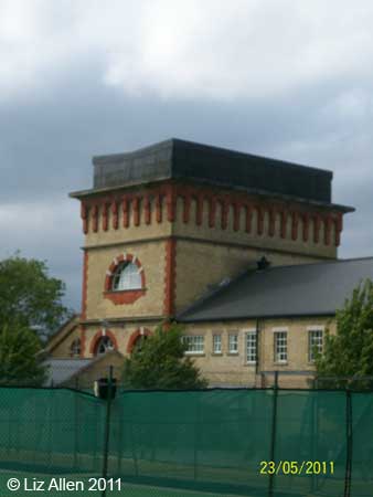
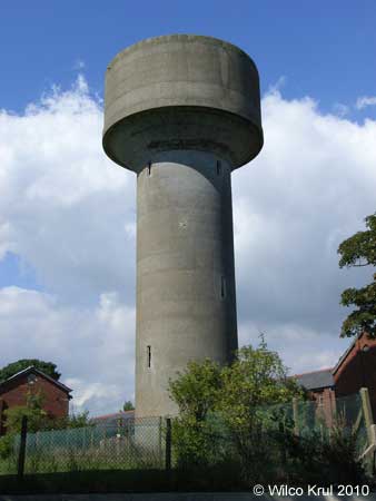
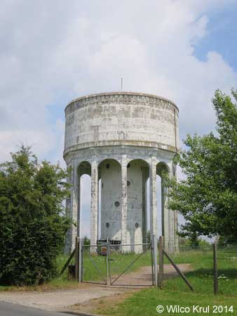
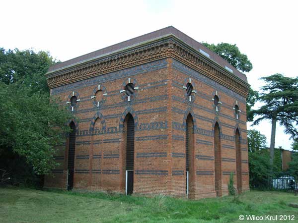
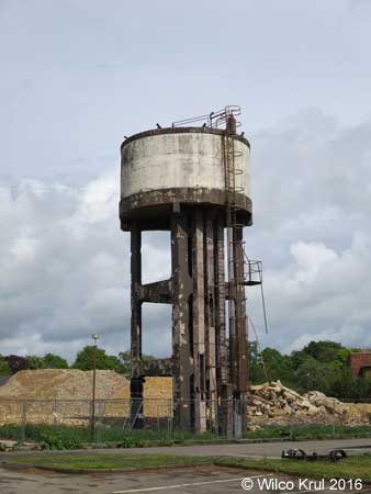
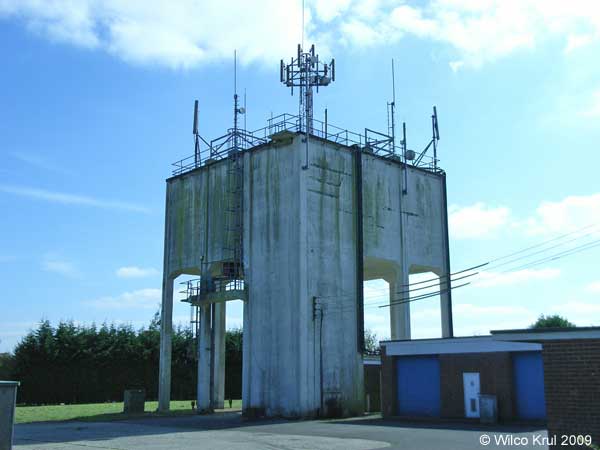
| Didcot N 51.6126 - W 1.2438 |
|
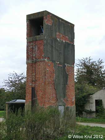
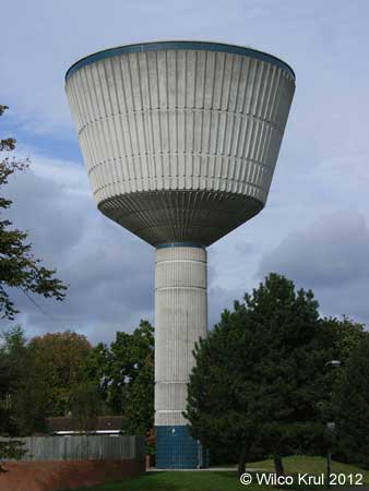
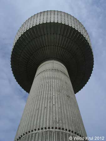
| The water tower in Didcot is not only a water tower (with a 74,000 gallon tank), but it’s also a coal stage. A coal wagon would be pushed up the embankment by a locomotive into the brick building under the water tank. There the coal would be unloaded into small wheeled tubs. The tubs were then pushed onto a ramp at the front of the coal stage and tipped up to allow the coal to fall into a locomotive tender. /Wilco Krul |
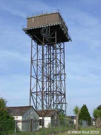
| Didcot N 51.6151 - W 1.2464 |
|
| Hornton Grounds, Stratford Road (former Oxfordshire Ironstone Company)(demolished) N 52.0917 - W 1.4441 |
|
| Milton Common, Rycote Lane N 51.7262 - W 1.0559 |
|
| Milton Hill, Featherbed Lane N 51.6118 - W 1.3166 |
|
| Stanton Harcourt, Main Road (former RAF Stanton Harcourt) N 51.7457 - W 1.4000 |
|
| Upper Heyford, Camp Road (tower demolished) N 51.9288 - W 1.2554 |
|
| Upper Heyford, Eglin Street (tower demolished) N 51.9284 - W 1.2603 |
|
| Upper Heyford, Gordon Road N 51.9292 - W 1.2687 |
|
| Wallingford, Station Road N 51.6017 - W 1.31346 |
|
| Woodeaton, Woodeaton Manor N 51.8037 - W 1.2260 |
|
| Reading |
| Emmer Green, Peppard Road N 51.4917 - W 0.9614 |
|
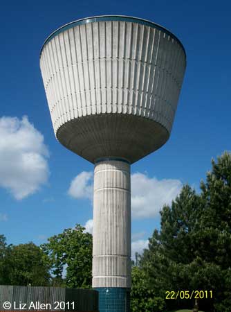
| Reading, Bath Road N 51.4495 - W 0.9902 |
|
 |
 |
| Tilehurst, Norcot Road N 51.4593 - W 1.0335 |
Late 19th Century |
| Tilehurst, Park Lane N 51.4516 - W 1.0471 |
|
| Surrey |
| Camberley, Black Hill N 51.3496 - W 0.7025 |
|
| Caterham, Gravelly Hill N 51.2625 - W 0.0849 |
|
| Chelsam N 51.3189 - W 0.0303 |
|
| Compton, Priorsfield Road N 51.2106 - W 0.6435 |
|
| Epsom, Hook Road N 51.3490 - W 0.2743 |
|
| Epsom, Horton Park |
|
| Epsom, Miller Place (former West Park Hospital) N 51.3390 - W 0.3003 |
|
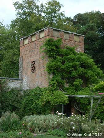
| Great Bookham, Polesden Lacey N 51.2589 - W 0.3738 |
|
| Great Bookham, Polesden Lacey N 51.2581 - W 0.3753 |
|
| Munstead, Munstead Heath Road (converted) N 51.1754 - W 0.5894 |
|
| Netherne-on-the-hill N 51.2900 - W 0.1432 |
|
| Woldingham N 51.2900 - W 0.1432 |
|
| West Berkshire |
| Brightwalton, Butts Furlong N 51.5117 - W 1.3883 |
|
| Burghfield Common, Padworth Road N 51.3879 - W 1.0727 |
|
| Greenham, Pigeons Farm Road N 51.3864 - W 1.3002 |
|
 |
 |
| Tidmarsh, Maidenhatch Estate N 51.4630 - W 1.1099 |
|
| Wash Common, Battle Road N 51.3803 - W 1.3491 |
|
| West Sussex |
| Balcombe |
|
| East Grinstead, Standen House N 51.1029 - W 0.0164 |
|
| Haywards Heath |
|
| Turners Hill |
|
| Waringlid |
|
| Windsor and Maidenhead |
| Holyport, Holyport Street N 51.4946 - W 0.7141 |
|
| Windsor, Riverside Walk N 51.4914 - W 0.6036 |
|
| Wokingham |
| Shinfield Rise, Fairlawn Green N 51.4286 - W 0.9426 |
|
| Hem Home |
Vattentorn Water Towers |
Water Towers: Great Britain | Upp Up |
| Senast uppdaterad 190730 |