| Skånska vattentornssällskapet - Urbanmorfologi Scanian Water Tower Society - Urban Morphology |
| Hem | Vattentorn - Water Towers | Ebers vattentorn | Eber's Water Towers | Observandum |
Vattenblandat |
aVA |
| VA-historia | VA-Profiler | VA-artiklar | VA-litteratur | Akvedukter | Däxlar | Diverse VA | Gästsidor | Länkar |
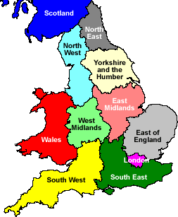
| Great Britain | East of England | East Midlands | Greater London | North East England | North West England | Scotland |
| Regions | South East England | South West England | Wales | West Midlands | Yorkshire and the Humber |
| Water Towers: Region East Midlands Vattentorn: Region Östra Midlands |
 Barby |
 Barby |
 Brafield-on-the-Green |
 Buckminster |
 Buckminster |
 Burley |
 Collyweston |
 Corby |
 Corby |
 Corby |
 Corby |
 Corby |
 Denford Ash |
 Dingley |
 Earls Barton |
 Everdon |
 Finedon |
 Flore |
 Great Doddington |
 Gringley on the Hill |
 Halse |
 Hemington |
 Knuston |
 Manton |
 Mears Ashby |
 Nobottle |
 Northampton |
 Northampton |
 Preston Capes |
 Roade |
 Roade |
 Southwick |
 Upton |
 West Haddon |
 Wollaston |
 Woodford Halse |
 Wymondham |
 Yardley Gobion |
| Leicestershire | Northamptonshire | Nottinghamshire | Rutland |
| Leicestershire |
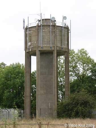
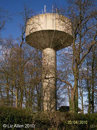
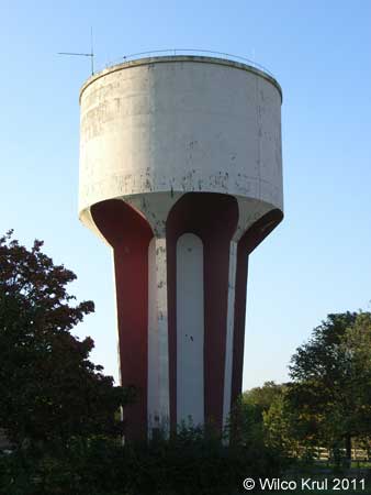
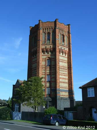
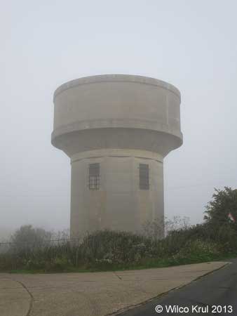
| Buckminster, The Drift N 52.8040 - W 0.6820 |
|
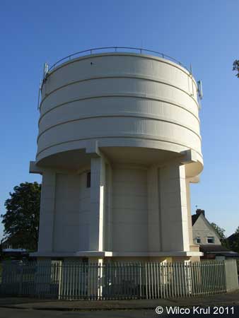
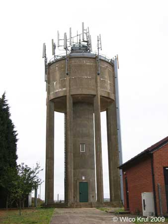
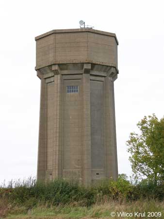
| Buckminster, Stainby Road/Manor farm N 52.7969 - W 0.6937 |
|
 |
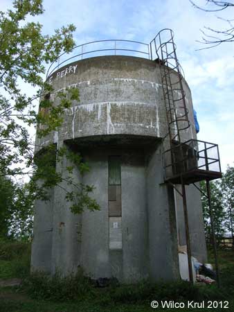
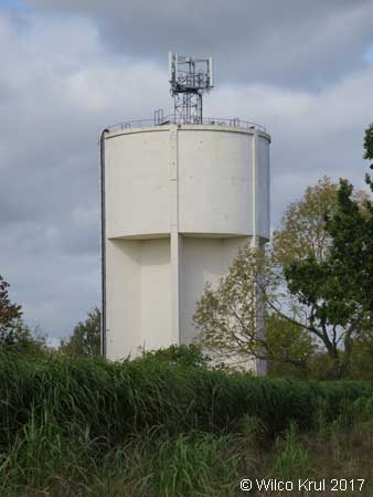
| Wymondham, Drift Hill N 52.7583 - W 0.7185 |
|
| Northamptonshire |
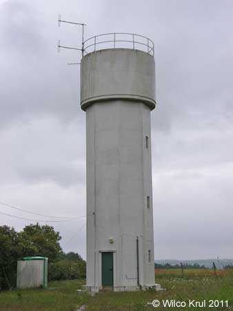
| Barby, Daventry Road N 52.3215 - W 1.2053 |
|
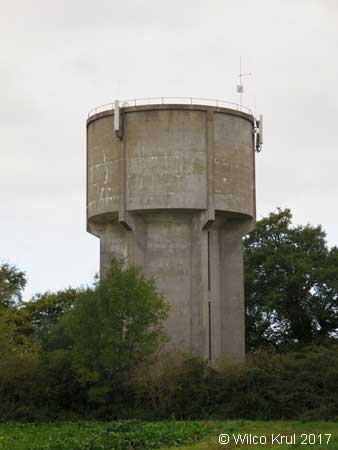
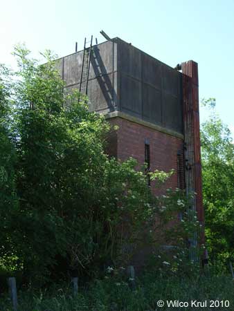
| Barby (former railway sidings) N 52.3302 - W 1.2411 |
 |
| Brafield-on-the-Green, Furze Road N 52.2189 - W 0.8016 |
|
| Collyweston, The Drove N 52.6103 - W 0.5247 |
|
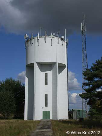
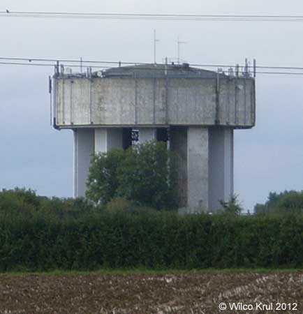
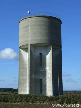
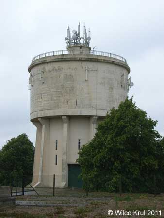
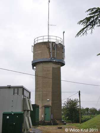
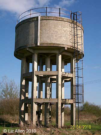
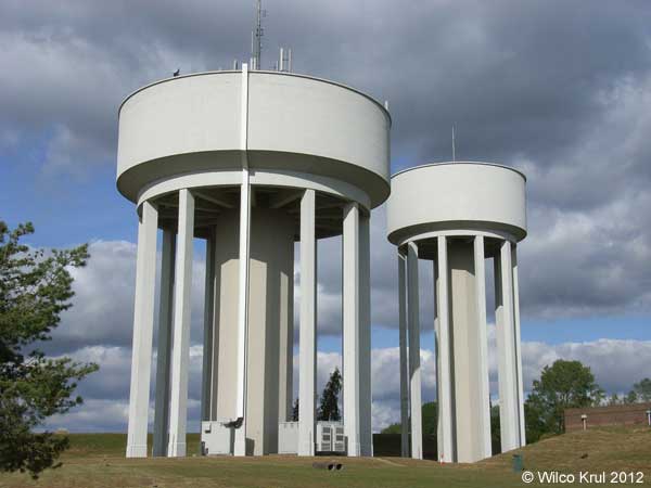
| Corby, Uppingham Road N 52.4884 - W 0.7340 N 52.4885 - W 0.7349 |
 |
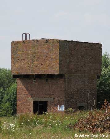
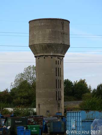
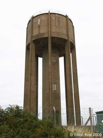
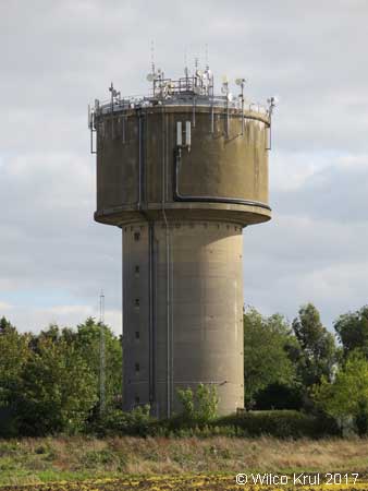
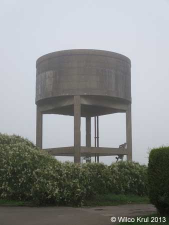
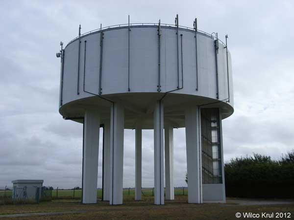
| Corby, Phoenix Parkway (former iron and steel works) N 52.4976 - W 0.6749 |
|
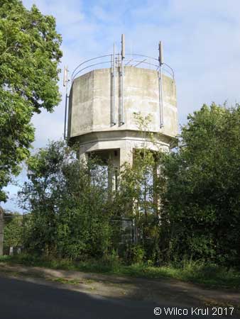
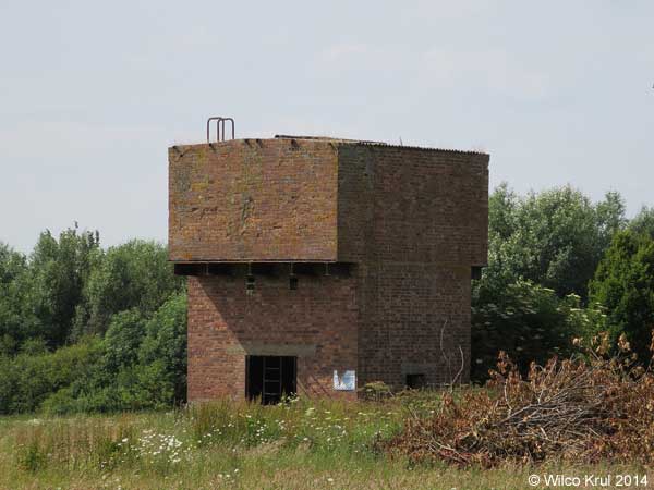
| Corby, Rockingham Road N 52.5105 - W 0.7166 |
|
| Corby, Tanfields Grove N 52.4963 - W 0.6971 |
|
| Corby, Willow Brook Road N 52.5003 - W 0.7139 |
|
| Denford Ash N 52.37035 - W 0.5180 |
|
| Dingley, Braybrooke Road N 52.4732 - W 0.8623 |
|
| Earls Barton, Stevens Court N 52.2704 - W 0.7388 |
|
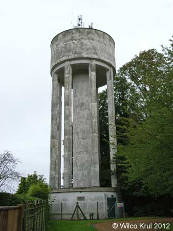
| Everdon, Everdon Stubbs N 52.2024 - W 1.1056 |
|
| Finedon, Irthlingborough Road N 52.3365 - W 0.6438 |
|
| Flore, Hillside Road N 52.2394 - W 1.0675 |
|
| Great Doddington, Earls Barton Road N 52.2756 - W 0.7277 |
|
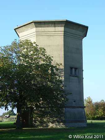
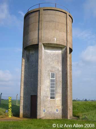
| Halse N 52.0625 - W 1.1687 |
|
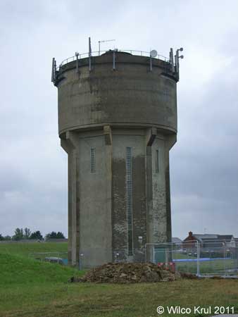
| Hemington N 52.4499 - W 0.4179 |
|
| Knuston, Irchester Road N 52.2898 - W 0.6214 |
|
| Mears Ashby, Highfield Road N 52.3002 - W 0.7642 |
|
| Nobottle, Roman Road N 52.2552 - W 0.9894 |
|
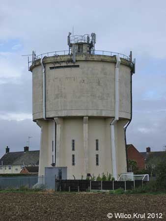
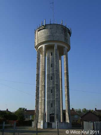
| Northampton, Boughton Green Road N 52.2746 - W 0.8864 |
|
| Northampton, Abington Park N 52.2493 - W 0.8624 |
|
| Preston Capes N 52.1858 - W 1.1717 |
|
| Roade, Manor Close N 52.1590 - W 0.8890 |
|
| Roade, Ashton Road N 52.1527 - W 0.8906 |
|
| Southwick, Glapthorn Road N 52.5108 - W 0.4935 |
|
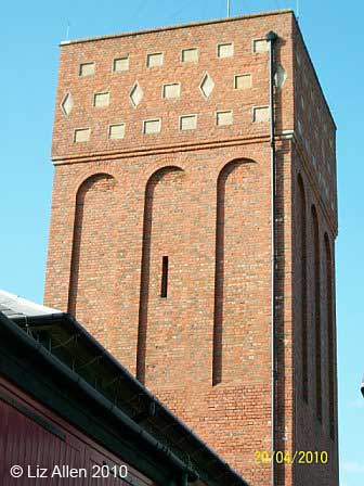
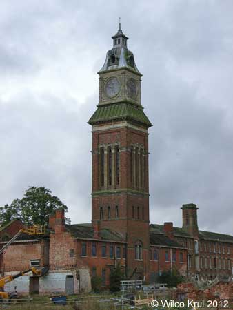
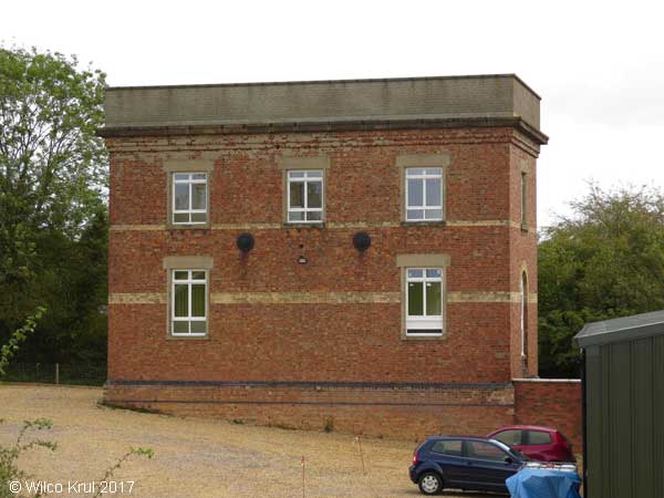
| Upton, St Crispin Drive (former St Crispin Hospital) N 52.2433 - W 0.9582 |
|
| West Haddon, Northampton Road N 52.3390 - W 1.0678 |
|
| Wollaston, Irchester Road N 52.2588 - W 0.6602 |
 |
| Woodford Halse (former railway yard) N 52.1853 - W 1.2061 |
|
| Yardley Gobion, Moorend Road N 52.0974 - W 0.8930 |
|
| Nottinghamshire |
| Gringley on the Hill, High Street N 53.4081 - W 0.8836 |
|
| Rutland |
| Burley, Exton Lane N 52.6916 - W 0.6814 |
|
| Manton, Wing Road (railway, converted) N 52.6241 - W 0.6955 |
 |
| Hem Home |
Vattentorn Water Towers |
Water Towers: Great Britain | Upp Up |
| Senast uppdaterad 171213 |