| Skånska vattentornssällskapet - Urbanmorfologi Scanian Water Tower Society - Urban Morphology |
| Hem | Vattentorn - Water Towers | Ebers vattentorn | Eber's Water Towers | Observandum |
Vattenblandat |
aVA |
| VA-historia | VA-Profiler | VA-artiklar | VA-litteratur | Akvedukter | Däxlar | Diverse VA | Gästsidor | Länkar |
| Guest: Wilco Krul, Eindhoven |
| Belgium | Great Britain | Netherlands | Slovakia | Sweden |
| Great Britain |
| Bath and North East Somerset | Bedford | Buckinghamshire | Cambridgeshire | Central Bedfordshire | Cheshire East | Gloucestershire |
| Greater London | Hampshire | Hertfordshire | Kent | Milton Keynes | Norfolk | Northamptonshire | North Somerset | Oxfordshire | Reading |
| Shropshire | Somerset | South Gloucestershire | Staffordshire | Suffolk | Surrey | Swindon | Warwickshire | West Berkshire | West Midlands |
| Wiltshire | Windsor and Maidenhead | Wokingham | Worcestershire |
| Region East of England |
 Abbotsley |
 Abbots Ripton |
 Albury |
 Balsham |
 Bedingfield |
 Berkhamsted |
 Bishop�s Stortford |
 Bishop�s Stortford |
 Bluntisham |
 Bluntisham |
 Botesdale |
 Bowthorpe |
 Bradfield St. Clare |
 Brookmans Park |
 Cambourne |
 Chatteris |
 Church Langley |
 Conington |
 Cottenham |
 Crowfield |
 Depden |
 Diss |
 Ditton Green |
 East Carleton |
 East Perry |
 Eaton Socon |
 Elmswell |
 Elveden |
 Elveden |
 Ely |
 Ely |
 Essendon |
 Felden |
 Finningham |
 Gaddesden Row |
 Gazeley |
 Grafham |
 Grantham |
 Great Gaddesden |
 Great Gransden |
 Haddenham |
 Haverhill |
 Heath and Reach |
 Hemel Hempstead |
 Hethersett |
 Huntingdon |
 Kenninghall |
 Kilverstone |
 Langford |
 Littleport |
 Little Wymondley |
 London Colney |
 Longstowe |
 Meppershall |
 Mill Green |
 Milton Ernest |
 Middlewood Green |
 Lavenham |
 North Lopham |
 Old Hall Green |
 Over |
 Potton |
 Pulloxhill |
 Ravensden |
 Ridgmont |
 Risby |
 Rye Hill |
 Sapley |
 Sawston |
 Soham |
 Stowlangtoft |
 Swaffham Prior |
 Tea Green |
 Tonwell |
 Welney |
 Weston |
 Whitwell |
 Yelling |
| Region East Midlands |
 Barby |
 Barby |
 Brafield-on-the-Green |
 Buckminster |
 Buckminster |
 Burley |
 Collyweston |
 Corby |
 Corby |
 Corby |
 Corby |
 Corby |
 Denford Ash |
 Dingley |
 Earls Barton |
 Everdon |
 Finedon |
 Flore |
 Great Doddington |
 Halse |
 Hemington |
 Knuston |
 Manton |
 Mears Ashby |
 Nobottle |
 Northampton |
 Northampton |
 Roade |
 Roade |
 Southwick |
 Upton |
 West Haddon |
 Wollaston |
 Woodford Halse |
 Yardley Gobion |
| Region Greater London |
 Arkley |
 Coulsdon |
| Region North West England |
 Congleton |
 Congleton |
 Congleton |
| Region South East England |
 Adisham |
 Ashford |
 Banbury |
 Berinsfield |
 Bicester |
 Bishop's Green |
 Blue Bell Hill |
 Brightwalton |
 Bucknell |
 Bunkers Hill |
 Castlethorpe |
 Camberley |
 Caterham |
 Chesterton |
 Chilbolton |
 Chipping Norton |
 Cholsey |
 Christmas Common |
 Coleshill |
 Cookley Green |
 Coxford Down |
 Coxheath |
 Didcot |
 Didcot |
 East Grinstead |
 Epsom |
 Faversham |
 Folkestone |
 Fritham |
 Gillingham |
 Goodworth Clatford |
 Gosport |
 Gosport |
 Great Bookham |
 Great Bookham |
 Green Hailey |
 Harrietsham |
 Hollingbourne |
 Holyport |
 Hornton Grounds |
 Kentsboro |
Marsworth |
 Milton Common |
 Milton Hill |
 Munstead |
 Mursley |
 Netherne-on-the-hill |
 Northfleet |
 Quainton |
 Quainton |
 Reading |
 Rough Common |
 Shinfield Rise |
 South Wonston |
 Stanton Harcourt |
 Tilehurst |
 Toy�s Hill |
 Upper Heyford |
 Upper Heyford |
 Upper Heyford |
 Vigo Village |
 Wallingford |
 Warren Street |
 Warrington |
 Whitchurch |
 Wickham |
 Winchester |
 Winchester |
 Windsor |
 Woldingham |
 Woodeaton |
 Worthy Down |
| Region South West England |
 Baydon |
 Charfield |
 Charlton |
 Churchinford |
 Cold Aston |
 Crudwell |
 Culmhead |
 Druids Lodge |
 East Winterslow |
 Failand |
 Fairford |
 Farleigh |
 Freshford |
 Hannington Wick |
 Kemble Airfield |
 Leigh Woods |
 Ludgershall |
 Malmesbury |
 Prestbury |
 Rockwell Green |
 Rockwell Green |
 Rodbourne |
 Rodmarton |
 Salisbury |
 Sherston |
 Swindon |
 Swindon |
 Tarlton |
 Taunton |
 Tetbury |
 The Mythe |
 Tilshead |
 Toddington |
 Toddington |
 Wellington |
 Willand |
 Yatton Keynell |
| Region West Midlands |
 Atherstone |
 Bedworth |
 Birmingham |
 Claverdon |
 Corley |
 Droitwich Spa |
 Essington |
 Hanchurch |
 Headless Cross |
 Headless Cross |
 Lapworth |
 Malvern |
 Moreton Paddox |
 Nuneaton |
 Pershore |
 Ratley |
 Romsley Hill |
 Rugby |
 Stafford |
 Stockton |
 Tasley |
 Upper Netchwood |
 Wednesfield |
| Bath and North East Somerset |
| Bath and North East Somerset, Freshford, Pipehouse Lane N 51.3430 - W 2.3274 |
|
| Bedford |
| Bedford, Milton Ernest, Thurleigh Road N 52.1992 - W 0.4945 |
|
| Bedford, Ravensden, Sunderland Hill N 52.1898 - W 0.4301 |
|
| Buckinghamshire |
| Buckinghamshire, Coleshill, Tower Road N 51.6525 - W 0.6175 |
|
| Buckinghamshire, Green Hailey, Peters Lane N 51.7245 - W 0.8080 |
|
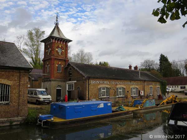
| Buckinghamshire, Marsworth, Upper Icknield Way (former Bulbourne Canal Works) N 51.8143 - W 0.6483 |
 |
| Buckinghamshire, Mursley, Whaddon Road N 51.9555 - W 0.8126 |
|
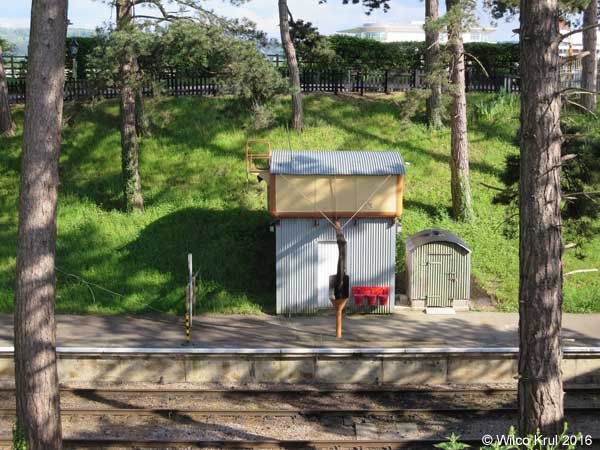
| Buckinghamshire, Quainton, Station Road (railway) N 51.8641 - W 0.9277 |
|
| Buckinghamshire, Quainton, Station Road (railway) N 51.8643 - W 0.9298 |
|
| Cambridgeshire |
| Cambridgeshire, Abbots Ripton, Clay Lane N 52.3888 - W 0.2039 |
|
| Cambridgeshire, Abbotsley, Cambridge Road N 52.2245 - W 0.2149 |
|
| Cambridgeshire, Balsham, West Wickham Road N 52.1252 - E 0.3213 |
|
| Cambridgeshire, Bluntisham, Bluntisham Heath Road (old) N 52.3574 - W 0.0042 |
|
| Cambridgeshire, Bluntisham, Bluntisham Heath Road (new) N 52.3582 - W 0.0021 |
 |
| Cambridgeshire, Cambourne, St. Neots Road N 52.2250 - W 0.0692 |
|
| Cambridgeshire, Chatteris, Eastwood N 52.4489 - E 0.0509 |
 |
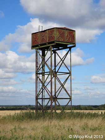
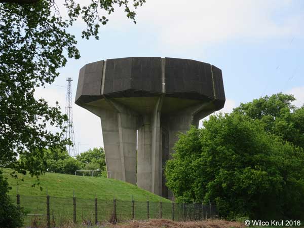
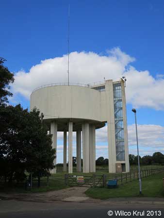
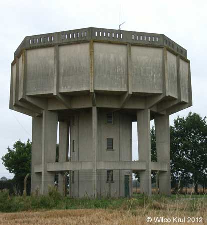
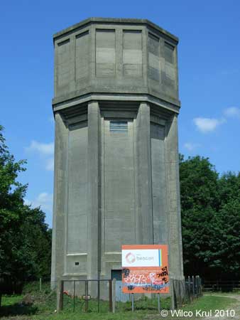
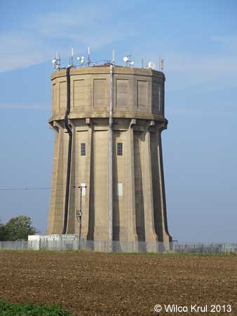
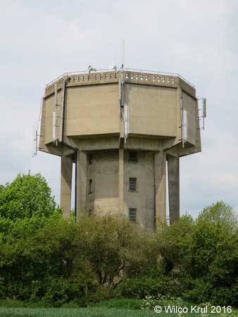
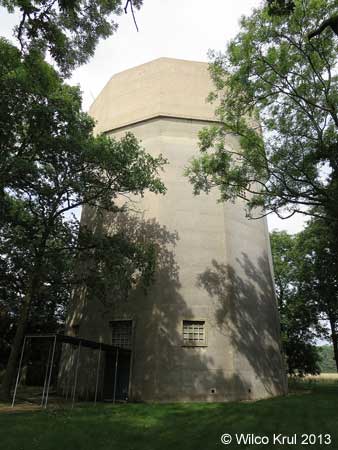
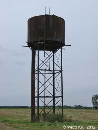
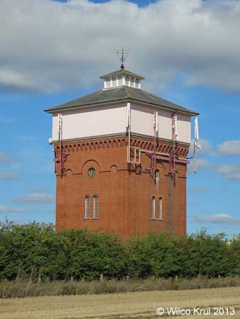
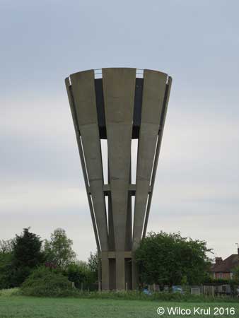
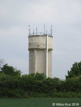
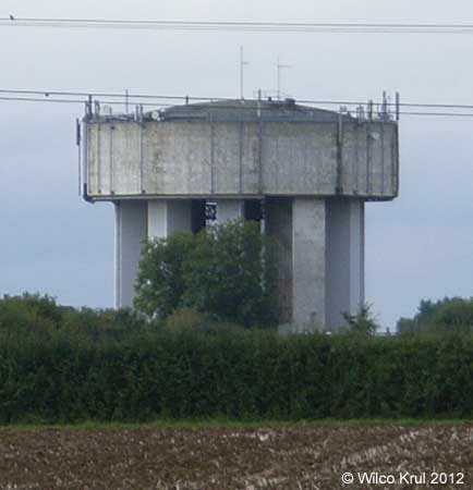
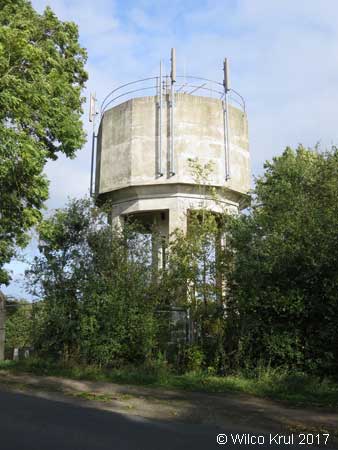
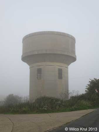
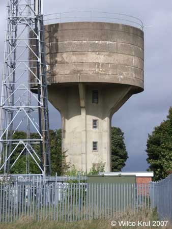
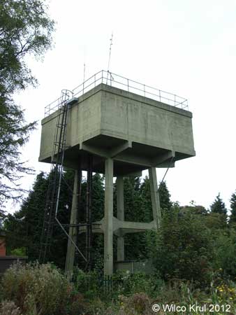
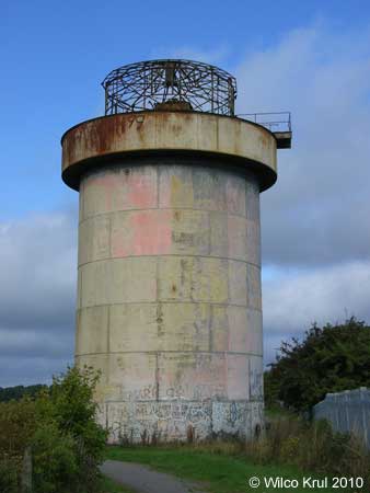
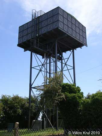
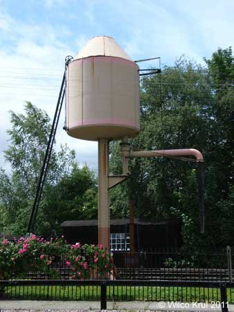
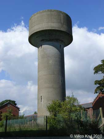
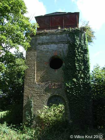
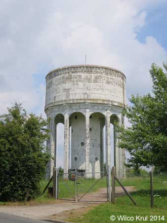
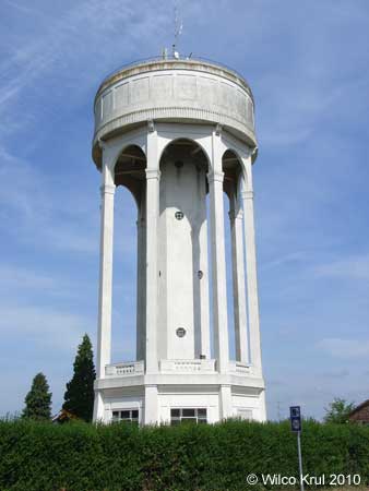
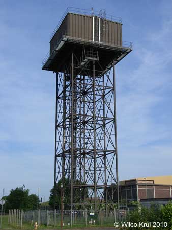
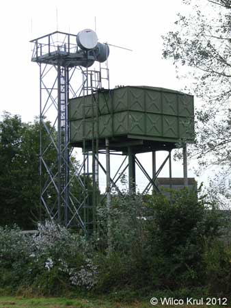
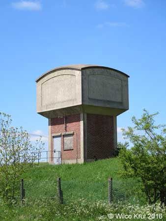
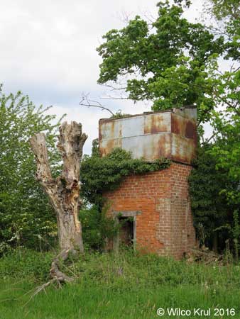
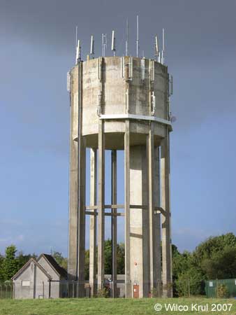
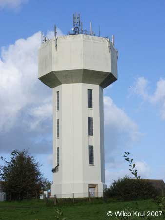
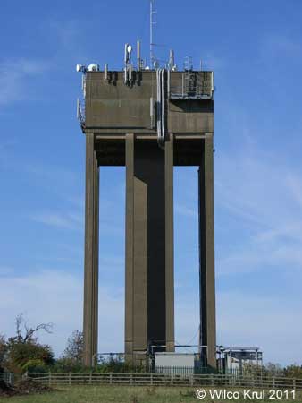
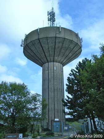
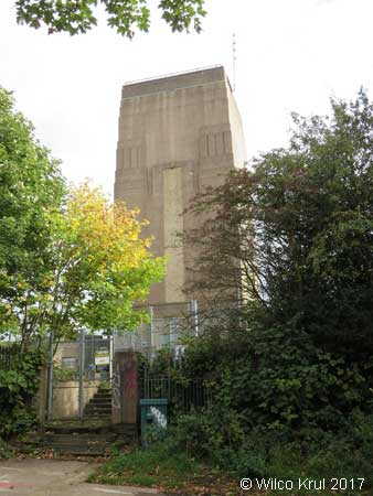
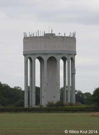
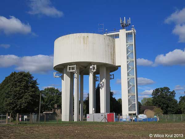
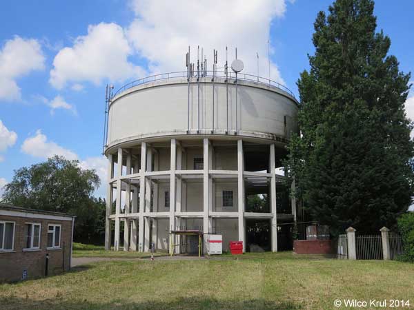
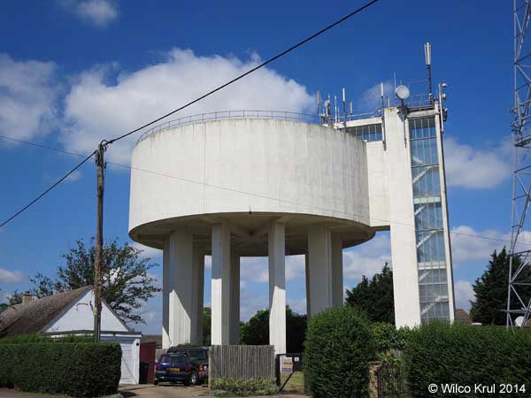
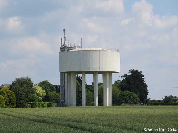
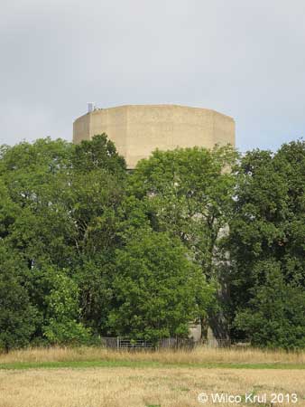
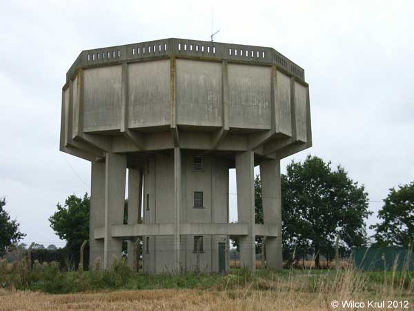
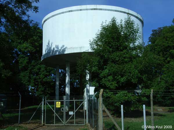
| Cambridgeshire, Conington, Conington Lane (former Glatton Air Base) N 52.4583 - W 0.2794 |
|
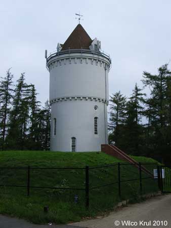
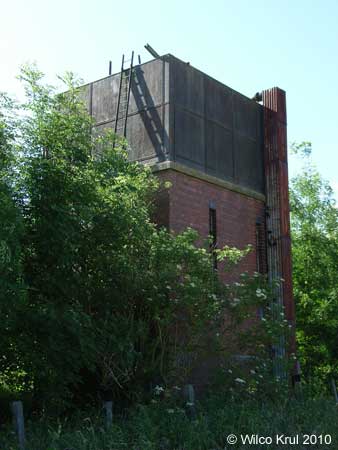
| Wilco Krul: |
| The water tower near Conington is a �symbol of remembrance�. This water tower is also depicted on a memorial plaque, which is located next to the water tower. The text on this memorial plaque reads: |
 |
GLATTON AIR BASE 1944 1945 The WATER TOWER that stands before you is the only remaining significant structure of the Glatton Air Base. Construction of this base (Station 130) was completed by the 809th Engineer Battalion (Aviation) of the United States Army in late 1943. It was home for the 457th Bomb Group (H) of the U.S. Army Eighth Air Force in 1944-45. Today this tower stands alone, like a silent sentinel, providing a visual landmark for those 457th Airmen who did not return from that last mission. It is a symbol of remembrance for all Airmen who fought in WWII for the cause of freedom.  [emblem of the 457th Bombardment Group (Heavy)] |
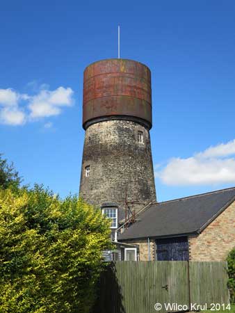
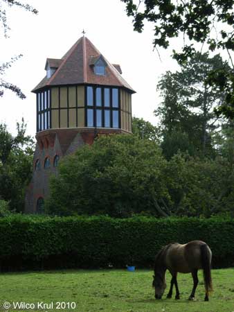
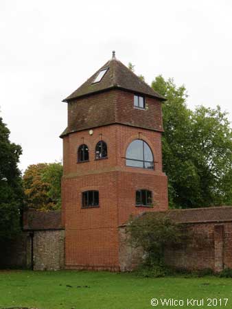
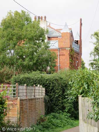
| Cambridgeshire, Cottenham, Manse Drive (converted) N 52.2856 - W 0.1157 |
|
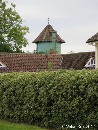
| The water tower in Cottenham was originally a windmill. The windmill was converted to a water tower circa 1903 and the water tower was converted to a house circa 2005. |
| /Wilco Krul |
| Cambridgeshire, Ditton Green, Stetchworth Road N 52.2250 - W 0.0692 |
|
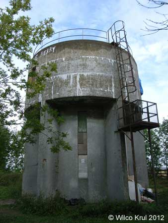
| Cambridgeshire, East Perry, Crow Spinney Lane N 52.2874 - W 0.3178 |
|
| Cambridgeshire, Eaton Socon, Bushmead Road N 52.2207 - W 0.2977 |
|
| Cambridgeshire, Ely, Heaton Close N 52.4124 - E 0.2795 |
 |
| Cambridgeshire, Ely, Tower Road N 52.3956 - E 0.2527 |
 |
| Cambridgeshire, Grafham, Buckden Road N 52.3067 - W 0.2967 |
|
| Cambridgeshire, Great Gransden, Caxton Road N 52.1922 - W 0.1308 |
|
| Cambridgeshire, Haddenham, Wilburton Road N 52.3544 - E 0.1535 |
 |
| Cambridgeshire, Huntingdon, Brampton Road N 52.3307 - W 0.1937 |
|
| Cambridgeshire, Littleport, Grange Lane N 52.4484 - E 0.2952 |
 |
| Cambridgeshire, Longstowe N 52.1666 - W 0.1084 |
|
| Cambridgeshire, Mill Green N 52.0812 - E 0.3682 |
|
| Cambridgeshire, Over, Willingham Road N 52.3075 - E 0.0299 |
|
| Cambridgeshire, Sapley, St Peters Road N 52.3509 - W 0.1830 |
|
| Cambridgeshire, Sawston, Babraham Road N 52.1276 - E 0.1747 |
|
| Cambridgeshire, Soham, Fordham Road N 53.3184 - E 0.3676 |
|
 © Wilco Krul 2013 |
| Cambridgeshire, Swaffham Prior, Mill Hill N 52.2535 - E 0.3015 |
|
| Cambridgeshire, Yelling, High Street N 52.2466 - W 0.1746 |
|
| Central Bedfordshire |
| Central Bedfordshire, Heath and Reach, Eastern Way N 51.9444 - W 0.6455 |
|
| Central Bedfordshire, Langford, Edworth Road N 52.0471 - W 0.2292 |
|
| Central Bedfordshire, Meppershall, Stondon Road N 52.0089 - W 0.3331 |
|
| Central Bedfordshire, Potton, Hatley Road N 52.1293 - W 0.1793 |
|
 |
| Central Bedfordshire, Pulloxhill, Higham Bury Lane N 51.9909 - W 0.4575 |
|
| Central Bedfordshire, Ridgmont, Eversholt Road N 52.0132 - W 0.5789 |
|
| Cheshire East |
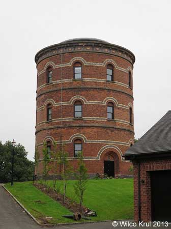
| Cheshire East, Congleton, Elm Road (converted) N 53.1660 - W 2.2282 |
|
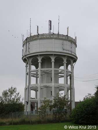
| Cheshire East, Congleton, Fields Road N 53.1546 - W 2.2031 |
|
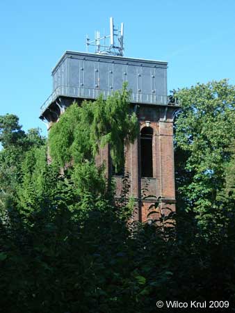
| Cheshire East, Congleton, Greenfield Road N 53.1662 - W 2.2284 |
 |
| Essex |
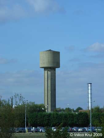
| Essex, Church Langley, Challinor N 51.7611 - E 0.1526 |
|
| Essex, Rye Hill, Rye Hill Road N 51.7399 - E 0.0975 |
|
| Gloucestershire |
| Gloucestershire, Cold Aston N 51.8779 - W 1.8161 |
|
| Gloucestershire, Fairford, Coronation Street N 51.7096 - W 1.7893 |
|
| Prestbury, Evesham Road (railway) N 51.9237 - W 2.0690 |
 |
| Gloucestershire, Rodmarton N 51.6808 - W 2.0896 |
 |
| Gloucestershire, Tarlton, Sandpoole Lane N 51.6933 - W 2.0614 |
|
| Gloucestershire, Tetbury, Lowfield Road N 51.6457 - W 2.1625 |
|
| Gloucestershire, The Mythe, Mythe Road N 52.0080 - W 2.1619 |
|
| Gloucestershire, Toddington (railway) N 51.9887 - W 1.9284 |
 |
| Gloucestershire, Toddington (railway) N 51.9894 - W 1.9283 |
|
| Greater London |
| Greater London, Arkley, Rowley Green Road N 51.6469 - W 0.2390 |
|
| Greater London, Coulsdon, Brighton Road (former Cane Hill Hospital) N 51.3139 - W 0.1485 |
|
| Hampshire |
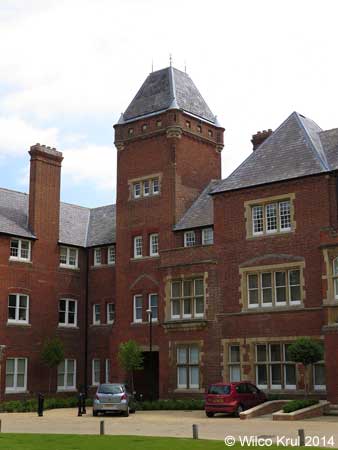
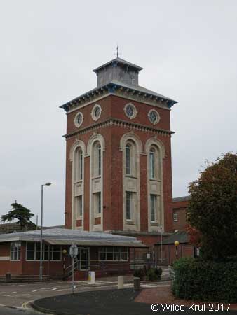
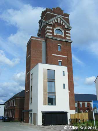
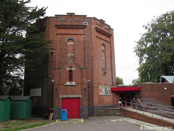
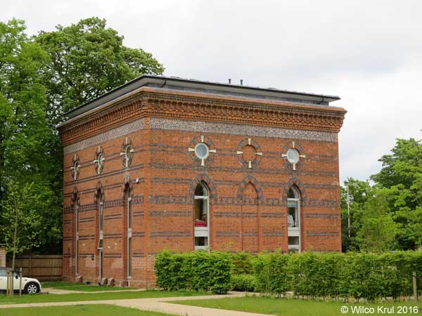
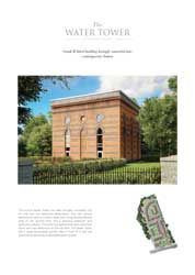
| Hampshire, Basingstoke, Limes Park (former Park Prewett Hospital) N 51.2816 - W 1.1179 |
 |
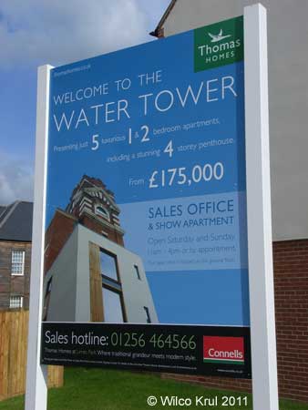 |
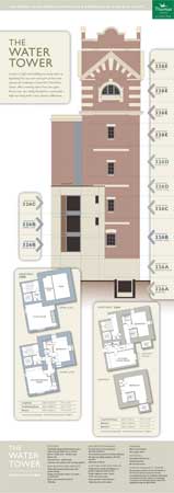 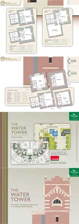 Download a brochure with the floor plans of the five apartments in the converted water tower. |
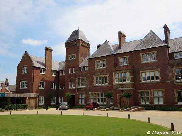
| The water tower is one of the few remaining buildings that originally belonged to Park Prewett Hospital. After the hospital had closed, the entire site was redeveloped into a housing site, which is named Limes Park. |
| /Wilco Krul |
| Hampshire, Bishop's Green, Eagle Road N 51.3617 - W 1.2819 |
|
| Hampshire, Chilbolton, Thirt Way N 51.1433 - W 1.4256 |
|
 |
| Hampshire, Coxford Down, Popham Airfield N 51.1930 - W 1.2438 |
|
| Hampshire, Fritham, Forest Road (converted) N 50.9277 - W 1.6563 |
|
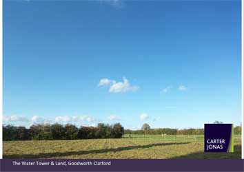
| Hampshire, Goodworth Clatford, St Peter's Close N 51.1814 - W 1.4769 |
|
|

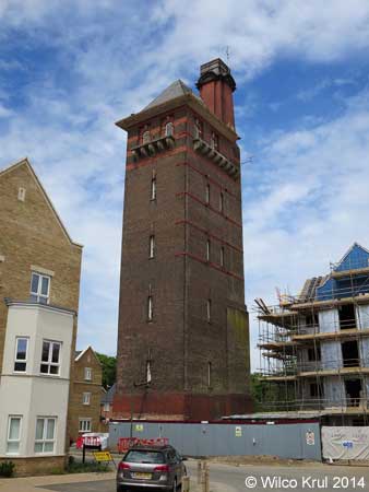
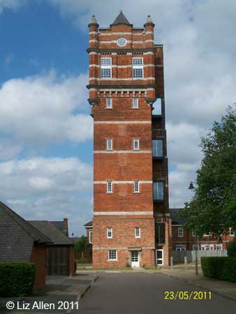
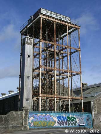
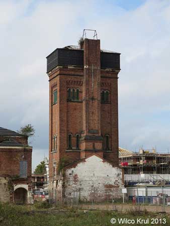
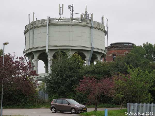
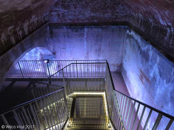
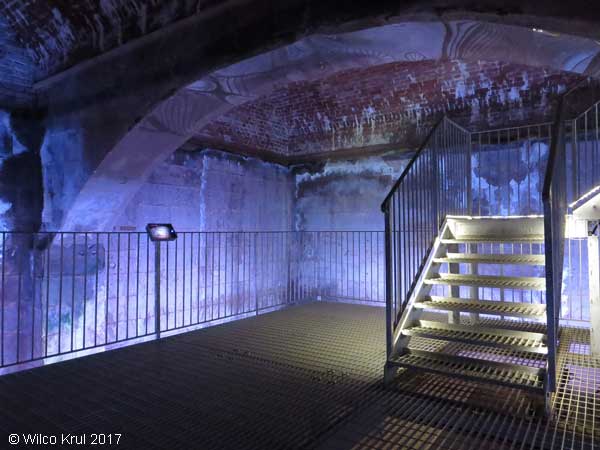
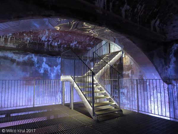
| Hampshire, Gosport, Haslar Road (former Royal Hospital Haslar) N 50.7860 - W 1.1258 |
|
The hospital water tower was built in 1885 and is 120 feet high with two 125-ton water tanks, each with the capacity to hold 50,000 gallons fed from the hospital wells. |
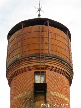
| Hampshire, Gosport, Haslar Road (former Royal Hospital Haslar laundry) N 50.7868 - W 1.1250 |
|
| The laundry was built to serve the hospital in 1854. The northern section of the laundry has a cast iron water tank with corrugated sheeting forming its roof. The laundry remained in use until 2009. |
| Hampshire, Kentsboro, Upper Mead N 51.1573 - W 1.5636 |
|
| Hampshire, South Wonston, Christmas Hill N 51.1178 - W 1.3454 |
|
| Hampshire, Whitchurch, Bere Hill N 51.2370 - W 1.3343 |
|
| Hampshire, Wickham, Hoad's Hill N 50.8886 - W 1.1795 |
|
| Hampshire, Winchester, Kings Road (converted) N 51.0583 - W 1.3456 |
 |
| Hampshire, Winchester, Northbrook Avenue (converted) N 51.0611 - W 1.2971 |
|
| Hampshire, Worthy Down, Blackwell Road N 51.1134 - W 1.3435 |
|
| Hertfordshire |
| Hertfordshire, Albury, Parsonage Lane N 51.9001 - E 0.0673 |
|
| Hertfordshire, Berkhamsted, Shootersway N 51.7545 - W 0.5798 |
|
| Hertfordshire, Bishop�s Stortford, Hadham Road N 51.8785 - E 0.1396 |
|
| Hertfordshire, Bishop�s Stortford, Heath Row N 51.8797 - E 0.1815 |
|
| Hertfordshire, Brookmans Park, Kentish Lane N 51.7307 - W 0.1750 |
|
| Hertfordshire, Essendon, High Road N 51.7589 - W 0.1540 |
|
| Hertfordshire, Felden, Featherbed Lane N 51.7335 - W 0.4928 |
|
| Hertfordshire, Gaddesden Row, Gaddesden Row N 51.8070 - W 0.4812 |
 |
| Hertfordshire, Great Gaddesden, Hoo Wood N 51.8021 - W 0.5031 |
|
| Hertfordshire, Hemel Hempstead, Farmhouse Lane N 51.7639 - W 0.4470 |
|
| Hertfordshire, Little Wymondley, Tower Close N 51.9285 - W 0.2344 |
|
| Hertfordshire, London Colney, Beningfield Drive N 51.7221 - W 0.3118 |
|
 |
| Hertfordshire, Old Hall Green N 51.8837 - W 0.0173 |
|
| Hertfordshire, Tea Green, Stony Lane N 51.8960 - W 0.3493 |
|
| Hertfordshire, Tonwell, Temple Lane N 51.8390 - W 0.0635 |
|
| Hertfordshire, Weston, Mill Lane N 51.9582 - W 0.1665 |
|
| Hertfordshire, Whitwell, Horn Hill N 51.8727 - W 0.2901 |
|
| Kent |
| Kent, Adisham, Woodlands Wood N 51.2372 - E 1.1635 |
|
| Kent, Ashford, Kennington Road N 51.1521 - E 0.8991 |
|
| Kent, Blue Bell Hill, Common Road N 51.3322 - E 0.5022 |
|
| Kent, Coxheath, Duke of York Way N 51.2300 - E 0.4952 |
|
| Kent, Faversham, Western Link N 51.3166 - E 0.8653 |
|
| Kent, Folkestone, Royal Military Avenue N 51.0815 - E 1.1342 |
|
| Kent, Gillingham, Courteney Road N 51.3679 - E 0.5815 |
|
| Kent, Harrietsham, Stede Hill N 51.2554 - E 0.6913 |
|
| Kent, Hollingbourne, Hollingbourne Hill N 51.2767 - E 0.6600 |
|
| Kent, Northfleet, Crete Hall Road N 51.4455 - E 0.3385 |
|
| Kent, Rough Common, Whitstable Road N 51.2915 - E 1.0575 |
|
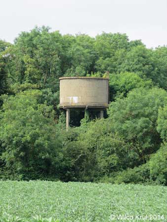
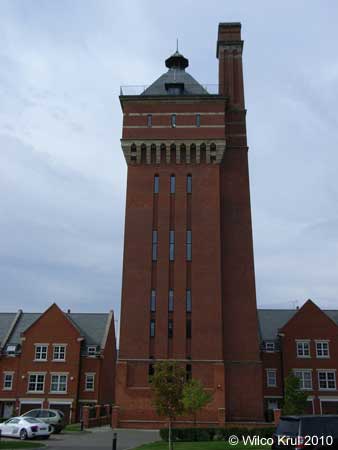
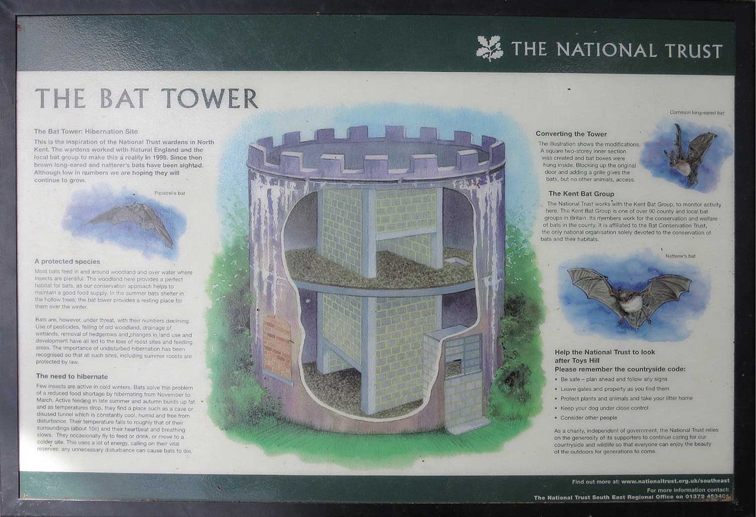
| Kent, Toy's Hill, Toy's Hill Road (converted) N 51.2489 - E 0.1037 |
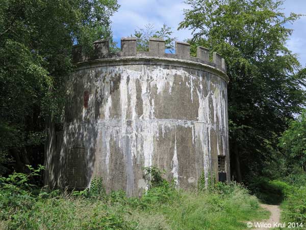 |
| The water tower on Toy�s Hill was converted to a hibernation site for bats in 1998. A square two-storey inner section was created and bat boxes were hung inside. The original door was blocked up and a grille was added, which gives bats (but no other animals) access to the tower. Bats hibernate there from November to March. |
| /Wilco Krul |
 |
| Kent, Vigo Village, Beech Mast N 51.3314 - E 0.3623 |
|
| Kent, Warren Street, Rayners Hill N 51.2422 - E 0.7576 |
|
| Leicestershire |
| Leicestershire, Buckminster, The Drift N 52.8040 - W 0.6820 |
|
| Leicestershire, Buckminster, Stainby Road/Manor farm N 52.7969 - W 0.6937 |
|
| Lincolnshire |
| Lincolnshire, Grantham, Gorse Lane N 52.8924 - W 0.6487 |
|
| Milton Keynes |
| Milton Keynes, Castlethorpe N 52.0857 - W 0.8268 |
|
| Milton Keynes, Warrington, Northey Farm N 52.1959 - W 0.6826 |
|
| Norfolk |
| Norfolk, Bowthorpe, Barnard Road N 52.6433 - E 1.2107 |
|
| Norfolk, Diss, Louie's Lane N 52.3808 - E 1.1038 N 52.3806 - E 1.1041 |
|
| Norfolk, East Carleton, Water Tower Road N 52.5713 - E 1.1999 |
|
| Norfolk, Hethersett, Great Melton Road N 52.6020 - E 1.1695 |
|
| Norfolk, Kenninghall, East Harling Road N 52.4335 - E 0.9823 |
|
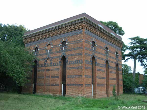
| Norfolk, Kilverstone, Kilverstone Hall N 52.4227 - E 0.7801 |
|
| Norfolk, North Lopham, High Common Road N 52.4026 - E 0.9906 |
|
| Norfolk, Welney, Main Street N 52.4227 - E 0.7801 |
|
| Northamptonshire |
| Northamptonshire, Barby, Daventry Road N 52.3215 - W 1.2053 |
|
| Northamptonshire, Barby (former railway sidings) N 52.3302 - W 1.2411 |
 |
| Northamptonshire, Brafield-on-the-Green, Furze Road N 52.2189 - W 0.8016 |
|
| Northamptonshire, Collyweston, The Drove N 52.6103 - W 0.5247 |
|
| Northamptonshire, Corby, Upphingham Road N 52.4884 - W 0.7340 N 52.4885 - W 0.7349 |
 |
| Northamptonshire, Corby, Phoenix Parkway (former iron and steel works) N 52.4976 - W 0.6749 |
|
| Northamptonshire, Corby, Rockingham Road N 52.5105 - W 0.7166 |
|
| Northamptonshire, Corby, Tanfields Grove N 52.4963 - W 0.6971 |
|
| Northamptonshire, Corby, Willow Brook Road N 52.5003 - W 0.7139 |
|
| Northamptonshire, Denford Ash N 52.37035 - W 0.5180 |
|
| Northamptonshire, Dingley, Braybrooke Road N 52.4732 - W 0.8623 |
|
| Northamptonshire, Earls Barton, Stevens Court N 52.2704 - W 0.7388 |
|
| Northamptonshire, Everdon, Everdon Stubbs N 52.2024 - W 1.1056 |
|
| Northamptonshire, Finedon, Irthlingborough Road N 52.3365 - W 0.6438 |
|
| Northamptonshire, Flore, Hillside Road N 52.2394 - W 1.0675 |
|
| Northamptonshire, Great Doddington, Earls Barton Road N 52.2756 - W 0.7277 |
|
| Northamptonshire, Halse N 52.0625 - W 1.1687 |
|
| Northamptonshire, Hemington N 52.4499 - W 0.4179 |
|
| Northamptonshire, Knuston, Irchester Road N 52.2898 - W 0.6214 |
|
| Northamptonshire, Mears Ashby, Highfield Road N 52.3002 - W 0.7642 |
|
| Northamptonshire, Nobottle, Roman Road N 52.2552 - W 0.9894 |
|
| Northamptonshire, Northampton, Boughton Green Road N 52.2746 - W 0.8864 |
|
| Northamptonshire, Northampton, Abington Park N 52.2493 - W 0.8624 |
|
| Northamptonshire, Roade, Manor Close N 52.1590 - W 0.8890 |
|
| Northamptonshire, Roade, Ashton Road N 52.1527 - W 0.8906 |
|
| Northamptonshire, Southwick, Glapthorn Road N 52.5108 - W 0.4935 |
|
| Northamptonshire, Upton, St Crispin Drive (former St Crispin Hospital) N 52.2433 - W 0.9582 |
|
| Northamptonshire, West Haddon, Northampton Road N 52.3390 - W 1.0678 |
|
| Northamptonshire, Wollaston, Irchester Road N 52.2588 - W 0.6602 |
 |
| Northamptonshire, Woodford Halse (former railway yard) N 52.1853 - W 1.2061 |
|
| Northamptonshire, Yardley Gobion, Moorend Road N 52.0974 - W 0.8930 |
|
| North Somerset |
| North Somerset, Failand, Clevedon Road N 51.4464 - W 2.7075 |
|
| North Somerset, Leigh Woods, St Mary's Road N 51.4531 - W 2.6384 |
 |
| Oxfordshire |
| Oxfordshire, Banbury, Bretch Hill N 52.0569 - W 1.3618 |
|
| Oxfordshire, Berinsfield, Fane Drive N 51.6661 - W 1.1705 |
|
| Oxfordshire, Bicester, Buckingham Road (former RAF Bicester) N 51.9161 - W 1.1422 |
|
| Oxfordshire, Bucknell, Trow Pool N 51.9190 - W 1.2038 |
|
| Oxfordshire, Bunkers Hill, Bunkers Hill N 51.8583 - W 1.3127 |
|
| Oxfordshire, Chesterton, Bignell Park Barns N 51.8962 - W 1.2002 |
|
| Oxfordshire, Chipping Norton, Wards Road N 51.9410 - W 1.5376 |
|
| Oxfordshire, Cholsey, Reading Road (former Fair Mile Hospital) N 51.5699 - W 1.1391 |
|
 |
| Oxfordshire, Christmas Common, Cowleaze Wood N 51.6525 - W 0.9540 |
|
| Oxfordshire, Cookley Green, Coates Lane N 51.6093 - W 0.9997 |
|
| Oxfordshire, Didcot N 51.6126 - W 1.2438 |
|
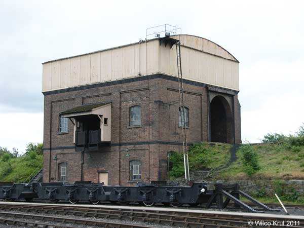
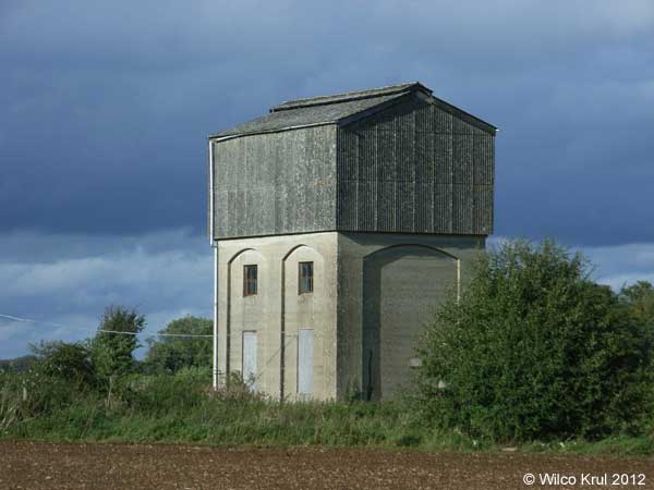
| The water tower in Didcot is not only a water tower (with a 74,000 gallon tank), but it�s also a coal stage. A coal wagon would be pushed up the embankment by a locomotive into the brick building under the water tank. There the coal would be unloaded into small wheeled tubs. The tubs were then pushed onto a ramp at the front of the coal stage and tipped up to allow the coal to fall into a locomotive tender. /Wilco Krul |
| Oxfordshire, Didcot N 51.6151 - W 1.2464 |
|
| Oxfordshire, Hornton Grounds, Stratford Road (former Oxfordshire Ironstone Company)(demolished) N 52.0917 - W 1.4440 |
|
| Oxfordshire, Milton Common, Rycote Lane N 51.7262 - W 1.0559 |
|
| Oxfordshire, Milton Hill, Featherbed Lane N 51.6118 - W 1.3166 |
|
| Oxfordshire, Stanton Harcourt, Main Road (former RAF Stanton Harcourt) N 51.7457 - W 1.4000 |
|
| Oxfordshire, Upper Heyford, Camp Road (tower demolished) N 51.9288 - W 1.2554 |
|
| Oxfordshire, Upper Heyford, Eglin Street (tower demolished) N 51.9284 - W 1.2603 |
|
| Oxfordshire, Upper Heyford, Gordon Road N 51.9292 - W 1.2687 |
|
| Oxfordshire, Wallingford, Station Road N 51.6017 - W 1.31346 |
|
| Oxfordshire, Woodeaton, Woodeaton Manor N 51.8037 - W 1.2260 |
|
| Reading |
| Reading, Tilehurst, Park Lane N 51.4516 - W 1.0471 |
|
| Reading, Reading, Bath Road N 51.4495 - W 0.9902 |
|
 |
 |
| Rutland |
| Rutland, Burley, Exton Lane N 52.6916 - W 0.6814 |
|
| Rutland, Manton, Wing Road (railway, converted) N 52.6241 - W 0.6955 |
 |
| Shropshire |
| Shropshire, Tasley, Church Lane N 52.5437 - W 2.4493 |
|
| Shropshire, Upper Netchwood N 52.5248 - W 2.5738 |
|
| Somerset |
| Somerset, Churchinford, Church Road N 50.9139 - W 3.1294 |
 |
| Somerset, Culmhead (former RAF Culmhead) N 50.9357 - W 3.1113 |
|
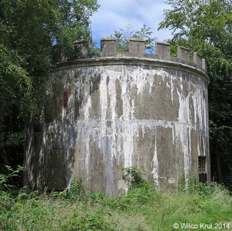
| Somerset, Dunster, Dunster Castle (earth reservoir) N 51.1812 - W 3.4451 |
 |
| The National Trust provides the following information: �In 1870 an underground water reservoir was constructed beneath the Keep Garden to store 40,000 gallons (182,000 litres) of water for the castle and village.� |
 |
 |
| Somerset, Farleigh, Hungerford N 51.3150 - W 2.2879 |
|
The website of Historic England and a sign next to the water tower provide the following information: �Approximately 2.5 metres diameter, 5 metres high with 3 iron inspection plates and iron depth indicator mechanism. Fed by river power driven pump from fresh water spring via 50 mm cast iron pipe and used until the early 1970s to distribute a domestic water supply to Farleigh Hungerford.� |
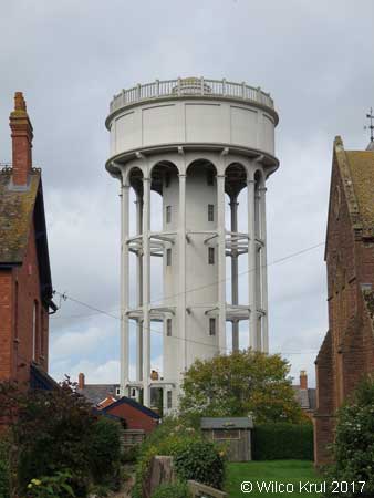
| Somerset, Rockwell Green, Popes Lane (old) N 50.9730 - W 3.2460 |
|
 |
| Somerset, Rockwell Green, Popes Lane (new) N 50.9729 - W 3.2462 |
|
 |
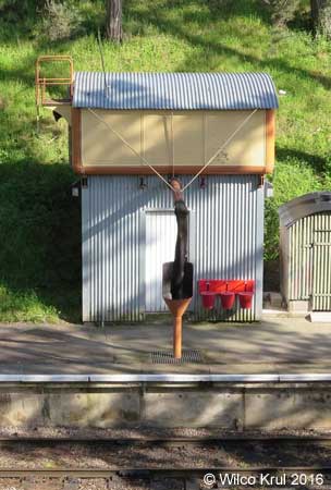
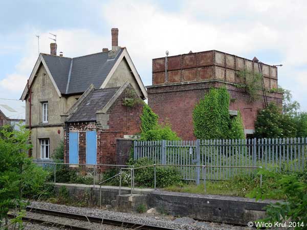
| Somerset, Taunton, Firepool Lock (railway) N 51.0224 - W 3.0975 |
 |
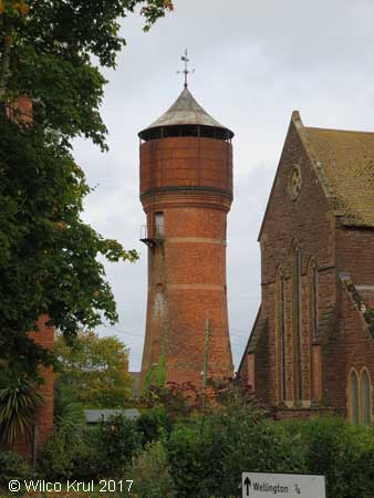
| Somerset, Wellington, Dark Lane (converted) N 50.9725 - W 3.2272 |
|
 © Off the Beaten Track in Somerset, blog, 5 October 2017 (photo from 1986, photographer unknown) |
| The Dark Lane water tower in Wellington was built in 1896 and held 40,000 gallons (180,000 litres). The tower was designed by Howard, a local architect. It was built with Thomas bricks (a local brickyard) and ironwork by Ford Brothers (local foundry). The tower was originally a two storey house with a water tank on top and a hipped slate roof on the water tank. It became redundant in 1991 and in the mid 90s the new owner replaced the tank with a third storey, but leaving some of the tank plates as balconies. The corner turrets add further distinction, reflecting some of Howard�s designs for his houses in nearby Wellesley Park. The photo from 1986 shows the tower before the tank was removed and the third storey put on. (Information kindly provided by the Wellington Local History & Museum Society.) /Wilco Krul |
| Somerset, Willand, Broad Street N 50.9055 - W 3.1444 |
|
| South Gloucestershire |
| South Gloucestershire, Charfield, Station Road (railway) N 51.6280 - W 2.3994 |
 |
| Staffordshire |
| Staffordshire, Essington, Hawthorne Road N 52.6287 - W 2.0609 |
|
| Staffordshire, Hanchurch, Harley Thorn Lane N 52.9549 - W 2.2399 |
|
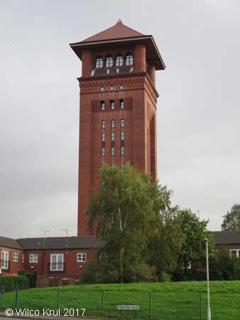
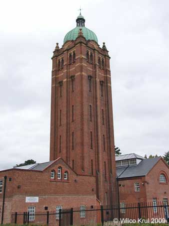
| Staffordshire, Stafford, St Georges Parkway (former Stafford County Lunatic Asylum) N 52.8117 - W 2.1140 |
|
| Suffolk |
| Suffolk, Bedingfield, Bedingfield Road N 52.2705 - E 1.1843 |
|
| Suffolk, Botesdale, Bury Road N 52.3470 - E 1.0191 |
|
| Suffolk, Bradfield St. Clare, Felsham Road N 52.1849 - E 0.7972 |
|
| Suffolk, Crowfield, Ipswich Road N 52.1716 - E 1.1508 |
|
| Suffolk, Depden, Wickhambrook Road N 52.1881 - E 0.5857 |
|
| Suffolk, Elmswell, Ashfield Road N 52.2552 - E 0.9216 |
 |
| Suffolk, Elveden N 52.3669 - E 0.6762 |
|
| Suffolk, Elveden, Chalk Hall N 52.3790 - E 0.6528 |
|
| Suffolk, Finningham, Station Road N 52.2760 - E 1.0251 |
|
| Suffolk, Gazeley, Moulton Road N 52.2512 - E 0.5098 |
|
| Suffolk, Haverhill, Moor Pasture Way N 52.0986 - E 0.4427 |
|
| Suffolk, Lavenham, Bury Road N 52.1296 - E 0.7952 |
|
| Suffolk, Middlewood Green N 52.2085 - E 1.0653 |
|
| Suffolk, Risby N 52.2717 - E 0.6246 |
 |
| Suffolk, Risby, Welham Lane N 52.2663 - E 0.6237 |
|
| Suffolk, Stowlangtoft, Kiln Lane N 52.2922 - E 0.8742 |
|
| Surrey |
| Surrey, Camberley, Black Hill N 51.3496 - W 0.7025 |
|
| Surrey, Caterham, Gravelly Hill N 51.2625 - W 0.0849 |
|
| Surrey, Epsom, Miller Place (former West Park Hospital) N 51.3390 - W 0.3003 |
|
| Surrey, Great Bookham, Polesden Lacey N 51.2589 - W 0.3738 |
|
| Surrey, Great Bookham, Polesden Lacey N 51.2581 - W 0.3753 |
|
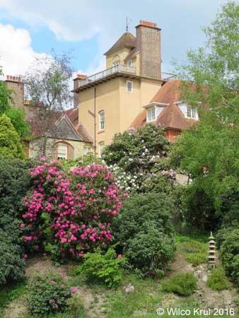
| Surrey, Munstead, Munstead Heath Road (converted) N 51.1754 - W 0.5894 |
|
| Surrey, Woldingham N 51.2900 - W 0.1432 |
|
| Swindon |
| Hannington Wick N 51.6561 - W 1.7507 |
|
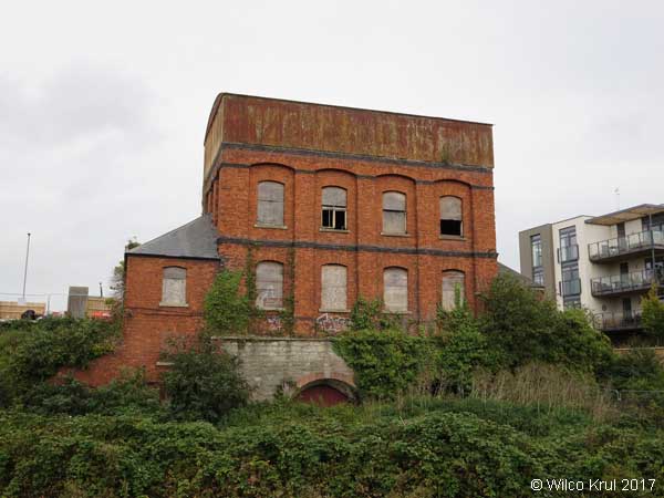
| Swindon, Swindon, Bristol Street (former Swindon Railway Works) N 51.5615 - W 1.7937 |
|
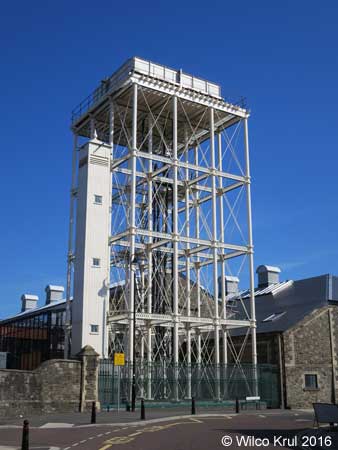 |
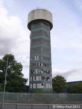
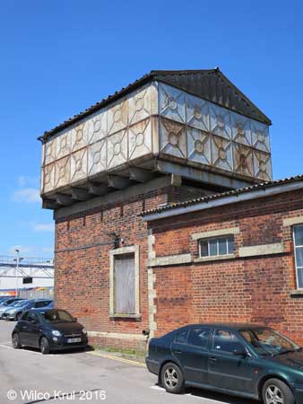
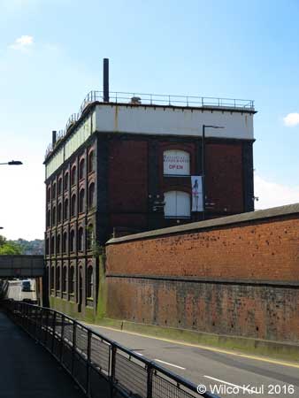
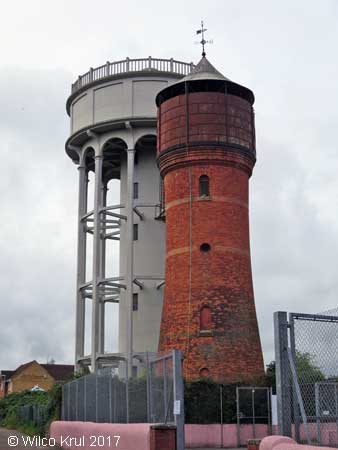
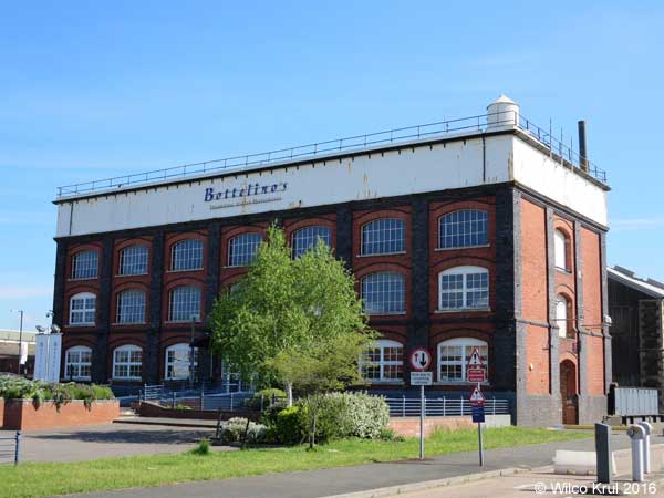
| Swindon, Swindon, Rodbourne Road (former Swindon Railway Works, converted) N 51.5611 - W 1.7978 |
 |
|
The website of Historic England provides the following information: �The building is a pattern store, dating from 1897, designed and constructed by the Great Western Railway for the Swindon Railway Works. The building is surmounted by a four-section cast iron water tank, which covers the entire roof of the building. The tank is covered in part with modern shallow-pitched roofs, and in part with a flat roof covered in mineral felt. At the south east end of the second floor of the building is a cast iron spiral staircase, which rises up through the tank to the roof, terminating inside a metal turret with a conical roof. The ground floor and basement have been converted into a restaurant, using lightweight cladding and partitions, behind which much of the original structure survives. The first and second floors have not been converted.� |
| Warwickshire |
| Warwickshire, Atherstone, Ratcliffe Road N 52.5809 - W 1.5320 |
|
| Warwickshire, Bedworth, Gatehouse Lane (converted) N 52.4760 - W 1.4794 |
|
| Warwickshire, Claverdon, Lye Green Road N 52.2886 - W 1.7118 |
|
| Warwickshire, Corley, Church Lane N 52.4629 - W 1.5647 |
|
| Warwickshire, Lapworth, Pound Close N 52.3372 - W 1.7434 |
|
| Warwickshire, Moreton Paddox N 52.1901 - W 1.5491 |
|
| Warwickshire, Nuneaton, Mancetter Road N 52.5370 - W 1.5000 |
|
| Warwickshire, Ratley, Camp Lane N 52.1318 - W 1.4440 |
 |
| Warwickshire, Rugby, Ashlawn Road N 52.3520 - W 1.2571 |
 |
| Warwickshire, Stockton, Rugby Road N 52.2785 - W 1.3557 |
|
| West Berkshire |
| West Berkshire, Brightwalton, Butts Furlong N 51.5117 - W 1.3883 |
|
| West Berkshire, Greenham, Pigeons Farm Road N 51.3864 - W 1.3002 |
 |
 |
| West Midlands |
| West Midlands, Birmingham, Sovereign Heights (former Hollymoor Hospital) N 52.4045 - W 1.9968 |
|
| West Midlands, Wednesfield, Planetary Road N 52.5932 - W 2.0830 |
|
| West Sussex |
| East Grinstead, Standen House N 51.1029 - W 0.0164 |
|
| Wiltshire |
| Wiltshire, Baydon, Finches Lane N 51.4990 - W 1.5872 |
|
| Wiltshire, Charlton, Pond Lane N 51.5965 - W 1.9950 |
|
| Wiltshire, Crudwell, Odd Farm N 51.6605 - W 2.0557 |
|
| Wiltshire, Druids Lodge N 51.1513 - W 1.8588 |
|
| Wiltshire, East Winterslow, Pincroft Lane N 51.1021 - W 1.6558 |
|
| Wiltshire, Kemble Airfield Enterprise Park N 51.6625 - W 2.0560 |
|
| Wiltshire, Ludgershall, Andover Road N 51.2516 - W 1.6023 N 51.2517 - W 1.6022 |
|
| Wiltshire, Malmesbury, Crudwell Road N 51.5919 - W 2.0896 |
|
| Wiltshire, Rodbourne N 51.5491 - W 2.0992 |
|
| Wiltshire, Salisbury, Fisherton Street (railway) N 51.0708 - W 1.8051 |
|
| Wiltshire, Sherston, Knockdown Road N 51.5755 - W 2.2202 |
 |
| Wiltshire, Tilshead, Salisbury Plain N 51.2266 - W 1.9681 |
|
| Wiltshire, Yatton Keynell N 51.4978 - W 2.1951 |
|
| Windsor and Maidenhead |
| Windsor and Maidenhead, Holyport, Holyport Street N 51.4946 - W 0.7141 |
|
| Windsor and Maidenhead, Windsor, Riverside Walk N 51.4914 - W 0.6036 |
|
| Wokingham |
| Wokingham, Shinfield Rise, Fairlawn Green N 51.4286 - W 0.9426 |
|
| Worcestershire |
| Worcestershire, Droitwich Spa, Newland Road N 52.2525 - W 2.1434 |
|
| Worcestershire, Headless Cross, Headless Cross Drive N 52.2937 - W 1.9466 |
|
| Worcestershire, Headless Cross, Evesham Road N 52.2937 - W 1.9466 |
|
| Worcestershire, Malvern, Blackmore Park Industrial Estate N 52.0906 - W 2.3009 |
|
| Worcestershire, Pershore, Pershore Trading Estate N 52.1295 - W 2.0716 |
|
| Worcestershire, Romsley Hill, Farley Lane N 52.4057 - W 2.0605 |
|
| Hem Home |
Gästsidor Guest pages |
Upp Up |
| Senast uppdaterad 190730 |